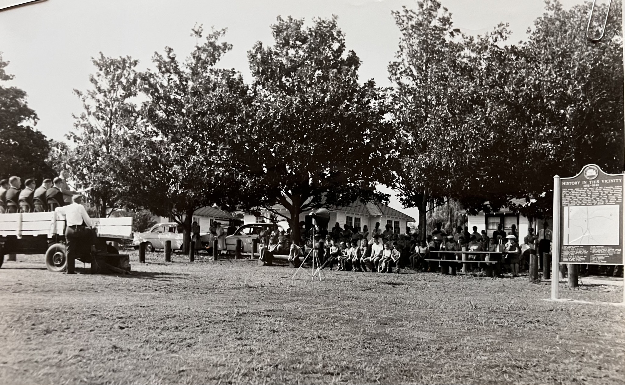


“One of York County’s most historic locations.”
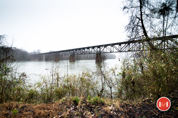
The Rock Hill Herald reported on Oct. 7, 1886 – “Mr. John Kane, a master bridge builder from St. Louis, Ms., has a force of workmen making preparations for putting a new iron bridge over the Catawba River on the Charlotte, Columbia and Augusta RR. The new structure is now being made by the Edgemore Iron Company of Wilmington, Delaware and the Baltimore Bridge Company. It will be heavier and stronger than the present bridge, which was built twenty years ago and is part wood. This wood is deteriorating. When the new bridge is finished the railroad can run larger engines and heavier and faster trains on the road.”
The YK Enquirer reported on Dec. 22, 1886 – “Early yesterday, William Stewart, a colored hand employed in erecting the new bridge of the CCA railroad trestles across the Catawba River, near Fort Mill, fell from the scaffolding falling about 20ft falling onto an iron bar and then 30 ft more into the river.” Later on May 18, 1887 the paper reported – “Some in Fort Mill have suggested that the county commissioners should obtain the consent of the railroad authorities to place a foot bridge under the railroad bridge at Nations Ford. This would keep people off the tract lessoning the risk of life.”
The Herald reported on Oct. 6, 1887 – “Mr. Hardeman, the contractor for the erection of the 3C’s bridge over the Catawba River has lost 45,000 board feet of lumber. It has been brought by railcar to the Nations Ford bridge and thrown into the river to drift down and be recovered at the site of the 3C’s bridge at Cureton’s Ferry. A sudden swell in the river occurred and the trap make of rope designed to catch the lumber became submerged, and the lumber floated down stream.”
The Rock Hill Herald reported on Feb. 16, 1888 – “Someone entered the Crossroads Baptist (Colored Church), near the river bridge last Tuesday and stole a bible, and several hymn books.”
The Yorkville Enquirer reported on Feb. 3, 1892 – “About fifty African Americans left the Rock Hill area last Monday bound for Arkansas. There starting point was the Catawba switch (also known as the Carhartt Station), on the CCA railroad. An entire coach had been left at that point and they were taken to Charlotte to leave for work in Arkansas.” On March 9, 1892 _ Another car of 40-50 men left last week for the west. They boarded a rail car that had been sided for them at the river trestle.” (It is unclear as to why this group was organized or what they were to do upon arriving in Arkansas.)
R&R HISTORY LINK: GARRISON’S MILL AND MORE
City Directories and History: The Herald reported on July 1, 1914 – under the title at the Carhartt Bungalow – the article describes “an outing of young people to the river. They rode out of town in two large wagons and had dinner under the trees of the Island. Mr. and Mrs. A.E. Hutchison where chaperons.”
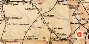
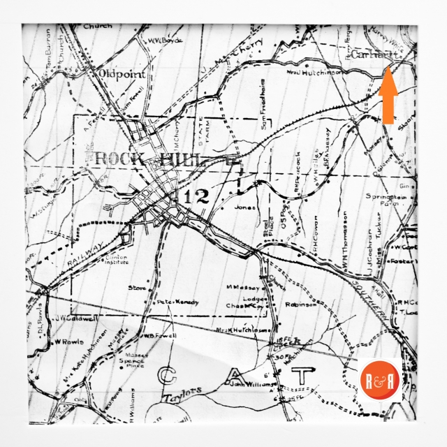
Postal map showing Rock Hill as a transportation hub on two railroads in 1896. Courtesy of the Un. of N.C. Note the area North of Rock Hill was called Old Point P.O. in 1896, the Town of Ebenezer.
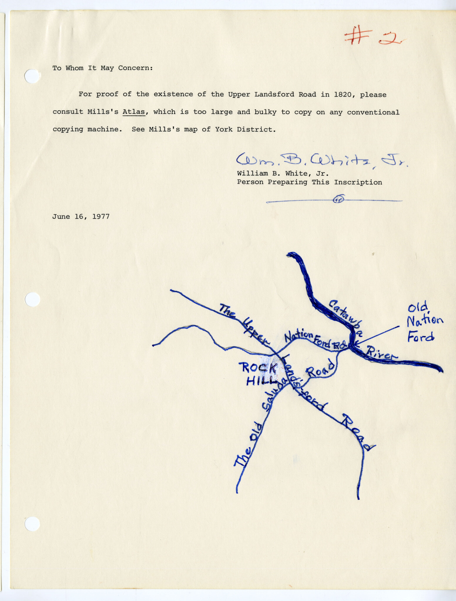
The Herald reported on July 19, 1902 – “Mr. B.F. Massey has informed the Fort Mill Times that the old Nation Ford in the Catawba River is now in good condition, a force of hands recently repaired it, and persons who are acquainted with the ford need have no hesitancy in using it. This will be convenient for persons in Fort Mill who wish to travel the most direct route to Rock Hill.”
The Rock Hill Record reported, on Dec. 14, 1908 of a proposal for work by the Chain Gang. “Mr. J.M. Cherry representing parties between here and the ferry at Carhartt’s Mill on the river. They would furnish materials to macadamize the road from where the pavement stops at the State Farm (Winthrop Farm), to the river a distance of about five miles. They would improve the ferry between Rock Hill and Fort Mill at the Carhartt Farm and turn it over to the City. The proposition is supported by Mr. Cherry, Mr. Carhartt and others living along the Old Nations Ford Road. Valuable farms along this road include: J.M. Cherry, Samuel Friedheim, W.C. Biggers, Mr. Whitner, Mr. Carhartt and the State Farm.”
The Herald reported on June 17, 1916 – “There is a rumor that a cotton mill will soon be erected by Hamilton Carhartt at Carhartt’s Station.”
The Herald reported on Oct. 2, 1925 – “Hamilton Carhartt Cotton Mill #2 on the river has been sold to a corporation of local investors. C.L. Cobb represents the buyers. The plan is to erect thirty new homes and have day and night shifts. It will employ between 200- 300 people. York Wilson is President. The mill had suspended operation over a year ago. The Carhartt Company is also selling its mill in Elberton, Ga., but trying to maintain the number #1 mill in Rock Hill, which produces denom.”
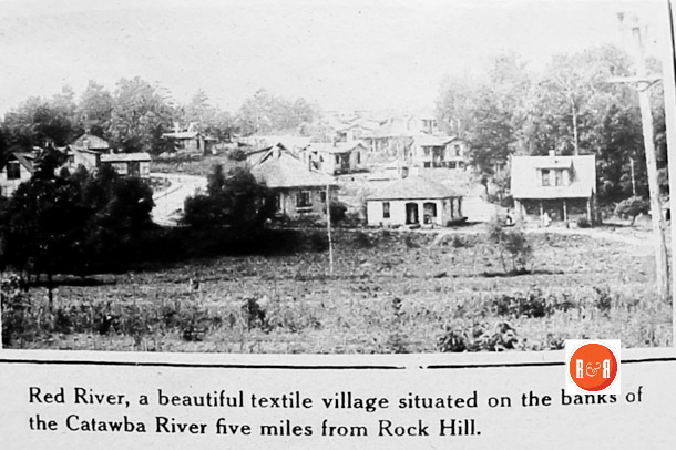
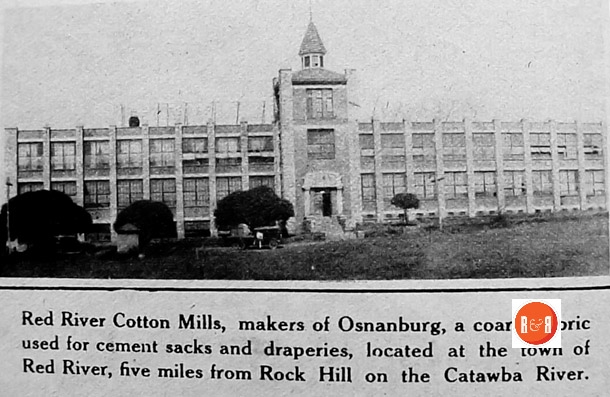
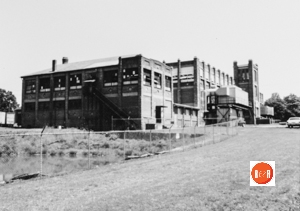
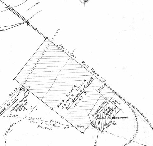
The Rock Hill Record reported on March 21, 1927, – “That real estate records show the transfer of lots from the Red River Cotton Mills to ten people for full value.” The Red River mill was last operational in ca. 1968 and was then Randolph Yarns.
Mr. Dan LaFar conveyed the following information on 2.20.2020 – ” My father and his brother purchased the Red River Mill after World War II in about 1945 from a person I recall as York Wilson. As you probably know, the original owners of the mill and the entire rather expansive village was the Carhartt company of Detroit, Michigan. My family tried to make the plant operational by replacing windows which were all broken, and fixing up the property which was in a poor state of repair. I personally joined the company which was one of six spinning plants it operated in 1960. They originally named the corporation Farmac which was a combination of the LaFar name along with Mr. Burke McConnell of Greensboro. McConnell sold his interest to the LaFars in the mid 1950s. In 1962 Mr. Tom Urmston of Wilmington, Delaware purchased a minority interest in the mill and the name was changed to Randolph Yarns. In about 1970 Urmston sold his interest back to the LaFars and the plant continued to operate until 2003.”
In the 1960s, Red River became a mysterious location revolving around the Crossroads Baptist Church abandoned cemetery and old church site. Note below the concrete baptismal pool which remains intact in 2005 on the old Saluda Road leading to the Nation Ford over the Catawba River. The mill was closed in ca. 2000 and was down to approximately fifty employees.
Red River was much more than a mill village, it was historically located at one of the most interesting and historic sites in all of York County. The famous Crossroads, the Yorkville Road and Saluda roads crossed at the top of a knoll just south of the village, but the all important Catawba River crossing, Nations Ford was just to its east. Other important associations were Garrison’s Mill, Moore’s Ferry, and the Carhartt Mansion.
CARHARTT’S HAPPY AND CONTENTED VILLAGE – Contributed by Paul Gettys
(Remnants of Carhartt village still exist on Red River road on the southeastern edge of Rock Hill near the Catawba river where the Norfolk and Southern Railroad crosses the highway. Recently the cotton mill building was torn down. A few cottages with Swiss chalet exteriors are still standing and a few mill houses are still there. Not far away is the “crossroads” where in 1840 local plantation owners and Catawba Indians agreed to petition the state legislature to bring an end to the practice of white settlers leasing land from the Indians. The result was the Nation Ford Treaty of 1840. The article appeared in the Rock Hill Herald, February 7, 1920.)
This thriving village is the scene of great daily activity and there is in the making a city at no far distant date, if one judges from the indications seen on every hand. One only needs to picture paved streets, the avenue already having been graded and curbed, to give one the prettiest little village to be seen anywhere. The mill here is operating to capacity and there are scores of happy homes, housing several hundred contented and industrious people. One great need felt by the residents is that of an adequate passenger station as they frequently desire to come to Rock Hill. The lonely little shed, that has for years served to protect one from the rain, while waiting for a train, is manfully doing duty at the same old stand, but in rainy weather the conditions are most disagreeable and there is no protection from the cold. It is to be hoped that the proper officials will at an early date take steps to see that a station with telegraphic communication is erected here.
D. E. Mahaffey is superintendent of the mill and that he is right on the job is evident, after a trip through the big mill. And he has gathered together an array of assistants, as follows: C. W. Ross, overseer of carding; W. S. Parker, overseer of weave room, with J. W. Davis, second hand; W. F. Morton, overseer of spinning; C. A. Moss, machinist; RR. Fry, overseer cloth room; J. R. Huddleston, overseer dye room. Mr. Green is head bookkeeper and postmaster. A small company store is being operated for the convenience of the people here and a new store is being built. W. M. Lybrand is manager of the store, with Miss Cora Nicholson as assistant. SCROLL DOWN
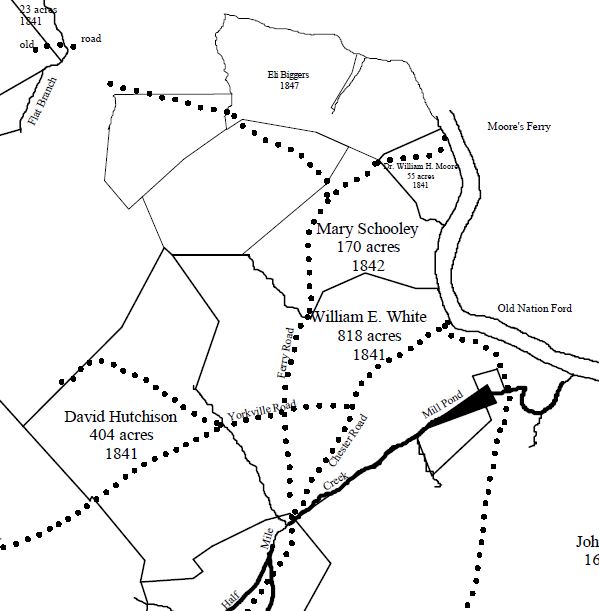
Map of the Nations Ford and area including the Hutchison farmstead and the historic Saluda and Yorkville Crossroads. Courtesy of the ENLARGEABLE Heritage Map Collection by Mayhugh – 2017 The coordinates for the historic Cross Roads Site are: 34.9562702, – 80.9717562 (Private Property)
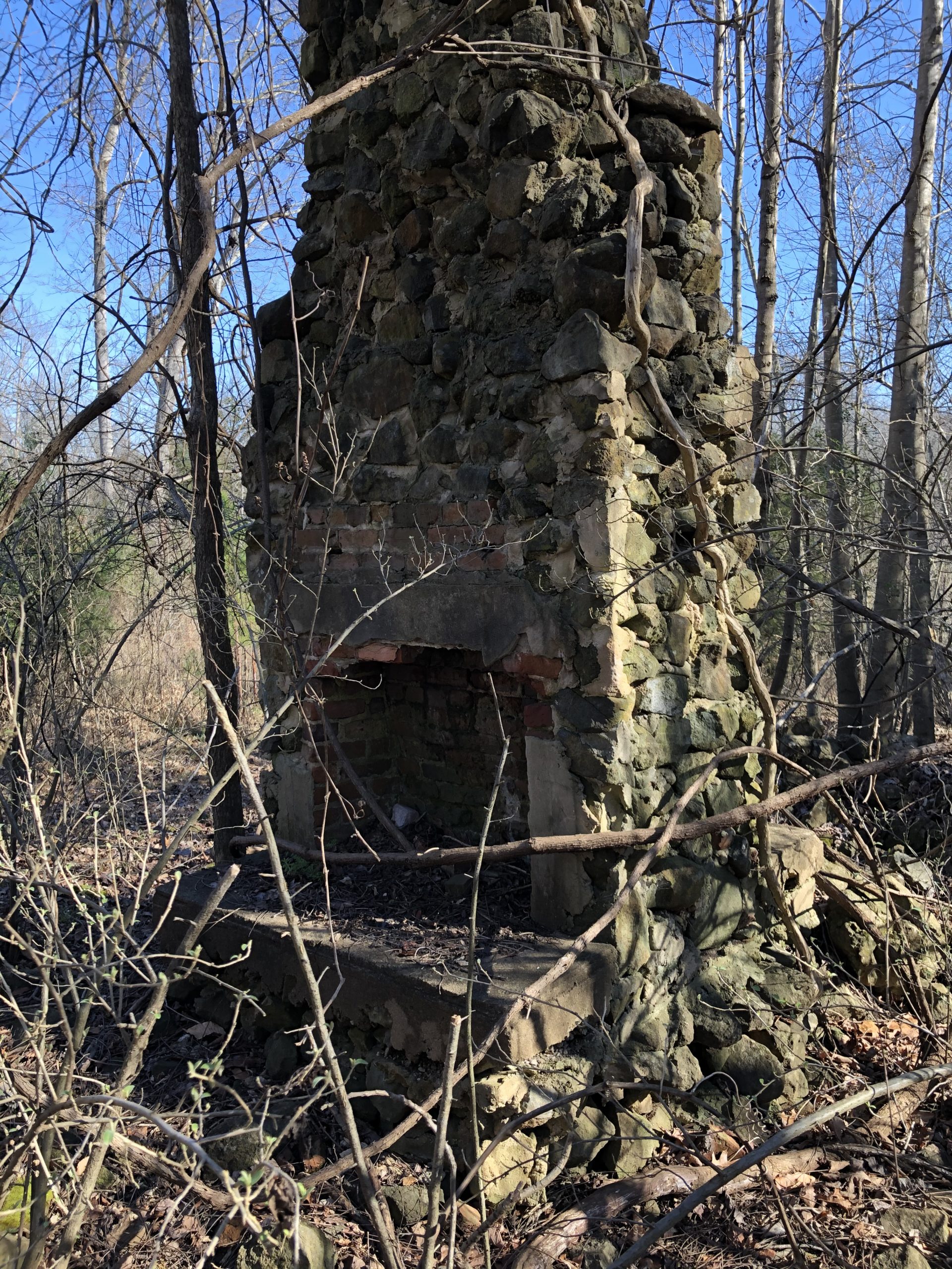
Double sided fireplace chimneys with rock and brick construction having tall peaks. Originally five of these were in a line on a ride to the north of the historic Cross Roads and appear, to have been connected, as perhaps as in a dormitory. DO YOU KNOW ANYTHING ABOUT THIS MYSTERY? IF SO PLEASE COMMENT THIS PAGE.
A splendid school is already in operation, with Miss Carrie Bell Poag as principal and Miss Nell Wood assistant teacher. There has been an average attendance of 45 this year and when the new school building, now nearing completion, is ready for occupancy the school facilities will be greatly increased. Many new residences are going up on the village streets and the ring of the hammer and buzz of the saw can be heard from morn until night. Plans are also about ready for a large and commodious boarding house and this will be another needed convenience. Those who know Hamilton Carhartt are convinced that he will not stop short of one of the most modern villages to be found anywhere. The site is most ideal and right in the heart of huge cotton fields, just off the banks of the Catawba, where in years gone by the happy Catawbas fished and hunted, a model building has arisen and is steadily being added to. The growth of this village will doubtless prove little short of a revelation to many in Rock Hill and all are cordially invited to come out and get acquainted with their busy and prosperous neighbor.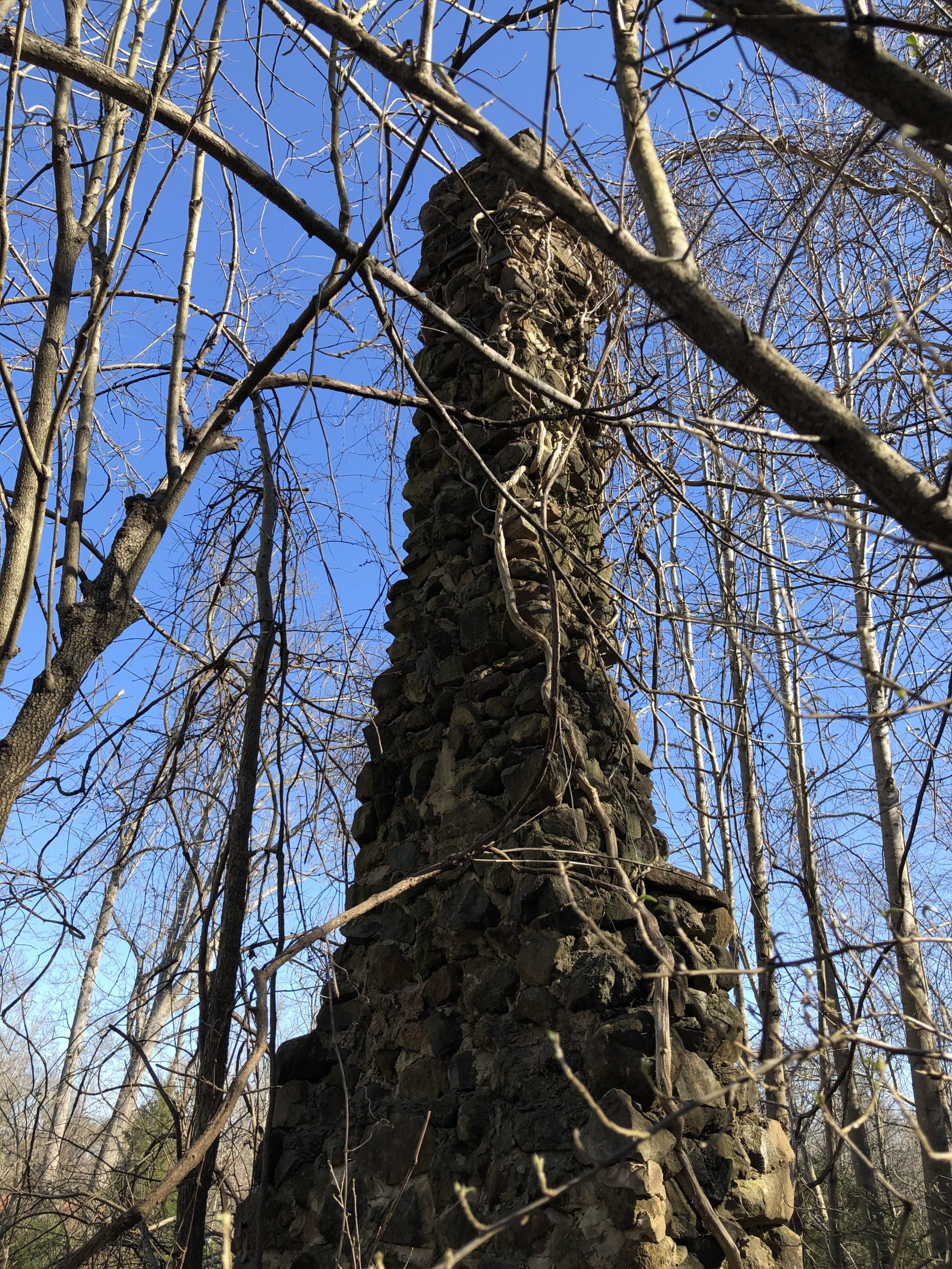
Every Friday night a social is enjoyed by the villagers and these gatherings are proving a means of getting every person in the village acquainted. Last night the “party” was at the home of Rev. S. W. Whiteside and he occasion was for the benefit of the church and Sunday School. There were numerous boxes to be auctioned off and the proceeds amounted to $11, one of the boxes bringing in the neat sum of $4. Following the sale he boxes were opened. Information from YCGHS—December 2003

R&R HISTORY LINK: NATIONS FORD RIVER WEIR – IMAGE
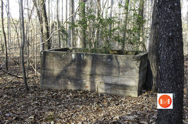
Baptismal pool at the Crossroads Baptist Church near Red River. Courtesy of the AFLLC Collection – 2015 The Rock Hill Herald reported on March 20, 1884 – “The Crossroads School House, which is now being used as a church, has recently been improved with the building being repaired and with new pews and a pulpit installed. The work was done at the expense of Mr. ___ D. Childs.” (Mr. L.D. Childs of Columbia was married to the only child of Baxter Springs @ Springstein.)
See the More Information link in the picture column for a detailed map of the Carhartt Property which encompassed most of Celanese and visit R&R’s other site on the location at Map 1939. As well as read about the Catawba Treaty of 1840, to learn more about this important site. Other interesting sites in the area include Garrison’s Mill.
Comments provided to R&R:
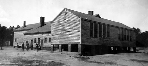
Richard Kee posted on FB 12/11/15 – “I was born in that community and attended first grade at the school at the top of the hill behind the church mentioned earlier. I still have my first-grade report card. Mrs. A. H. Kaylor was my teacher.”Chuck Porter stated on 12/12/15 – “I started school at Red River School in 1946. When the school burned down I moved to Richmond Drive. I remember when the train would come by at times it would start a fire near the school and the fire had to be put out. The tracks were close to the school and I think the conductor had fun blowing the horn when it got near the school Outside the school was a long water trough that had water spewing out that we could get drinking water. At the entrance of the school was an old church that we sometimes heard rumors of ghost being at this church. We had to take our lunch and I remember swapping sandwiches with other kids. I remember one of my teachers was a Mrs. Kaylor. Wow what memories.”
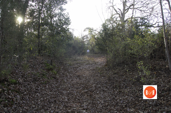
Section of the historic cross roads near Red River. Reportedly, the site of the signing of the 1840 Catawba Treaty.
On 12/13/15, R&R received the following note from Dr. Richard Kee – If ever there was a community that fitted the phrase “It Takes a Village to Raise a Child,” it was Red River in the 1930’s and 1940’s. I think my father gave the best description of Red River when I asked him about Red River on Father’s Day, 1980 when he was 81 years of age. His response: “Red River was family – everything done there was done in fun – when someone needed help, the whole village helped. When outsiders came in and tried to change things, they were in trouble. “There were beautiful magnolia trees on either side of the street on the “Front Line”. Most who lived there worked in the mill, other than my grandfather, John McCraven, who lived in the first house on the left when entering the village from the Charlotte Highway, and my father, Lonnie Key, who lived in the last house on the front line before reaching the railroad. It was in that house in 1938 that I was born. Though people worked in the mill, they had cows, chickens, and pigs, and everyone pitched in caring for the animals. I recall buckets left on back porches with food waste, commonly called “slop” for the pigs and those who had pigs would feed that slop to the pigs. When slaughter time came, fresh meat was shared with neighbors. I had an uncle, James T. McCraven, who would read to children in the neighborhood, often at night by the light of a kerosene lantern. My late sister was always captivated by Uncle James’s readings.
A section of the Celanese survey of 1947 of the Carhartt Properties and Red River. Note the historic crossing shows on the dotted lines and the railroad trestle over the Catawba River in the top left corner of this map. Courtesy of the Stegall Collection.
Both my older brothers used rabbit boxes to catch wild rabbits in the area that was known as t bottom. One skinned and cleaned the rabbits and sold them to villagers for 25 cents each during WWII. For decades following our move from Red River in 1944, when a villager who lived there during WWII passed away, the whole clan of villagers still living would gather at the funeral to recall the camaraderie they experienced in the village. In fact, one of my cousins, James S. “Jimmy” McCraven, just before he died in 2001, when talking about things he might want in his funeral, remarked, “Can’t they just make one more trip through Red River on the way to the graveyard?”
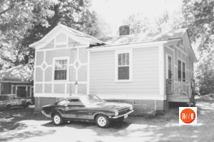
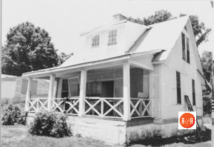
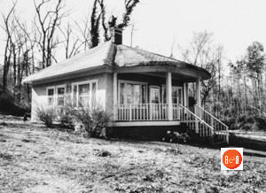
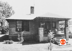
Some of the Red River houses taken by the S.C. Dept. of Archives and History in the 1980s.
There aren’t many of us left who experienced that lifestyle in Red River. All of my family in the previous generation are gone, as well as most of those in my generation, but when we do get together, we share the fond memories we experienced growing up there.
Chuck Porter also stated, lots of memories. “One is my dad, Desport Porter drove a school bus back and forth to Red River.” 12/23/15
Stay Connected
Explore history, houses, and stories across S.C. Your membership provides you with updates on regional topics, information on historic research, preservation, and monthly feature articles. But remember R&R wants to hear from you and assist in preserving your own family genealogy and memorabilia.
Visit the Southern Queries – Forum to receive assistance in answering questions, discuss genealogy, and enjoy exploring preservation topics with other members. Also listed are several history and genealogical researchers for hire.
User comments welcome — post at the bottom of this page.

R&R HISTORY LINK: The Hutchison Group – 2021 HISTORIC CATAWBA TREATY SIGNED AT THE CROSSROADS

R&R HISTORY LINK: HISTORIC CROSSROADS

R&R HISTORY LINK: CARHARTT MANSION HISTORY
Please enjoy this structure and all those listed in Roots and Recall. But remember each is private property. So view them from a distance or from a public area such as the sidewalk or public road.
Do you have information to share and preserve? Family, school, church, or other older photos and stories are welcome. Send them digitally through the “Share Your Story” link, so they too might be posted on Roots and Recall.
Thanks!

User comments always welcome - please post at the bottom of this page.


Another interesting thing to note about the Red River area is that it was part of the earliest area of modern-day Rock Hill to be settled in the late 1700’s. Daniel Sturgis had a log cabin built on what was surveyed by Celanese as ‘Wilkerson’ land. The log cabin sat on the property through the late 1980’s before it was bulldozed. Maggie Wilkerson lived in the home until it was inhabitable and she then moved into a school bus on the property.
John McCraven was my great grandfather. I rode Desporte Porter’s school bus. He stopped on Charlotte Hwy (we lived where McDonalds is today) and picked us up and then picked others up along the way. He drove past the mill and went right around the pond, then on to the top of the mountain and circled the old building which was either the school or the Chapel. I’m not sure where the old mansion was but I believe we turned right on a dirt road and circled around just before the railroad track. Didn’t matter how long the trip was because the bus kids were not counted tardy. I remember the lady living in the bus. (Maggie Wilkerson was her name. She was a large landowner adjoining the Carhartt’s property – WF).
Vivian, was Besse Mae your grandmother? Marion McCraven was my grandfather. Dena was my mother. i remember my grandfather taking me to see Maggie a couple of times at the bus.
Vivian, Are there any photos of the Carhartt Mansion?
I heard that there are no known photos of the Carhart Mansion. If there were, I am sure it would be here on R&R.
Both sides of my families were from Red River. I never lived there but I have Red River running through my veins. My mother was Marie Farmer and my daddy was Billy Kennington. They were in Mrs Kaylor’s class in the school there. Many many years later I was in Mrs Kaylor’s class at Richmond Drive and when she saw my name on the list she asked about my parents and were they from Red River? I said yes mam’ and she nearly fainted (I guess they must have been a little bit on the bad side) I knew all the people who lived there and the comments about everyone being family is so right, because even as people began to leave that area they still kept in touch and loved one another. I am proud my roots came from a place called Red River…..wish we had a Red River now!
Does anyone know what happened to the Mansion? Did it burn, damaged by flood, etc?
I hope one of our members or users will provide the answer.
Wade@R&R.com
Does the crossroads location and mysterious rock chimneys still exist, or have they been overrun by all of the “progress” at Paragon Way road?
Rusty,
I haven’t been to R&R in quite awhile and just saw your question. With permission (private property), I visited the ‘crossroad treaty site’ yesterday and the road bed is still there. One of the chimneys is standing. With all the dirt moving neither one may be there today. Seems there should be some type of marker there for the ‘crossroads’.