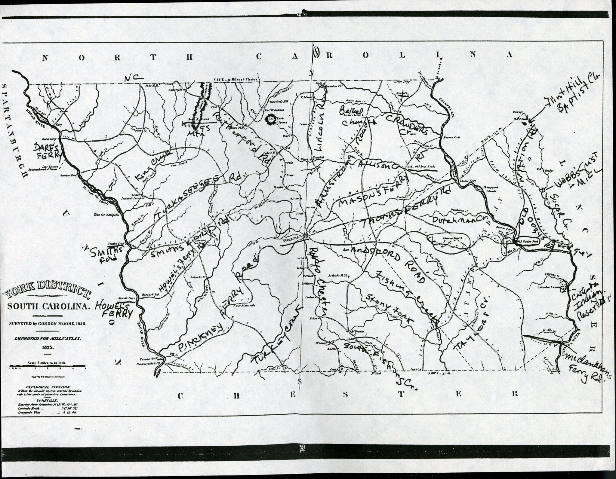
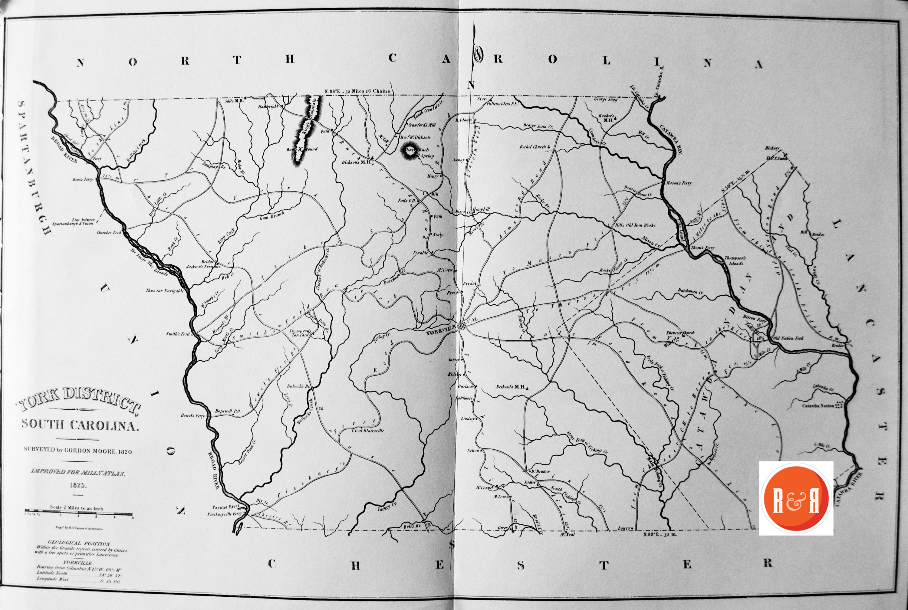
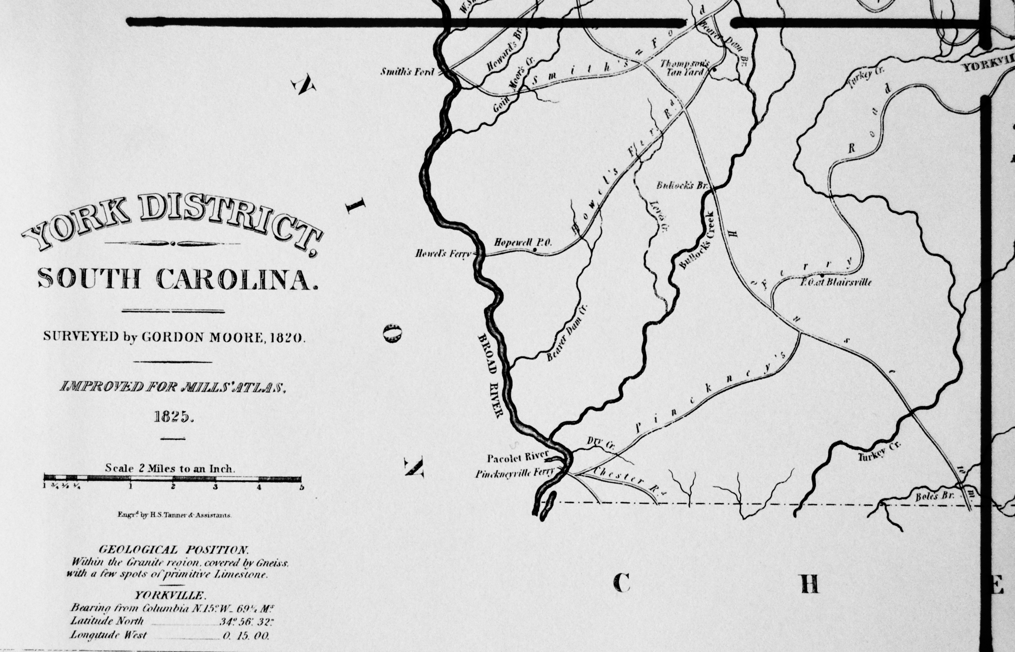
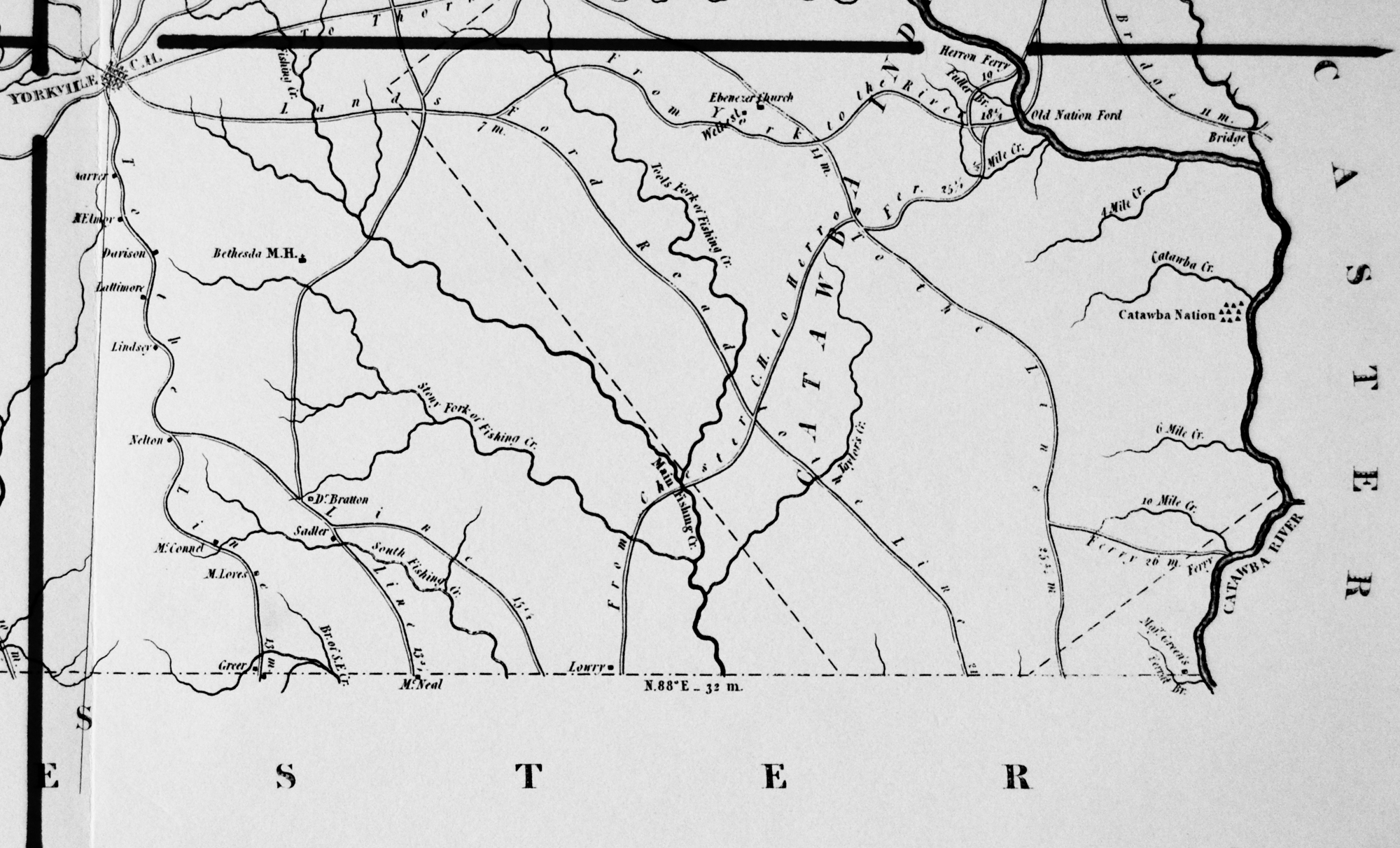
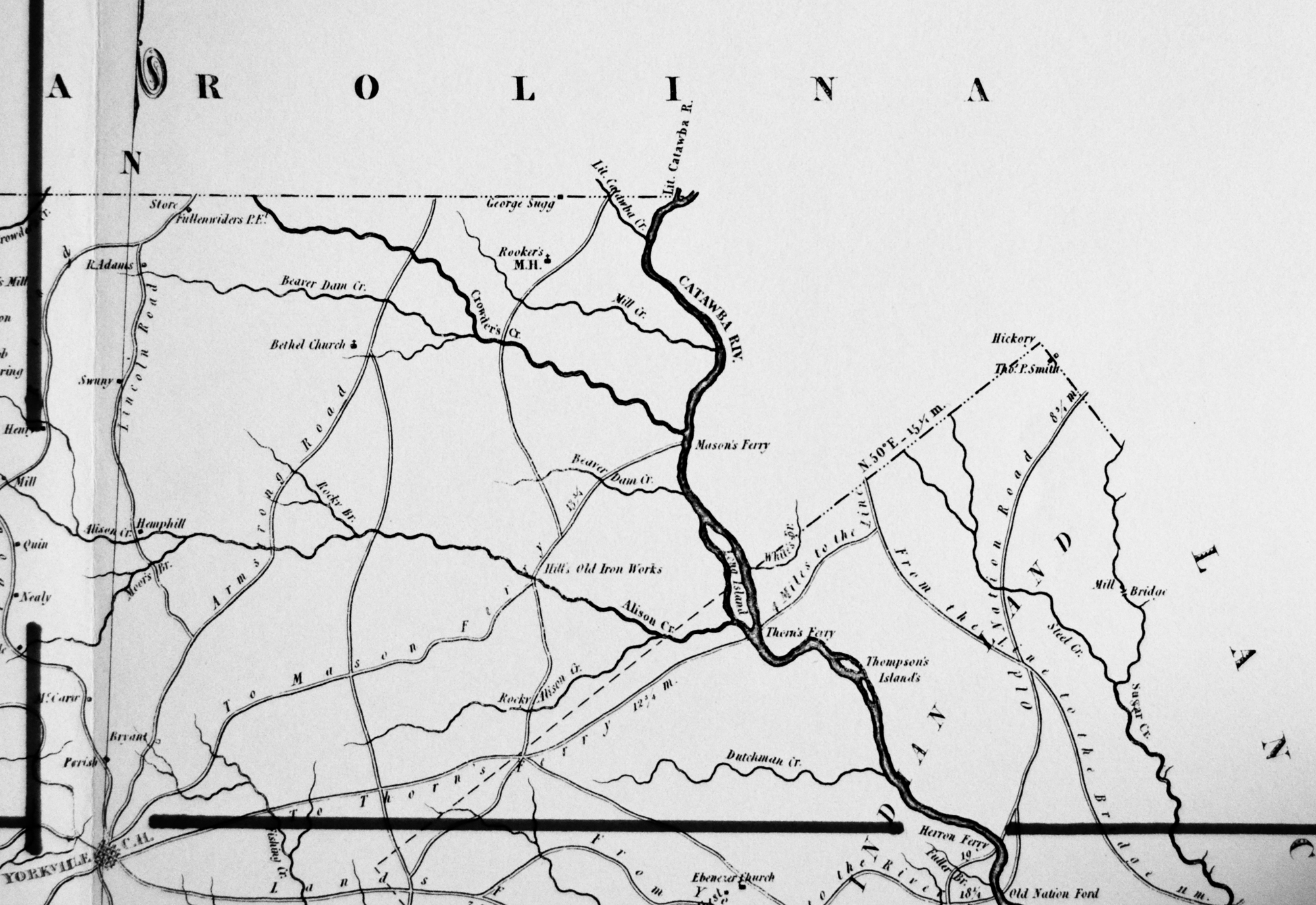
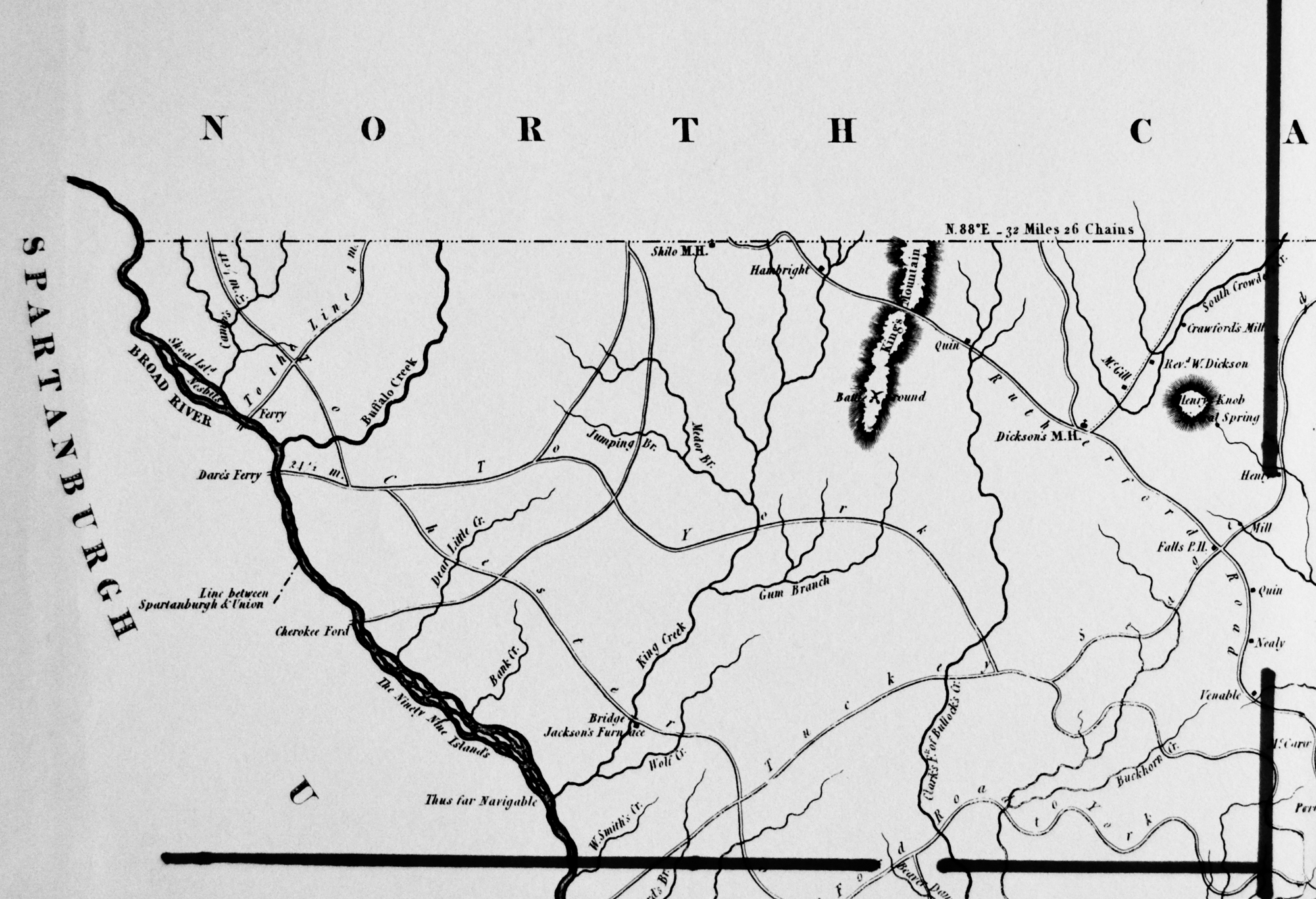
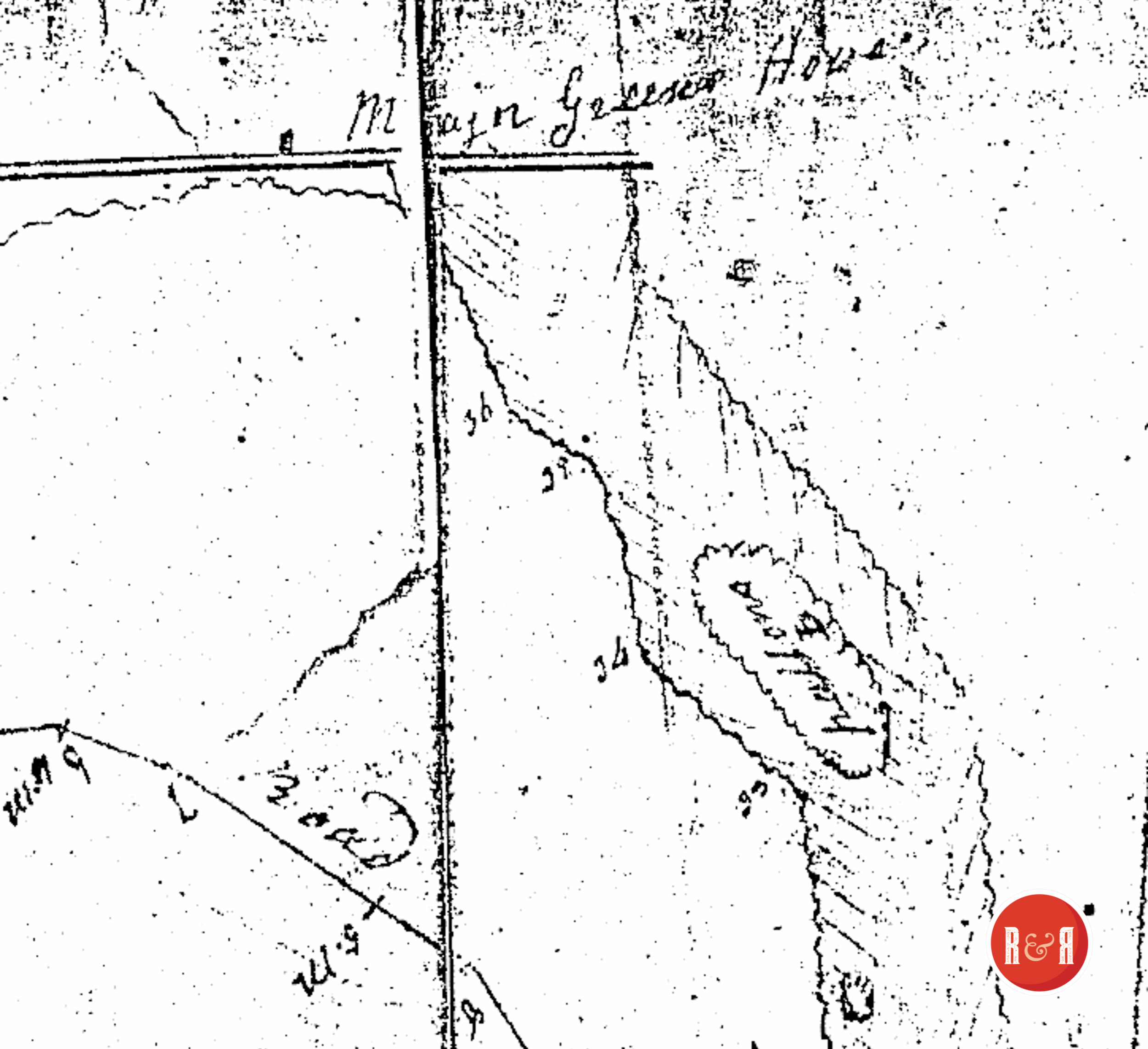
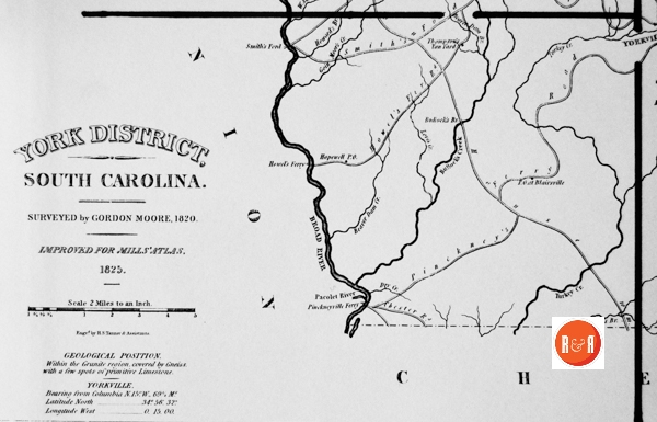
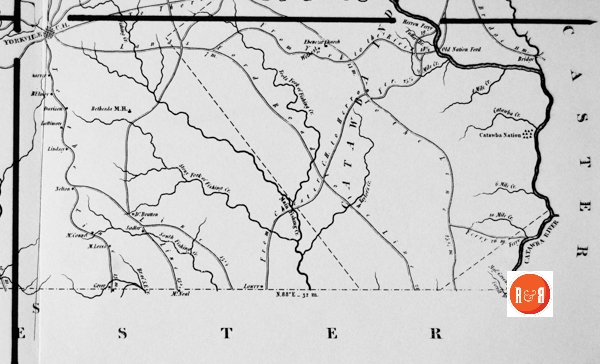
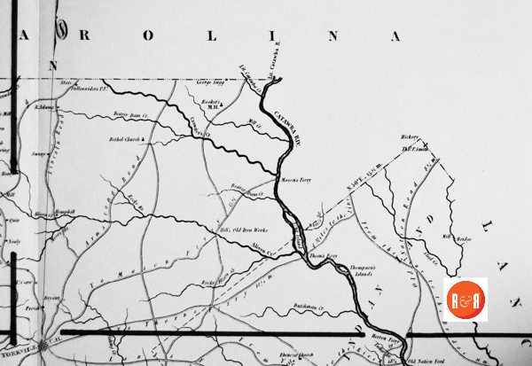
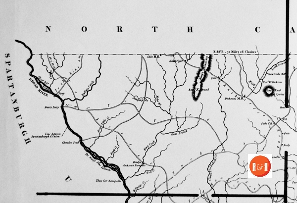
City Directories and History: Architect, Mr. Robert Mills was hired by the State of S.C. to create accurate maps of the state’s districts. In turn, he employed knowledgeable surveyors to survey the local areas, from which he created his finished maps of S.C., districts or counties. This resulted in accurate maps of roads, streams, and cities located in each. Click on the More Information /Enlargeable links, (found under the picture column), for an enlargeable county map, a history of Robert Mill’s survey of S.C. counties, written by Gene Waddell in 1980, an index to the names listed on the maps, and enlargeable quadrants for conducting in depth research.
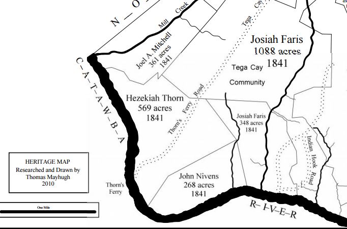
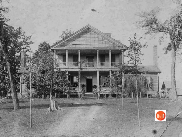
THORNES FERRY Heritage Plat Map by Mayhugh – All rights reserved R&R.com
“Gordon Moore had completed his survey of York by December, 1818, but through no fault of his own, he was not paid until a full year later. He petitioned the Legislature for additional work that he was required to do and for interest, and he was compensated. His petition states that he was to have been paid $1,000 upon completion of a survey and that he had finished before the one of Chester was approved, but illness prevented him from submitting it for approval until one or two days later. The Civil and Military Engineer, Wilson, had ordered him to resurvey the boundary between Chester and York because upon comparing the two surveys,”it was found that there was a difference of two miles.” His resurvey satisfied Wilson “that his first measurement was strictly correct” and that the error had been made by Charles Boyd. The Legislature voted him $100 for the extra work and $70 in interest.” Information from: Mill’s Atlas of South Carolina – 1825, Southern Historical Press, 1980
R&R has also taken individual county maps and created a list of their recorded sites, allowing R&R’s users, faster access to historic data. Each of the More Information links opens items connected to the Mill’s map of this county. The last four are those related to Quadrants 1-4. Names within each quadrant are listed below and at the bottom of the page, is an alphabetical list, of all names shown in York District, along with other counties in which the name also appears. Click on the highlight below to see another excellent digital map of York District.
Scroll down to view the sectional lists.
| Map Section #1 | Map Section #2 | Map Section #3 | Map Section #4 | ||||
| 1 | Adams, R. – Y | 2 | 10 Mile Creek – Y | 3 | Alison Creek – Y (2) | 4 | Bank Creek |
| 1 | Beaver Dam Creek – Su, Y | 2 | 4 Mile Creek – Ge (2), Y | 3 | Armstrong Road – Y | 4 | Broad River |
| 1 | Blairsville P.O. – Y | 2 | 4 miles to the Line – Y | 3 | Bethel Church – Sp, Y | 4 | Buckhorn Creek – P, Y |
| 1 | Bole – Ch, Y | 2 | Bethesda M.H. – Y | 3 | Bryant | 4 | Buffalo Creek – A, Ch’f, N, U, Y |
| 1 | Bole’s Branch – Ch, Y | 2 | Catawba Creek – Y | 3 | Crowder’s Creek – Y | 4 | Camp’s Creek – Y |
| 1 | Bullock – H, Y | 2 | Catawba Nation – Y | 3 | Four Miles to the Line | 4 | Cherokee Ford – A, U, Y |
| 1 | Bullock’s Br. – Y | 2 | Davison – Co (3), Y | 3 | From the Line to the Bridge – Y | 4 | Clark’s F’k of Bullock’s Creek – Y |
| 1 | Bullock’s Creek – Y | 2 | Dr Bratton | 3 | Fullenwider, P.E. – Y | 4 | Crawford – Be (2), Cha, Mar (3), Y |
| 1 | Chester – F, Lan, U, Y | 2 | Ebenezer Church – D, Y | 3 | George Sugg | 4 | Crawford’s Mill – Y |
| 1 | Chester Court House 10 m. – Y | 2 | Ferrat Br. – Y | 3 | Hemphill – Y | 4 | Dare – Sp, Y |
| 1 | Chester Road – Y | 2 | Ferrat- Y | 3 | Hill – A, D, F, Gr, Su, U, Y | 4 | Dare’s Ferry – Sp, Y |
| 1 | Dry Creek – E, Y | 2 | Ferry – Be, Cha (2), Co, K (4), Lan, N (2), U,Y(S) | 3 | Hill’s Old Iron Works – Y | 4 | Dear Little Cr. – Y |
| 1 | Dutchman’s Creek – F, Sp, U, Y | 2 | Ferry 26 Miles | 3 | Lincoln Road – Y | 4 | Dickson, Rev. – W, Y |
| 1 | Goin Moore’s Creek | 2 | Fishing Creek | 3 | Little Catawba Creek – Y | 4 | Dickson’s M.H. – Y |
| 1 | Herron Ferry – Y | 2 | Four Mile Creek | 3 | Little Catawba River – Y | 4 | Falls P.H. – Y |
| 1 | Heward’s Branch | 2 | From Chester C.H. to Herron Ferry – Y | 3 | Long Island | 4 | Ferry |
| 1 | Hopewell P.O. – Y | 2 | From York to the River – Y | 3 | Mason – Be, F, Y | 4 | Gum Branch – Su (2), Y |
| 1 | Howard – Mar, Y | 2 | Fuller – Y | 3 | Mason’s Ferry | 4 | Hambright – Y |
| 1 | Howard’s Br. – Y | 2 | Fuller Br. – Y | 3 | McCarter – Y | 4 | Henry – N, R, Y |
| 1 | Howel – H, U, Y | 2 | Garver – Y | 3 | Meers Branch | 4 | Henry Knob – Y |
| 1 | Howel’s Ferry – U, Y | 2 | Green, Majr. – Ch, Y | 3 | Mill | 4 | Jackson’s Furnace |
| 1 | Howel’s Ferry Road – Y | 2 | Greer – Ch, H, Y | 3 | Mill Creek | 4 | Jumping Br. – Y |
| 1 | Love – Creek, 1C, Y | 2 | Herron – Y | 3 | Moor – E, K, P, Su, Y | 4 | King Creek – Ba, N (2), Y |
| 1 | Love’s Creek – Y | 2 | Lands Ford Road to the Line – Y | 3 | Moors Branch – E, Y | 4 | King’s Mountain Battleground – Y |
| 1 | Pacolet River – Sp (2), U, Y | 2 | Lattimore – Y | 3 | Old Nation Road | 4 | Knob, Henry – Y |
| 1 | Pinckney Ferry Road – Y (2) | 2 | Lindsey – A, Y | 3 | Parrish – K, Y | 4 | Lancaster – Ch’f, F, K, Lan, Y |
| 1 | Pinckneyville Ferry – Y | 2 | Love, M. – Y | 3 | R. Adams | 4 | Line Between Spartanburg and Union |
| 1 | Smith Ford – U, Y | 2 | Lowry – Ch, Ch’f, Su (2), Y | 3 | Rocky Alison Creek – Y | 4 | McGill – W, Y |
| 1 | Thompson’s Tan Yard – Y | 2 | Main Fishing Creek – Ch, Y | 3 | Rocky Branch – F, N, R, Y | 4 | Medor Br. – Y |
| 1 | Turkey Creek | 2 | Major Greene’s | 3 | Rooker – Y | 4 | Mile Creek – Y |
| 2 | McConnel – Y | 3 | Rooker’s M.H. – Y | 4 | Mineral Spring | ||
| 2 | McElmoy | 3 | Smith, Thomas P. | 4 | Nealy – Y | ||
| 2 | McNeal – Ch, Y | 3 | Steel – Lan, Y | 4 | Nesbit – E, Ge (3), Sp, Y | ||
| 2 | Nelton – Y | 3 | Steel Creek – Y | 4 | Nesbits – Y | ||
| 2 | Old Nation Ford – Y | 3 | Sugar Creek – Sp, U, Y | 4 | Quin – Sp, Y (2) | ||
| 2 | Sadler – O, Y | 3 | Swuny | 4 | Rutherford Road – Gr (2), Y | ||
| 2 | Six Mile Creek – Lan, Lex, Y | 3 | Thompson’s Islands – Y | 4 | Shilo M.H. – Y | ||
| 2 | South Fishing Creek – Ch, Y | 3 | Thorn – Ch, Y | 4 | Shoal Island – Sp, Y | ||
| 2 | Stony Fork of Fishing Creek – Y | 3 | Thorn’s Ferry – Y | 4 | Smith Ford Road to York – Y (2) | ||
| 2 | Taylor – Ba, F, Ge (2), K, Su (3), U, Y | 3 | To Mason Ferry – Y | 4 | Smith, W. – D, Y | ||
| 2 | Taylor’s Creek – F, Y | 3 | To Thorn’s Ferry – Y | 4 | Smith, W.: Creek -,Y | ||
| 2 | Ten Mile Creek | 3 | White’s Br. – Y | 4 | South Crowder’s Creek – Y | ||
| 2 | Tool – Y | 4 | The Ninety Nine Island – U, Y | ||||
| 2 | Welhest – Y | 4 | Thus for Navigable – U, Y | ||||
| 2 | Yorkville C.H. – Y | 4 | To the Line – Y (2) | ||||
| 4 | To York – Y | ||||||
| 4 | Turkey Seage Road – Y | ||||||
| 4 | Venable – Y | ||||||
| 4 | Wolf Creek – P, Y |
Stay Connected
Explore history, houses, and stories across S.C. Your membership provides you with updates on regional topics, information on historic research, preservation, and monthly feature articles. But remember R&R wants to hear from you and assist in preserving your own family genealogy and memorabilia.
Visit the Southern Queries – Forum to receive assistance in answering questions, discuss genealogy, and enjoy exploring preservation topics with other members. Also listed are several history and genealogical researchers for hire.
User comments welcome — post at the bottom of this page.
Do you have information to share and preserve? Family, school, church, or other older photos and stories are welcome. Send them digitally through the “Share Your Story” link, so they too might be posted on Roots and Recall.
Thanks!

User comments always welcome - please post at the bottom of this page.


Share Your Comments & Feedback: