“Rock Hill’s highest point become the Johnston’s home site.”
Thomas L. Johnston, M.D., (0000 – 1938) Rock Hill historian William B. White, Jr., wrote, “The highest point on the rail line between Charlotte, N.C., and Augusta, Georgia. The surveyors who originally laid out the path the railroad would follow erected a stone marker on the highest hill at Rock Hill. That stone stood in what became the front yard of the residence of Thomas L. Johnston, (this was the Kirkpatrick farm prior to the Civil War) on Johnston Street, and disappeared when Johnston Street was relocated during an urban renewal project of the City of Rock Hill in the 1970s or 1980.”
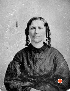
Image of Mrs. T.L. Johnston of Rock Hill, S.C., the wife of Dr. Johnston. Courtesy of the Hutchison Collection
Furthermore, Doctor Johnston and his wife, Dorcas A. (Luckey) Johnston, gradually sold off the land, dividing the entire acreage into residential lots and opening up new streets in the area as needed. The original Johnston Street was nothing more than a one-lane farm road that led to Dr. Thomas L. Johnston‘s house, which sat on an eminence overlooking Church (later Black) Street and the rest of downtown Rock Hill. When the railroad surveyors were laying out the roadbed for the Charlotte & South Carolina Rail Road in the late 1840‘s, they placed a large boulder in the yard of the house that became Doctor Johnston‘s residence in 1869 in order to mark the highest point they had encountered in their surveying of the rail line from Columbia to Charlotte. [Along the Lands Ford Road, Vol. II]
The Johnston-Hampton-Marion-Trade street area was once a part of the 144- acre farm of Dr. Thomas Lynn Johnston, early Rock Hill physician and town warden (councilman). The earliest proved record of the Johnston farm was a grant from the State of South Carolina for 278 acres on June 17, 1842, to Jane McNair, probably unmarried at the time. She was the daughter of William McNair and wife, Elizabeth Neely. It is likely that the original lease of this tract from the Catawba Indians dates from about 1819 and was registered in the name of Jackson Neely, who was a brother of Elizabeth (Neely) McNair. On October 15,1846, Jane McNair deeded the 278 acres to her first cousin, William H. Neely. On December 31, 1851, Neely sold 150 acres of the original 278 acres (including the area cited above, mentioned in Mrs. Guess’ writing) to Isom Kirkpatrick.
*** See p. 80, Leasing Away a Nation PDF… for additional information on many leaseholders including but not limited to: Jackson Neely took a lease on 215 acres dated May 21, 1819.
On October 8, 1863, Mr. Kirkpatrick parted with his farm, selling to Thomas Kirkley Brown for the remarkably inflated sum of $13,500 (Confederate currency). Finally, on August 6,1869, Brown sold the place to Dr. Thomas Lynn Johnston of Lancaster County, S.C. , for $2,500 (Federal currency). Doctor Johnston then moved his family to this place. The house he lived in on his newly acquired farm was situated on the highest point of ground located along the rail line from Charlotte, N.C., to Columbia, S.C. To mark this site, the railroad surveyors erected a large boulder CHI the high ground about 1848-49. This stone remained in place until well after World War II. Dr. T. L. Johnston’s granddaughter Annie Luckey (“Jenks”) Johnston (Mrs. John Wesley) Anderson, wrote once that she could stand in her bedroom in the house her father, Thomas Luckey Johnston, built on the same spot where Doctor Johnston’s house had once stood, look out the window with the southern exposure, and plainly see in the distance the trains passing through the little community of Ogden several miles below Rock Hill. Information courtesy of YYGHS – March, 93
Stay Connected
Explore history, houses, and stories across S.C. Your membership provides you with updates on regional topics, information on historic research, preservation, and monthly feature articles. But remember R&R wants to hear from you and assist in preserving your own family genealogy and memorabilia.
Visit the Southern Queries – Forum to receive assistance in answering questions, discuss genealogy, and enjoy exploring preservation topics with other members. Also listed are several history and genealogical researchers for hire.
User comments welcome — post at the bottom of this page.
Please enjoy this structure and all those listed in Roots and Recall. But remember each is private property. So view them from a distance or from a public area such as the sidewalk or public road.
Do you have information to share and preserve? Family, school, church, or other older photos and stories are welcome. Send them digitally through the “Share Your Story” link, so they too might be posted on Roots and Recall.
Thanks!

User comments always welcome - please post at the bottom of this page.


Share Your Comments & Feedback: