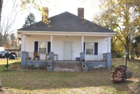
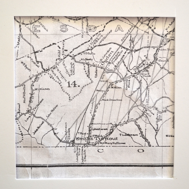
In the 1927 Sanborn Insurance survey of the Ogden area this house was occupied by T.F. Steele. Note on the Sanborn map the platform beside his house for railroad service. This would have been for passengers, mail, freight, etc. being shipped to and from the Ogden community. Note on the 1910 Walker’s map below, the site of the Strait’s Store.
The attached map is Walker’s 1910 Postal map showing the Ogden area just west of Rock Hill, SC.
Please enjoy this structure and all those listed in Roots and Recall. But remember each is private property. So view them from a distance or from a public area such as the sidewalk or public road.
Do you have information to share and preserve? Family, school, church, or other older photos and stories are welcome. Send them digitally through the “Share Your Story” link, so they too might be posted on Roots and Recall.

User comments always welcome - please post at the bottom of this page.


Share Your Comments & Feedback: