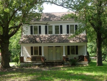
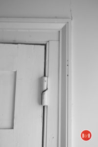
“An historic double door entrance worth entering.”
The Yorkville Enquirer reported on June 21, 1877 – “Chestnut Grove, based on a recent act of the S.C. Legislature, has ceased to be an incorporated town. It was designated as a town for only a short period.”
The Yorkville Enquirer on Feb. 29, 1888 stated – “The name of the PO on the Charlotte, Augusta and Columbia railroad in Chester County heretofore known as Chestnut Grove has been changed to Lewis Turnout.”
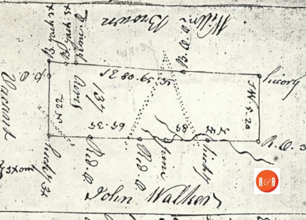
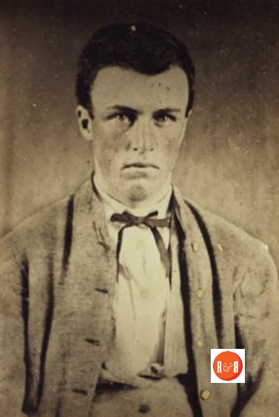
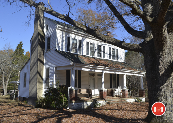
City Directories and History: The Captain James Alexander Lewis house was built circa 1840. The three hundred acre plantation had been purchased by his father, Samuel Lewis in 1830. The plantation was willed to James when Samuel died in 1832. The land originally granted to Elijah Browne in 1787 came down through several conveyances to “Courthouse” John Walker, who conveyed it to Samuel Lewis.
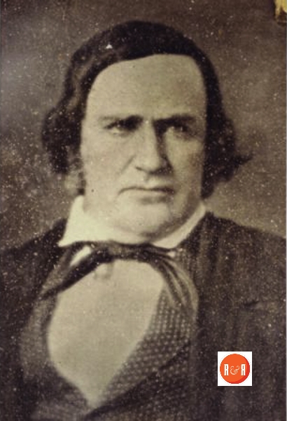
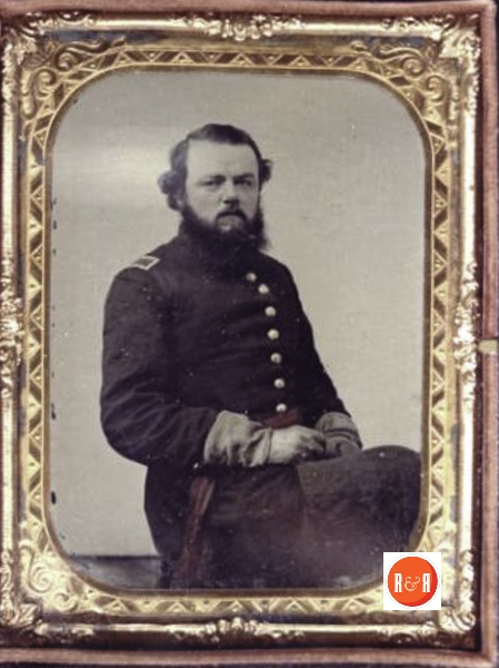
James A. Lewis had been born in the “Lewis Inn” and served as postmaster for the Chestnut Grove Post Office then operated there at the Inn. He later became a Magistrate for Chester District serving the Lewisville area.
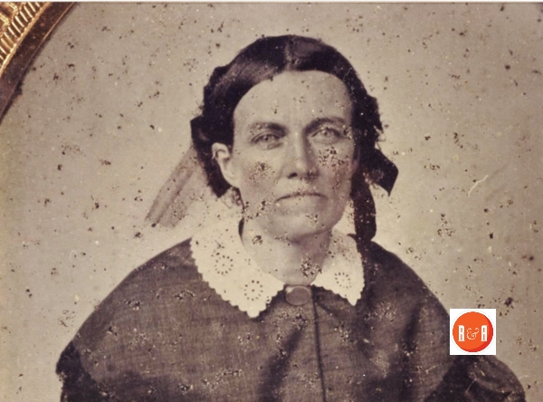
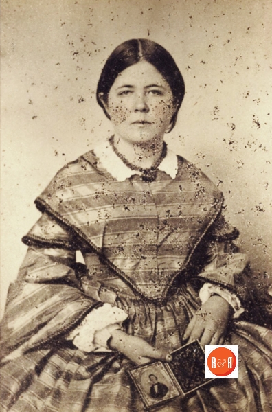
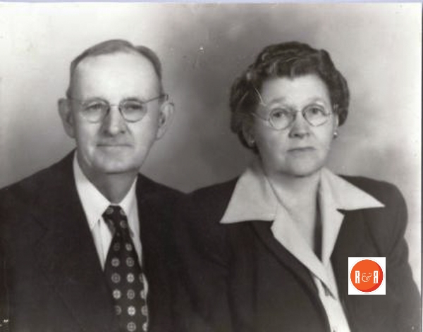
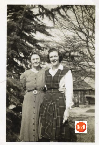
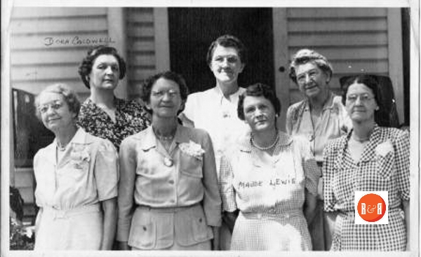
Six generations of the Lewis family have lived in the house and it is still owned today by Thomas Mayhugh son of Catherine Lewis, great-granddaughter of James Alexander Lewis. Justin Mayhugh, son of Thomas occupies the house today – 2016.
The house is built of hand hewed timbers, mortised and pegged together. Prior to assembly each beam was designated with a roman numeral to match each hand crafted joint. The house was covered originally with lap board siding and cedar shingles. Note the wonderful proportions of the “I” house that was so popularly constructed throughout the region in the early 19th century. This house along with many in the Chester area features a double door. This was due to the limited ability of the contractor to remove the central
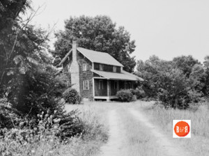
The historic National Register property, the Lewis Inn at Lewis Turnout could easily be Chester County’s oldest remaining structure. Courtesy of the SCDAH
beam that ran down the center of the house, separating the two front doors. An addition was added onto the back in 1910 by James Joseph, son of James Alexander, and Joseph Harold Lewis, his son. The concrete poured around the old rock well in the back yard is inscribed “J.J. Lewis and son plantation – 1909“.
The house sits on the “old road from the South Fork of the Catawba river to Charleston” and on the dividing ridge between Fishing Creek and Rocky Creek one mile from Lewis Turnout. [Family information written by Thomas Mayhugh]
Historian Harvey S. Teal’s Post Office Data in S.C., states: “Chestnut Grove, later Fishing Creek PO, was operated from ca. 1832 – 1853 by James A. Lewis – Postmaster. From 1855 – 1859, Samuel J. Lewis was the Postmaster. Fishing Creek was run by Smith L. Lewis from ca. 1828 – 1832.”
Informative and connection links: Mills Map of Chester SC also see the Guy Family Home and the Lewis Inn.
Stay Connected
Explore history, houses, and stories across S.C. Your membership provides you with updates on regional topics, information on historic research, preservation, and monthly feature articles. But remember R&R wants to hear from you and assist in preserving your own family genealogy and memorabilia.
Visit the Southern Queries – Forum to receive assistance in answering questions, discuss genealogy, and enjoy exploring preservation topics with other members. Also listed are several history and genealogical researchers for hire.
User comments welcome — post at the bottom of this page.
R&R HISTORY LINK: Samuel Blair’s Plantation
R&R HISTORY LINK: Guy Homeplace
R&R HISTORY LINK: Rev. Arch. Whyte
Please enjoy this structure and all those listed in Roots and Recall. But remember each is private property. So view them from a distance or from a public area such as the sidewalk or public road.
Do you have information to share and preserve? Family, school, church, or other older photos and stories are welcome. Send them digitally through the “Share Your Story” link, so they too might be posted on Roots and Recall.
Thanks!
LEWIS TURNOUT HISTORY by Thomas Mayhugh (Information courtesy of and from: CDGHS Bulletin)
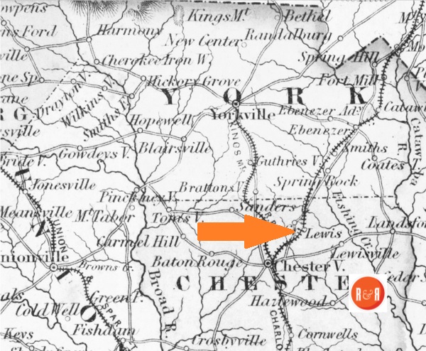
Preface: There is little to substantiate and much to refute the notion that Lewis Turnout in Chester County received its name in 1850 from a “John Lewis”, civil engineer on the C.C.&A. railroad. I assert that Lewis Turnout received the name Lewis not from an itinerant engineer, but from the family of Samuel Lewis who lived at that locale over thirty-five years before the construction of the Charlotte, Columbia, and Augusta Railroad. However, upon construction of the railroad in 1850, the word Turnout did become associated with the location. Turnout is a term referring to the side tract or siding that ” turns out” at strategic points along the rail line where cars could be loaded or unloaded without obstructing the main line. Between Chester and Rock Hill one such turnout was constructed at Lewis and another 4 miles north at Smith’s. When the county was surveyed by Charles Boyd for Mills’ Atlas in 1818, this point on the Saluda road was simply denoted as Lewis.
Walker’s:
Near the open end of a small valley created by a loop in the ridge line between two tributaries, Fishing and Rocky Creeks, of the Catawba River in northern Chester County S.C. is the locality known as Lewis Turnout, where the old Saluda, and Rocky Mount roads cross the Southern Railroad. The valley drained by a small branch of the South Fork of Fishing Creek opens out into the great Fishing Creek valley to the north but is surrounded by the high rise of the Rocky Creek ridge on the east, south, and west. The old Saluda Road (Highway 72) enters from the south and the direction of Chester running parallel to the railroad and passes out into the large Fishing Creek valley in a northerly  direction toward the old Nations Ford on Catawba River. The Rocky Mount road (Blaney Road) enters this vale southeast from the direction of the river ford at Rocky Mount ( near Great Falls) coming over the ridge and meandering down across the branch, the Saluda Road, and the Southern rail to return again onto the ridge to join with the Old Armstrong Ford road or Charleston road. This crossroads and vicinity in 1785 became significant in Chester County history when the first court was held in the nearby log house of John Walker.
![]()
This rich rolling creek valley on the west side of the Catawba river in present York and Chester counties was believed to have been part of Anson County in die province of North Carolina when the first pioneer families (mostly Scots Irish Presbyterians) came down from Pennsylvania and settled circa 1750 on the banks of Fishing Creek. But by 1760, Irish immigrants began arriving in the area from Charles Towne and were granted tracts of from 100 to 300 acres by the colonial governor of South Carolina, – tracts often intermingled with adjacent surveys patented through the North Carolina counties of Anson, Mecklenburg and Tryon. A Richard Carroll in 1763 was first to obtain warrants of survey and consequent grants of land in the small branch valley of the South Fork of Fishing Creek which today is Lewis Turnout, – a 150 acre tract surveyed by John Gaston in April and another 150 acres a short distance up the Saluda Road to the north surveyed by Issac Perry in December.2 In 1769, he was granted a third tract of 300 acres also surveyed by John Gaston adjacent to the first on the Saluda Road and on the head of the Dry Branch of the South Fork of Fishing Creek.3 (See page 2) Each of the three surveys was laid out to include both the small creek and the Saluda path within its lines. At the time of the survey, the old Indian path to the river ford at Rocky Mount crossed the Saluda trail further south about one mile – but consequent to the numerous wagons entering die area in the 1760’s, the path evolved into a wagon road following die nearby ridge between Fishing and Rocky Creeks, crossing the Saluda trail one mile north of its old location at die point of Lewis Turnout, where die road expeditiously passed through the small vale formed by die circuitous loop in the ridge line. Nine years later, in April 1772, John Walker purchased from Richard Carroll die two adjacent tracts of 150 and 300 acres, built a house and began clearing land. His 450 acre plantation encompassed die area now called Lewis Turnout and his house built on the hill above the crossroads was die site of die first court held in Chester County in April, 1785.4 In January 1786, Edward Lacey, Gendeman Sheriff; agreed and was appointed to build a temporary jail at die house of John Walker, die place gained by die vote of the people for die situation of the Courthouse and other public buildings of die county. In the minutes of Chester County Court, October 6,1786, it is recorded that John Walker had built a jail according to a former order empowering Edward Lacey Esquire to carry on said project The court received die jail as substantial and amply fit for the county but did not proceed to settle the price of the building with John Walker. They did order that all public money for the discharge of the jail be paid to him.5 At a court held April 9th 1790, it was ordered that a road be cleared from the York County line at the most convenient place to Hambleton’s Ford on Broad River, the nearest and best way to John Walker’s plantation where the court is now held, and from thence to die Mountain Gap Road.
In September court 1793, it was ordered that the clerk, sheriff, or treasurer of Chester County shall by order of Edward Lacey pay unto John Walker the balance due to him for building the old county jail.6 Thus by 1792, a more central location (the present site of Chester) had been chosen to be the site of the courthouse and public buildings of the county. (Article continues with legal documents……..)
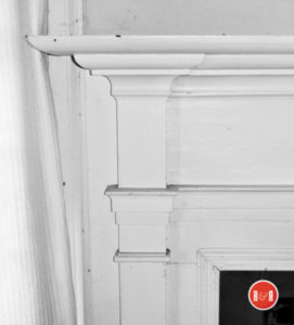
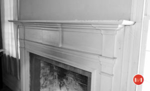
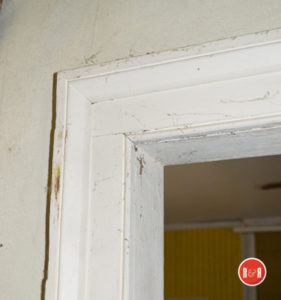
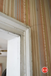
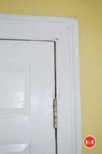
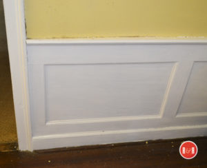
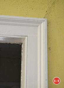
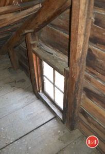
PHOTO GALLERY – 2017
-
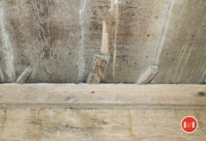
- Floor shims showing the leveling of the early 19th century floors.
-
- SCROLL DOWN FOR ADDITIONAL IMAGES
-
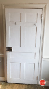
- Beautifully paneled doors on second floor.
-
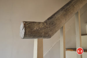
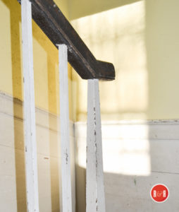
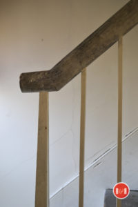
- Newel post to the 3rd floor – attic.
-
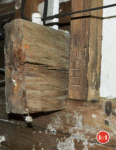
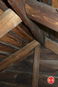
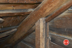
- Main framing was hewn and numbered with Roman numerals for quick assembly.

User comments always welcome - please post at the bottom of this page.


Share Your Comments & Feedback: