Barnwell – County and County Seat
Once a cattle-raising empire and a region devoted to horse racing and fine horse flesh, Barnwell County at first shunned railroads, a decision that had profound effect upon the seat of county government. But in the early 1880s the town of Barnwell finally got a rail line, and with it came considerable economic growth and development.
In the latter part of the eighteenth century Barnwell, called at first Winton County, was formed from a portion of Orangeburg District, and for a hundred years her citizens have been prominent in the social, political, and industrial development of South Carolina. In the early days of the county the people were pastoral, and vast herds of cattle fed through the virgin forests, untracked previously save by the Indians and the game they followed. In fact, until the soft white fingers of the cotton queen throttled other industries, stock raising was very extensively carried on in this section. It is said that on the immense farm of Col. Maham there were 700 brood mares.
Seventy-five years ago horse shows were held here, and about the same time the Sherwood Track was laid out and the first races were run. Stock raising being stimulated by these events, blood horses were brought into the neighborhood, and many noted stallions have left their impress upon the Barnwell horses, which for generations have been famous saddle and draft animals. Col. Cash, Major Bacon, and other racing men brought their stables here frequently, and it is an interesting fact that on the day that the Ordinance of Secession was passed races were run on the Sherwood course, which were really the first, last, and only races run in the “free and independent Commonwealth of South Carolina.” All of the horses which participated on that day perished on Virginia battlefields in the Confederate service.
At one time many prominent Charlestonians owned estates in this county, among them, John Rutledge, the “dictator.” Upon one of his plantations on the Upper Three Runs near the Savannah River there is an immense mill dam constructed, tradition says, by negroes who carried the earth with rush fanners. By the water power thus developed several saw mills were operated, and the lumber was rafted down the Savannah River and around to Charleston.
When the South Carolina Railroad was projected, it was proposed by the engineers to run it through the rich country several miles to the west of its present course through Barnwell County, but there was so much opposition shown by wealthy landowners to its passage through their property that the route was changed and diverted nine miles from the county seat. The short-sightedness of these opponents has been shown in the subsequent creation and development of Blackville, Bamberg, Graham, Midway, and other towns along the line of the railroad, which traverses what is now the richest portion of the county.
For a short time after the county of Barnwell was formed the assizes were held several miles from the present county seat. A year or two thereafter the Court House was moved to this place, which was then a stopping place on the stage route between New York, Charleston, and New Orleans, known previously as the Old Cherokee Trail. Having no railroad connection, the village grew slowly. A handful of wealthy planters and graziers and a few lawyers formed about all the population. It was a charming place to visit, truly, but having no business or commercial importance to speak of. The railroad from Blackville to Barnwell Court House was contemplated about 1845, and the first experimental line was run in 1848. Nothing more was done, however, until just previous to the war when $40,000 or $50,000 was raised and the road graded, trestled, and laid with crossties. Before the iron could be secured the war put a stop to work, and Sherman subsequently burned the crossties. The road was then sold for taxes, bought by Col. W.H. Duncan, and then resold to a Mr. Woodward, who laid it with wooden rails and hauled lumber over it to his saw mill. Bought by the South Carolina Railroad about eight years ago, the road was ironed and a regular schedule was inaugurated. One year ago Col. Mike Brown secured the property and has spent a great deal of money in the purchase of steel rails, the filling up of trestles, and the general raising and improvement of the road bed.
The town of Barnwell has grown with the railroad. It has now 1,500 inhabitants, and is rapidly increasing its business and its population. The intendant is Mr. G. Duncan Bellinger, and the wardens are Messrs. N.G.W. Walker, M.J. Pate, F. H. Brown, and Alonzo Harriman. The town marshal is Mr. C.B. Swann, and he is one of the best in the State. The educational facilities of Barnwell are excellent. The graded school is an admirable one and is ably presided over by Prof. B.L. Clark, a graduate of the Citadel Academy. Prof. Clark is assisted by Miss Anna Walker and Miss Hallonquist. The daily attendance is nearly 150 pupils.
There are five church in Barnwell. The Episcopal, the Rev. Mr. Cornish; the Baptist, the Rev. Mr. Bradford; the Methodist, the Rev. Mr. Kistler; the Presbyterian, the Rev. Mr. Dow; and the Catholic, Father Wedenfellow. There are four hotels in Barnwell and the travelling public are well cared for. In fact, the fare and attention will compare very favorably with that of more pretentious establishments in larger places. The Molair House is owned by Leroy Molair; the Brown House, by Benj. Davies; Pechman’s Hotel, by Chas. Pechman; and the Patterson House, by Jno. C. Dowling.
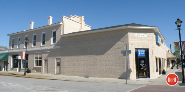
Image of the Lancaster Building by photographer Ann L. Hlems – 2018
Barnwell has two excellent weekly newspapers, both Democratic, of course, and extensively circulated through the county. The Sentinel is one of the landmarks of this section and is edited and managed by Mr. John J. Brunson. The People is owned and edited by Major John W. Holmes, a graceful and pungent writer, whose essay read at last summer’s meeting of the State Press Association at Greenville will be remembered with pleasure by the readers of the News and Courier. Major Holmes is a bachelor and would like to mend his ways.
The municipal authorities of Barnwell have now in course of construction a fine brick building two stories high and measuring 50 by 100 feet. The lower floor will contain two handsome stores, while the upper will be devoted to a hall or theatre, which will be attractively decorated and fitted with a modem stage, opera chairs, scenery, and all that pertains to a first-class place of amusement. The building will also contain a council chamber and lodge rooms.
The public-spirited town council are boring an Artesian well in the public park near the centre of the town. They have already reached a depth of 800 feet, and it is proposed to sink the well 1,200 or 1,300 feet, if necessary, to obtain an ample supply of water for municipal purposes. As soon as sufficient water is secured, a system of pipes and water-works will be established. For the safe-keeping of those visitors who imbibe too freely of the waters of Turkey Creek the council are constructing a strong and commodious guard house of brick and iron.
The Masons of Barnwell are about to erect a handsome temple at a cost of $6,000. The structure will measure 40 by 80 feet and will be built of brick on the lot owned by Harmony Lodge. Two large stores will occupy the first floor, and the hall and several rooms will be above.
Eighteen months ago the Barnwell Bank was established and commenced work in a handsome brick and iron building on the public square. The president is Gen. Johnson Hagood; the vice-president, Col. Mike Brown; and the cashier, Mr. Theo. J. Simons. The bank has been very successful, and at the close of business on January 31,1889, had assets of over $125,000.
There is every probability that before the next cotton season opens Barnwell will have a large cotton seed oil mill and fertilizer factory. (The Yorkville Enquirer reported on March 27, 1889 – “The United Cotton Seed Oil Co., of Penn., has signed a contract for the erection of a $50,000. plant at Barnwell for the manufacture of cotton seed oil and fertilizers. They hope to be in operation by July 1st.”) A part of the money required for such an establishment has been guaranteed, and the additional amount needed will be forthcoming in a few months. A Barnwell enterprise that deserves special notice is the carriage and wagon factory of G.W. Price. This establishment is provided with some of the best modem machinery for planning and woodworking, and in the iron department there are several forges and all necessary appliances for turning out first-class work. Above the shops is an extensive painting and finishing room.
Mr. J.W. Woodward operates a large saw and planning mill near Barnwell and makes very heavy shipments of lumber to northern points. He is now filling an order for 500,000 feet for a Philadelphia firm. Mr. W.H. Hagood, Jr.,
The Anderson Intelligencer of May 27, 1880 quoted an article from the Barnwell People stating, “Major Sell and Capt. Woodward of the Fairmount Factory returned from their trip to the Piedmont. They succeeded in selling considerable stock in the factory in Aiken and Newberry Counties. Three quarters of the capital stock has now been taken.”
also mans a saw mill, grist mill, and cotton gins, and Col. Mike Brown’s cotton gins at this place have a capacity of forty bales per day. Col. Mike Brown is the president and Col. Butler Hagood the secretary and treasurer of the recently organized ‘Watermelon Alliance” for South Carolina. The melon industry is a large one here, bringing a business to this town alone of perhaps $300,000 per annum. The cotton receipts of Barnwell are 6,000 bales. Mike Brown occupies a fine brick store on Main Street and sells….. Other merchants are: McNab, Walker & Co., general merchandise; J.J. Heffeman, dry goods, millinery, and shoes; Charles Pechman, general merchandise; Leroy Molair, general merchandise and saloon; T. Vogel, general merchandise; George K. Ryan, fancy groceries; T.S. Cave, millinery; Mrs. L. Molair, millinery; F.H. Brown, drugs and fancy goods; J. A. Tobin, drugs and notions; A.B. Patterson, drugs and fancy goods; C.F. Nurmberger, general merchandise; S.L. Knopf, general merchandise and optician; John J. Brunson, general store; G.K. Ryan, fancy bakery; Benj. Davies, general merchandise and saloon; C. C. Califf, saloon; Furman Brothers, saloon; J.H. Tobin, saloon; W.R. Christie, saloon; E.W. Vogel, general store; S.L. Heath, beef market; and B.P. Rodgers, blacksmith shop.
Members of the Barnwell Bar include Judge John J. Maher, G. Duncan Bellinger (master), Charles Carroll Simms, B.T. Rice, G.H. Bates, J.M. Skinner, W.H. Duncan, A.H. Patterson, J.J. Brown, Geo. G. Thompson, A.M. Owens, Robert Aldrich, James E. Davis, John C. Davant, R. A. Ellis, J.B. Burckhalter, A.T. Woodward, W. A. Holman, H. Melvin Myers, and J.O. Patterson. The physicians are J.J. O’Bannon, A.B. Patterson, G.R.C. Tedd, R.C. Kirkland, and W.F. Helms. Dr. Patterson has recently established an eye, ear, and throat infirmary with rooms at the Brown House, where he will make a specialty of the treatment of these diseases.
The county officers are W. Gilmore Simms, clerk of court; S.W. Trotti, auditor; J.W. Lancaster, sheriff; N.F. Kirkland, Sr., treasurer; and J.O. Patterson, probate judge. The county commissioners are N.M. Walker, W.B. Chitty, and J.A. Chassereau. With Miss G.L. Tobin as postmaster, the Barnwell post office is in good hands and the public are well served. The health of Barnwell is excellent. A case of consumption has never been known here, and there has been no diphtheria, typhoid fever, or pneumonia here for a generation. Turkey Creek, a beautiful stream, flows along the base of the elevation upon which the town is built, and the drainage is perfect. Altogether Barnwell is a most enjoyable place to visit, for climate, for business, and for society.
Reprinted from South Carolina in the 1880s: A Gazetteer by J.H. Moore, Sandlapper Publishing Company – 1989
NAMES IN BARWELL COUNTY
Turkey Creek. This unusual stream flows into the Big Salkehatchie River, but is certainly not a minor tributary. Even a map of Barnwell County attests to this, for the stream of Turkey Creek flows about ten to twelve miles from a series of underground streams near the Elko fire tower and flows almost exactly due south to the Great Salkehatchie. Rivers normally flow north to south as does this one…….the streams of the vicinity went dry with the exception of Turkey Creek and cattle were driven here over several miles for water. During the drought in the summer of 1911, the Great Salkehatchie (Big Salkehatchie) was so low that one could step over it, but there was the same even run of water in Turkey Creek.” Its name undoubtedly stems from the abundance of wild turkeys once found along its banks and in the entire general area of the Eastern Seaboard. Tarleton Brown in his memoirs tells of running down as many as fifty in a day on horseback. The exact date it became Turkey Creek is unknown, but sometime during the operation of McHeath’s Tavern, it was known as this. McHeath’s Tavern was on Red Hill just above Turkey Creek from about 1765 until sometime during the Revolution. Turkey Creek appears on Mills Atlas of Barnwell District surveyed by Thomas Anderson in 1818.
White Oak Spring was one of the loved picnic and pleasure spots of old Barnwell. It still exists although the present owner says it needs cleaning to flow properly. Although the street by which it may now be approached does not have an official name on the 1955 Map of Barnwell, it can be described on this map as being very near the road that cuts off a triangle between the 2100 block of Jackson Street and the 1400 block of Dunbarton Road and the East bank of Turkey Creek. As to present landmarks White Oak Springs is on the street behind the County National Bank and the street that runs into either Dunbarton Road or which one may fork off of to cross the lower causeway at Lake Edgar Brown. The great white oaks no longer exist that made the spring so inviting once, but it may still be located very close to the bank of Lake Edgar A. Brown and is almost surrounded by a grove of pecan trees. Duncan says, “But the life-giving blood of Barnwell is the spring on the banks of Turkey Creek, ‘The White Oak Spring’, a very fine water, which analyzes almost perfectly for drinking purposes. This spring has poured out about twelve gallons of water a minute ever since time began.” The old school of the town used to be on the hill, near where the colored Baptist Church is now, and drinking water for the children was brought by the school boys from this spring for the past five generations. The tradition has been handed down for generations that if you drank from the old artesian well, now capped in the Circle, or from White Oak Spring “you would always love and live in Barnwell.”
Brown, Edgar Allen, lawyer; born near Shiloh Springs, Aiken ‘County, S. C., July 11, 1888; son of Augustus Abraham and Elizabeth (Howard) Brown; attended graded school ; senior member of law firm of Brown & Bush, city and county attorney, appointed official court stenographer, Second Judicial Circuit, January 5, 1908, holding position for ten years, Barnwell County chairman of Democratic party since 1918, elected to South Carolina House of Representatives, 1920, colonel on .staff of Governor R. A. Cooper; married Annie Love Sitgraves, Laurens, S. C., December 30, 1913; member of Masons, Knights Templar, Shriner, K. of P., Elks, W. O. W. Home, Barnwell, S. C. Courtesy of Who’s Who in S.C. – 1921
Happy Bottom. Down Turkey Creek Hill, Red Hill, or Barnwell Hill, whichever you prefer, and across the creek on the western side of its banks lies a section of Barnwell referred to in the older days, and more infrequently now, as “across the Creek in Happy Bottom.” There was in the older days a small store in the fork of the Augusta and Williston Highways which many a year ago sold liquor, which was drunk in, on, and around the premises. The store’s patrons were always so “happy” that the name Happy Bottom stuck with this section, although time has altered the conditions considerably.
Hell’s Half Acre. Once there was in Barnwell a Negro man by the name of Peter Dorch who happened to live in what was referred to as “the section,” about a half acre of run-down houses at about the present junction of Hagood Avenue and Perry Street. Peter liked to liven up his Saturday nights by “drinking it up and raising Hell in the section.” Thus this became known as Hell’s Half Acre. The name persists although the appearance of the houses and the reputation given the area by Peter Dorch have long ago changed. For some reason known only to the students of human nature, everyone seems to like to use this phrase, just to hear it roll around on his tongue while a sly, half-hidden grin crosses his face. It’s specially fun to mention Hell’s Half Acre to one’s preacher, and he equally seems to get a peculiar smile from the term. It’s doubtful if this colorful name ever dies.
Bannon Fork. This is a name almost lost except in far back memories and four numbers in the local phone directory listed for Bannon Fork. This section is just outside the limits of Barnwell and west of the town in the area where Turkey Creek forms a fork with the Big Salkehatchie. For practical purposes it is considered to be just south of Highway 64 on Highway 20 to Turkey Creek on what is commonly known as the Patterson Mill Road. Its name is obviously a shortening of O’Bannon. Almost 5,000 acres in this area were granted to Thomas O’Bannon, native of Fauquier County, Virginia, September, 1784. This land is described as lying in the fork of Turkey Creek and the Salkehatchie River.
Patterson’s Mill. This old mill stood on the banks of the Lower Three Runs Creek about four miles out on the above road. The Three Runs Creek is so named because it branches off into three runs of water. Tarleton Brown in his memoirs makes mention of both the Upper Three Runs and the Lower Three Runs.48 49 At one time Tarleton Brown actually had the first grist mill near the site….Later it became Harley’s Mill, and finally this site came into the Patterson family. The water of these creeks is so pure and abundant it was one of the reasons for the Savannah River Plant locating in Barnwell County. The property of both runs is now owned by the U. S. Government, but one is still allowed to pass over Highway 20 on to Martins in Allendale County over Lower Three Runs and by the site of the Patterson Mill. The Mill, which is still remembered by many natives, stood on the right bank of the creek going from Barnwell. Just before one gets to it is a steep hill, which in the days before it was paved was very much steeper and pure red clay. On the left bank on the north side was a little church.60 The name seems now unknown, although there has always been a Meeting House at the site. A Baptist Church has always been in the area, and the old Columbian Baptist Church which stood on the top of the hill on the north side of the creek was burned by Sherman’s troops and some of the timbers used to build a crossing over Three Runs Creek since the Confederates had destroyed the bridge.
Boiling Springs. This area needs a full article and more than the passing treatment it is getting here. It is hoped a full article can be done on this historic area which was a hot seat of patriot fighting in the Revolutionary War and mentioned much in Tarleton Brown’s memoirs. It is here also that we learn of the existence of Caters Boiling Springs. This is a well-known family of the Boiling Springs Community. To reach it from Barnwell, one travels out toward Allendale on Highway 278 and turns west on South Carolina Highway 3. In the early days this was a famous watering spot and summer area because of the cooling, pure waters which numerously “bubbled” or “boiled” up from the ground. A famous old hotel made it the mecca of social life for these parts. It was originally known as Lyndhurst, but the people of this area always referred to it as Boiling Springs. An article in The State says, “One of the Boiling Springs (perhaps the largest) from which the little village derived its name has been partially ruined. Its course was changed in a effort to improve it. While this was a disappointment — there are numerous springs along the banks of the runs which will perpetuate the name of the place — Boiling Springs.”
Sanders Old Mill or the present Fuller Pond. To 67 reach the present site of Fuller’s Pond or the original site of Sanders Mill one takes the same Highway 278 toward Allendale and turns off to the west on County Road 70. Just up a slight incline time Fuller Pond was under construction, we learn from B. O. Norris the history of Sanders Mill which once stood on that site. Mr. Norris describes Sanders Mill as once being located a few hundred feet from the present Allendale-Boiling Springs Highway. In actuality it was located between the Boiling Springs Road and County Highway 70, known as the Fuller Pond Road. They are very close to each other. The mill was owned by Jesse Sanders and built by slave labor sometime before the War Between the States. It was a popular place for the people of this area during the war, as most people were dependent on it for their daily bread. 59 Near the end of the war, it became a battlefield for a short time. Mr. Norris’ description of the battle and breastworks is borne out by history as accurate in every detail.60 He states that a small force of Confederate troops under General Wheeler were on the north side of the Salkehatchie to hold the crossing, known as Morris Ford, against Sherman’s troops. Wheeler’s men had thrown up breastworks on a line extending just north of the highway bridge for several miles up Sanders Mill Creek. He states that some of these can still be recognized. After exchanging a few artillery shells, the Confederate forces withdrew and Sherman’s men passed over Morris Ford and thus into Barnwell. He says fifty years ago — that would be 75 years ago now — the foundations of the hand hewn timbers of the mill were still visible. Speaking of the present Fuller Pond, he says the Sanders family cemetery is on the banks of the stream just over the pond and just a few paces from the dam is the colored cemetery where the slaves and many of their descendants are buried. This information was passed down to Mr. Norris by his parents who were very familiar with the old mill and its surroundings. He even prophetically pointed out in 1945 that for generations to come the place will probably be known to all as Fullers Pond.
Hagoods Mill. This is the oldest mill still remembered by many older Barnwell people. It appears on the Mills’ Atlas as Haygoods Mill and again on a map of the period after 1872 and before 1898, when Bamberg is still part of the county, and Aiken is not. To reach its site from Barnwell one goes toward Allendale and at the Five Points Intersection takes the Olar Road, Highway 64, for about four miles to Toby’s Creek. Once the old mill and pond was the center of social gatherings, picnics, hayrides, buggy rides, fish fries, and just as a happy, pleasant day’s outing. It was not only a lovely, cool spot, abundant with fish….a unique spot still reminiscent of Barnwell County in its heyday, since Shermans troops did not pass that way. Those who still remember the horse and buggy days remember the old mill fondly and say that its appearance was extremely old in those early days. If it was not the same mill as that appearing on Mills’ Atlas, it at least was in the exact same spot on the left of the road from Barnwell. My maid, Essie Odom, grew up on the old Hagood property near the mill where her father, Thomas Walker, worked.
She describes it with the fond recollections of childhood as just a beautiful place. She says the creek itself was “so pretty and wide,” not at all like it is today. Now it is not more than six to twelve feet across Toby’s creek at the mill site. Then the creek was about thirty feet across. There was not a highway bridge there then, but a picturesque old wooden bridge between the highway and the mill. Essie’s mother loved to fish, and while her mother, Della, fished, little Essie plundered around to her heart’s content — often too long for a child, for she remembers her impatience at her mother’s long fishing, when Essie fought off yellow flies, plain flies, mosquitoes, and gnats after becoming hot and tired from her play. Mr. Brew Hagood ran the mill then, and where his home stood is still marked by a row of trees on the right of the road on the hill before one got to the mill and before one got to the Hagood family cemetery on the right also.
Where woods now abound were then field after field, mostly cotton, on Short Staple Plantation. In Essie very definitely remembers that it was short staple cotton planted in the early days, and undoubtedly the origin of the name. At the time Essie remembers Brew Hagood’s father, Tom Hagood, lived in Barnwell. In Meet Your Grandfather, Johnson Hagood uses a quote from a newspaper article published in Barnwell on March 21, 1935. The Mill Pond is described as a popular resort in “the golden summer time.” Boats were available for fishing or gathering pond lilies. Picnics and barbecues abounded. Bream, perch, and trout were plentiful. A real day at the Pond began with an early canter on horseback, followed by a waiting breakfast. The fishermen at the Pond would have a meal of hot fried fish, com muffins made from freshly ground meal, and coffee ready after the canter. On moonlight nights there were boats for two and usually singing. Around the shore were hammocks, swings, and joggling boards under majestic oaks.
Barnwell Academy and The Early Public Schools. 70 The date of the opening of the private Academy in Barnwell is unknown but we do know it was in operation in 1824 and before, as we have a letter testifying to this from a former student of 1824.71 Next it was in operation in 1843 as William Gilmore Simms makes mention of this.72 Duncan tells us the water was carried from White Oak Spring to the school which stood on what is now Wall Street across from the Bethlehem Baptist Church and which Sherman’s men burned in February 1865.From an article in the 73 News and Courier about the late 1920’s we learn that prior to 1886 there were no public schools.74 From 1865 to 1886 there was no school in Barnwell, only private tutoring for education. The Barnwell Graded Schools were chartered by an act of the legislature and approved by Governor J. P. Richardson on December 23, 1886. A small building was erected the following year. In 1900 what is still remembered as the four-room school stood on the site selected in 1886, the 1700 block of Marlboro Avenue on the west side of the street. A professor Kennedy from Camden and Miss Anna Walker were the first teachers. One professor whose date of arrival is not known, but he himself is well- remembered was Professor Claude V. Neuffer, who was principal and taught algebra for one term. He is described as a favorite by those he taught and his former pupils state he was the uncle of Prof. Claude Henry Neuffer, presently of the English Department of the University of South Carolina and editor of Names In South Carolina. Professor and Mrs. Neuffer lived across the street from Mrs. W. J. Lemon on the comer of Burr Street and Academy Street.
Hilda is a small town located on the Atlantic Coastline Railroad built from Augusta through Barnwell to Florence in 1899. The construction engineer for the railroad had a sweetheart named
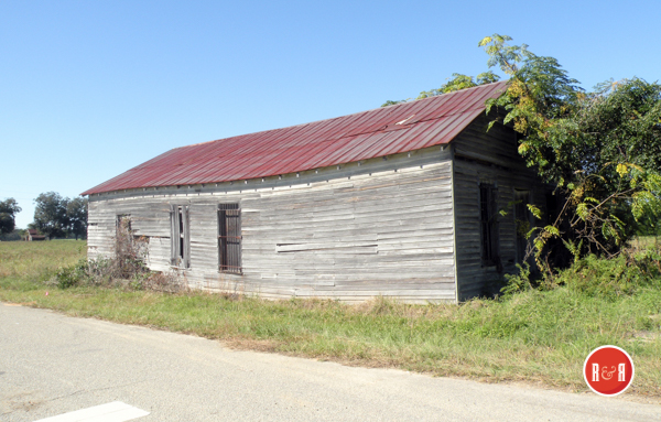
Old barn / store at Hilda, S.C. by photographer Ann L. Helms – 2018
Hilda. He asked that the depot and town be named Hilda for her. This was done and the engineer and Hilda, then his wife, came through on one of the first passenger trains of the community. Mr. Isaac Hartzog’s father gave the land for the depot and Isaac remembers the origination of the name well, although as a small boy at the time, the construction engineer’s name escapes him. Mrs. Frank Hartzog talked to Isaac Hartzog to get the following information on the naming of Hilda.
Kline. A town named because of the construction of the Carolina Midlands Railroad built from Barnwell to Allendale by Mike Brown is Kline on High-way 278. In 1884 Colonel Mike Brown first came to Barnwell and purchased the Barnwell Railroad from the South Carolina Railroad Company. He extended its services to Servem in Aiken County. In 1891 he extended the Barnwell Railroad to Allendale and changed the name to Carolina Midland Railroad. It was at this time Kline was named for Mike’s wife, the former Jennie Kline, a Philadelphia lady.
Elko was once a tourist mecca where the old Charleston-Hamburg Railroad pulled up at dusk with its little, open passenger cars, with its tired and perhaps scared passengers who had plummeted along the route all day from Charleston at the unprecedented speed of 16 to 25 miles per hour. This tiny village lies between Williston and Blackville on Highway 78. Mims obeyed and chose the name Ninety Six since it was exactly 96 miles from Charleston. No, this wouldn’t do either. There was another Ninety Six, South Carolina. According to Horace J. Crouch, Barnwell County’s Superintendent of Education and Elko native, this town was first named Mims. He says that today they cannot trace one of the inhabitants back to the Mims family. This is a family name prevalent in the Healing Springs Community north of Blackville. They were ordered to change the name from Mims because South Carolina had another Post Office named Mims. By this time, disgusted with the whole game of naming the town, the citizens pounced on the name an Englishman who had come there had given to his nearby plantation, Elko. This time the name chosen was satisfactory.
The Rock Hill Herald reported on March 8, 1883 – “Col. W.W. Willis will build a cotton seed oil mill near Elko in Barnwell Co., this summer.”
Williston. This Barnwell County town lies between Aiken and Blackville on Highway 78. Growing up along the route of the Charleston – Hamburg Railroad, Williston’s lands originally belonged to the Willis family. The land belonged to Robert Willis and his wife Kiziah Watson Willis. By the time of the coming of the railroad the land had been divided among their thirteen children. Owning the actual land where Williston now is was one of their sons and heirs, John Turner Willis.More justice should be done to Williston in an article devoted entirely to it and the surrounding intriguing community.
Blackville. U.S. 78 runs from Williston to Blackville and South Carolina north-south to Barnwell, completed in 1833. It was named after Alexander Black, businessman of Charleston who petitioned the legislature for the charter of the South Carolina Railroad and Canal Company and who was the real organizer of the million-dollar project.
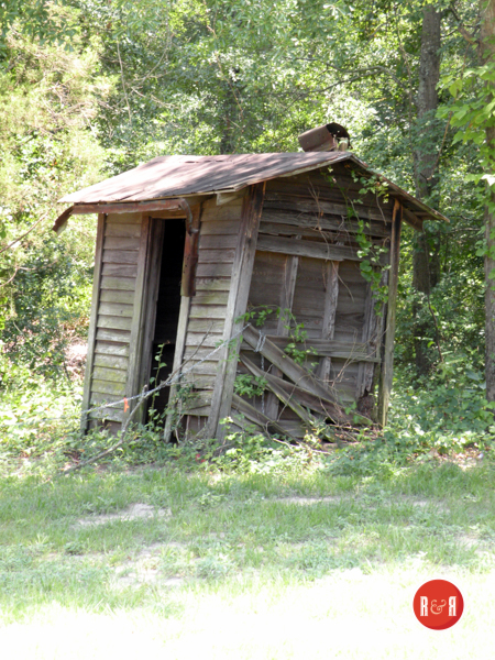
Old outhouse at Blackville, S.C. by photographer Ann L. Helms – 2018
Slaughter Field and Healing Springs. Just north of Blackville on Windy Hill Creek and just north of Sheepford Branch is Slaughter Field on Leon Lott’s property. To reach Slaughter field from Blackville, take Highway 87 past the Farmer’s Market, and after crossing Highway 32, which is the road Healing Springs is on, keep on Road 87 to the first creek, Windy Hill Creek. On the east side of the highway and north of the creek, Mr. Lott’s property begins. About one quarter mile up the road a small road leads right. Following this small road will lead one as near to Slaughter Field by car as possible. To go further, get a truck or jeep and head east as far as possible. From that last navigable point by vehicle, head about 200 yards north of where Sheepford Branch runs into Windy Hill Creek. Look carefully and one can see the dugouts and earthen embankments put there by the British who were camped at Healing Springs about one mile away on Windy Hill Creek. This entire area is on Windy Hill Creek, not more than 3 miles from the South Fork of the Edisto River where Bloody Bill Cunningham committed his many massacres of the American patriots and populace.
The story of Slaughter Field, as told by Mr. Lott, It is noted here also that Hezekiah Williams followed in the steps of “Bloody Bill” from the Forks of the Edisto to raid and harass the Whigs in Ninety Six. 106 the massacre was pretty much as follows. The British had set up the em-battlements and were encamped at Healing Springs, the best camp site, where the pure springs bubbled up from the sand. They were lying in wait to entrap a group of American patriots. This they did at Slaughter Field and killed the last man of the Americans. One person got through the lines and rode to warn Ninety Six which was prepared for “Bloody Bill’s” onslaught when with his men he rode up on his famous horse “Ringtail.”Mr. Lott, who is in his seventies, has requested several times that the County of Barnwell see if a road cannot be built back to the Slaughter Field. He says he would give the historic Field itself for a public park asking only that where necessary a fence be built to protect his cattle. He has taken great care that not one of the dugouts or em-battlements has been plowed under and is afraid when he passes on, the land will be sold and plowed up, losing all historic significance. 107 Once he traveled to Ninety Six to talk to a schoolteacher (he cannot remember her name) who was brother to a Mr. Kinard. Mr. Kinard stated he knew well the stories of the Indian girl who rode up from Healing Springs to warn Ninety Six of Cunningham’s approach. After the “slaughter” tradition says a group of sick or wounded British soldiers were left at the springs along with a burial detail. The burial detail were given orders to rejoin their company at Charleston as soon as the men died and the unpleasant work was completed. Some time later all the men—so the story goes—sick, wounded and burial detail, showed up in Charleston.
Mr. Lott showed enough interest last spring when I was Chairman of The Barnwell County Historic Preservation Commission to come by my house with all his land plats in hopes again something could be done to save the historic spot for posterity. On April 4, 1967, Charles Lee, Barney Slawson, and Carlee McClendon of the Archives Department trekked over Slaughter Field with Mr. Lott, and are still searching for historical verification of the massacre at the field and encouraging interested parties in the county to throw any light possible on the event.
Religious services have been held in the area of Healing Springs since January 14, 1770, when David Martin baptized Elijah Padgett.114 115 David Martin was ordained by the “tunkers” (Dunkers) and Seventh Day Baptists on September 28,1770, by David Leath- erman and Nicholas Martin Still in the neighborhood of Beaver Creek, South Carolina.Other members were added at Healing Springs until by 1772 there were sixteen members from eight families of English Dunkers. Although not ordained, Elijah Padgett led them. By 1777 a regular Baptist Church called Edisto was established here and by 1787 Nathaniel Walker was the pastor.116 117 It became known soon as the Healing Springs Baptist Church.118 The church was incorporated in 1804 and the present building was built by slave labor before the War Between the States.110 & 120Most interesting is the fact that the little white wooden, shuttered church still uses an outdoor Bap- istry, probably built by slave labor as the brickwork in the Baptistry pool seems identical to that in the columns of the church. The pulpit is hand-carved. 121 Right behind the church is a small dirt road leading down to Windy Hill Creek and the Baptistry. The wall of the pool is about three feet high and is fed by one of the bubbling Healing Springs. There are said to be eleven of the springs in all. Older members of the church who have been members more than sixty years recall being baptized in the same Baptistry.
From the traditional history of Healing Springs we learn more about its name and the names of the earliest owners. General Walker of the Revolutionary War lived near Blackville. He partly made his living by trading maize with the Indians for skins and hides. One day as General Walker was traveling with his maize, he saw an Indian bathing his face with water from a small opening in the ground. General Walker asked why he had never seen the water, and the Old Indian Chief revealed a secret he had sworn his tribe to keep for fear the white man would take the water from the Indians. The Old Chief told him that the spring was used only when an Indian was sick or wounded. General Walker bartered with the Chief and got the spring for a trade in maize. After selling the spring, the Indians soon moved on to other parts of the state. People soon began to move in around the area of the main and other springs and built homes. A wooden curb was eventually built around the main spring and the water was piped. Many people heard of the springs and came from great distances to drink the water, especially people with skin diseases or stomach trouble.
(Information from: Names in South Carolina by C.H. Neuffer, Published by the S.C. Dept. of English, USC)
Stay Connected
Explore history, houses, and stories across S.C. Your membership provides you with updates on regional topics, information on historic research, preservation, and monthly feature articles. But remember R&R wants to hear from you and assist in preserving your own family genealogy and memorabilia.
Visit the Southern Queries – Forum to receive assistance in answering questions, discuss genealogy, and enjoy exploring preservation topics with other members. Also listed are several history and genealogical researchers for hire.
User comments welcome — post at the bottom of this page.

