 Click on image to pan and zoom.
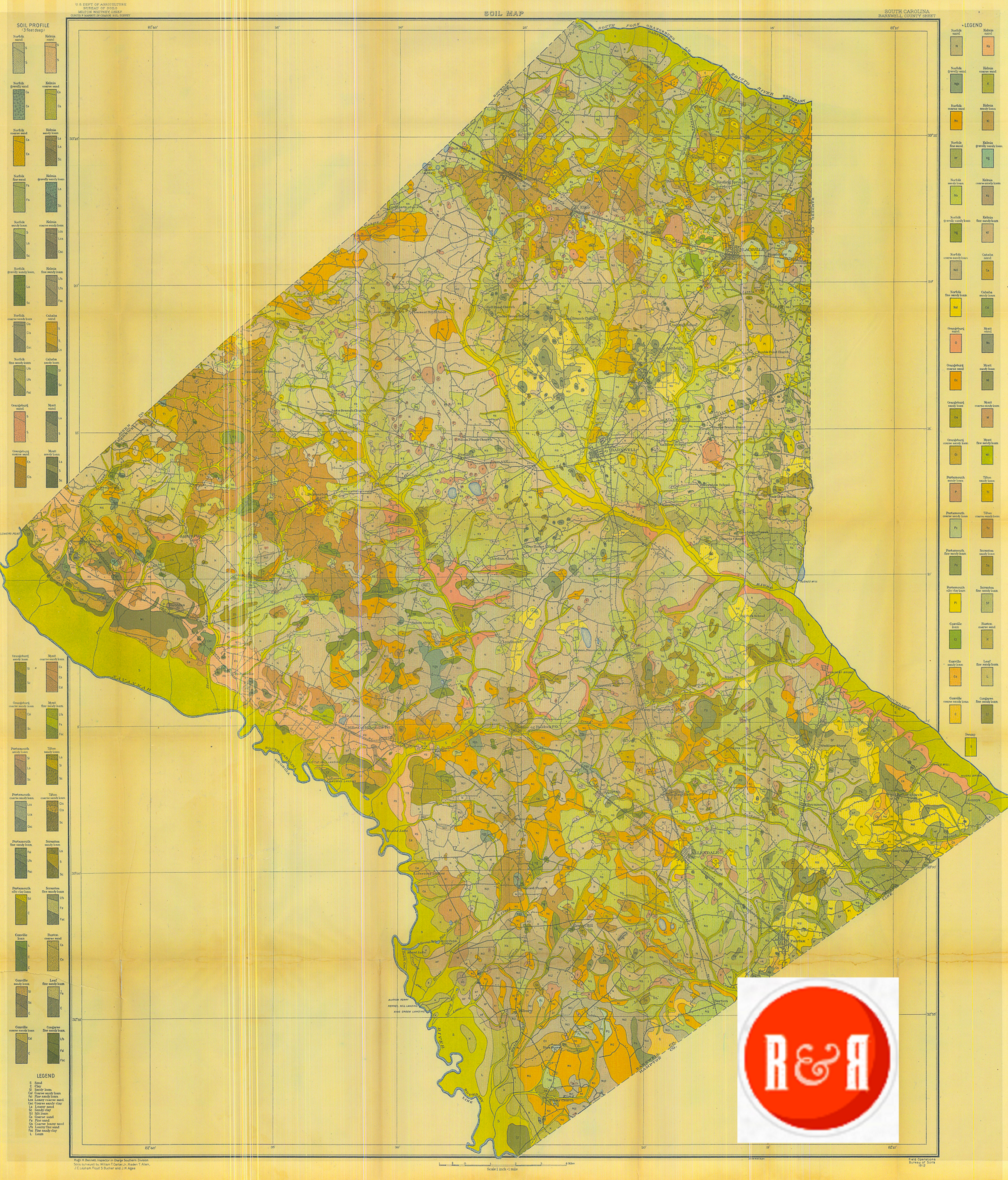
City Directories and History: The early 20th century U.S. government soil map of Barnwell County, S.C.
The historic soil maps presented by R&R on this and other county pages have been digitized, enhanced, updated and watermarked. They are offered as educational maps to link with family farms and local community history. Maps are not for reproduction and are never sold through this website. Maps are available for further study or procurement at several other sites including the South Carolinian Library Map Collection found at: http://library.sc.edu/digital/collections/schmscl.html
An enlarged PDF of the map can be viewed by opening the MORE INFORMATION link – bottom left.
Stay Connected
Explore history, houses, and stories across S.C. Your membership provides you with updates on regional topics, information on historic research, preservation, and monthly feature articles. But remember R&R wants to hear from you and assist in preserving your own family genealogy and memorabilia.
Visit the Southern Queries – Forum to receive assistance in answering questions, discuss genealogy, and enjoy exploring preservation topics with other members. Also listed are several history and genealogical researchers for hire.
User comments welcome — post at the bottom of this page.
Please enjoy this structure and all those listed in Roots and Recall. But remember each is private property. So view them from a distance or from a public area such as the sidewalk or public road.
Do you have information to share and preserve? Family, school, church, or other older photos and stories are welcome. Send them digitally through the “Share Your Story” link, so they too might be posted on Roots and Recall.
Thanks!

User comments always welcome - please post at the bottom of this page.


Share Your Comments & Feedback: