City Directories and History: Architect, Mr. Robert Mills was hired by the State of S.C. to create accurate maps of the state’s districts. In turn, he employed knowledgeable surveyors to survey
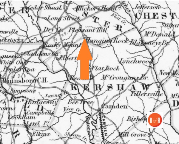
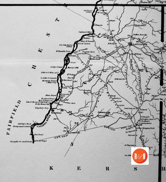
1852 Map of SC showing the location of Hanging Rock, S.C.
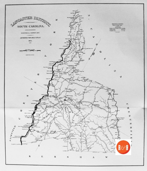
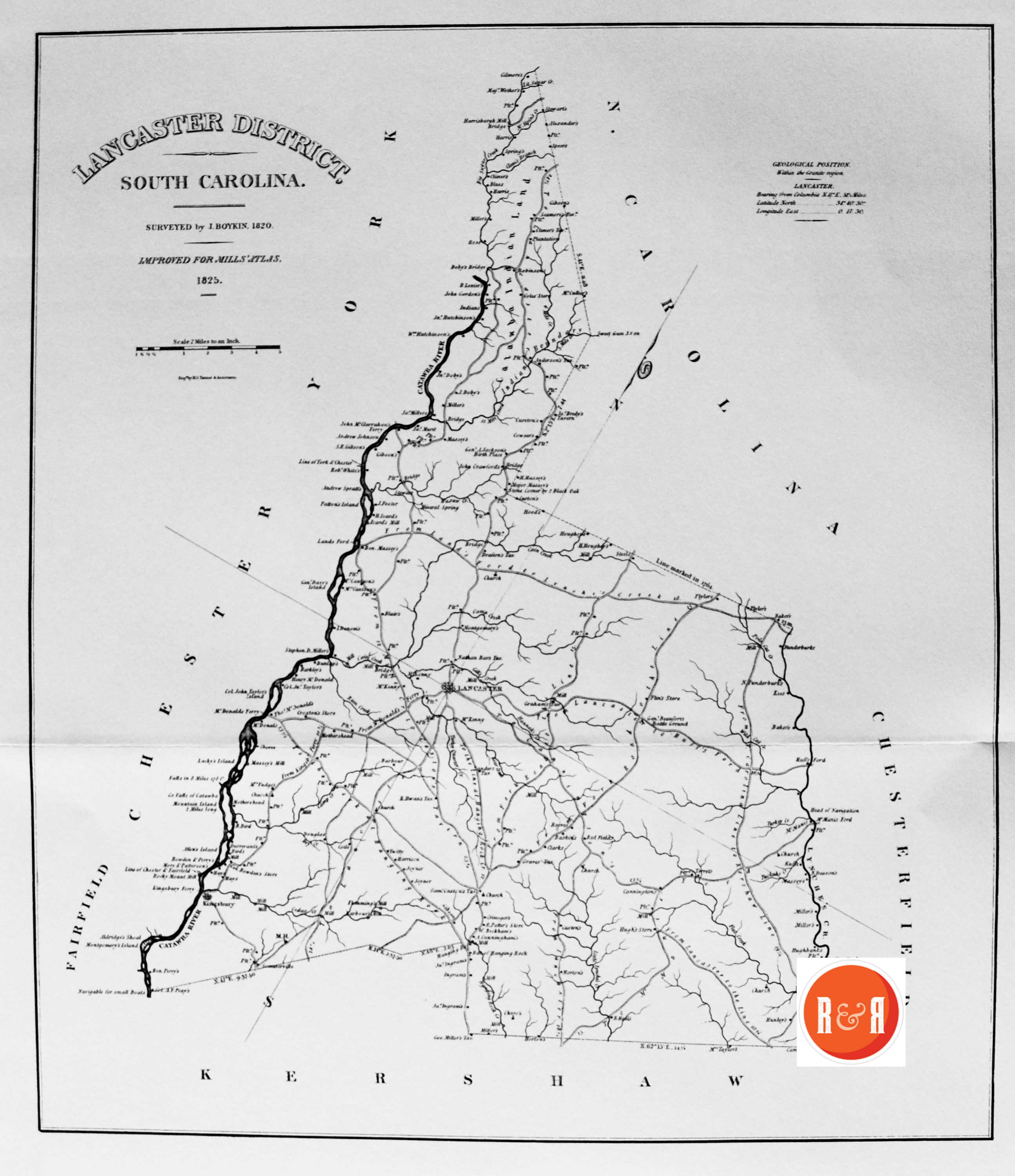
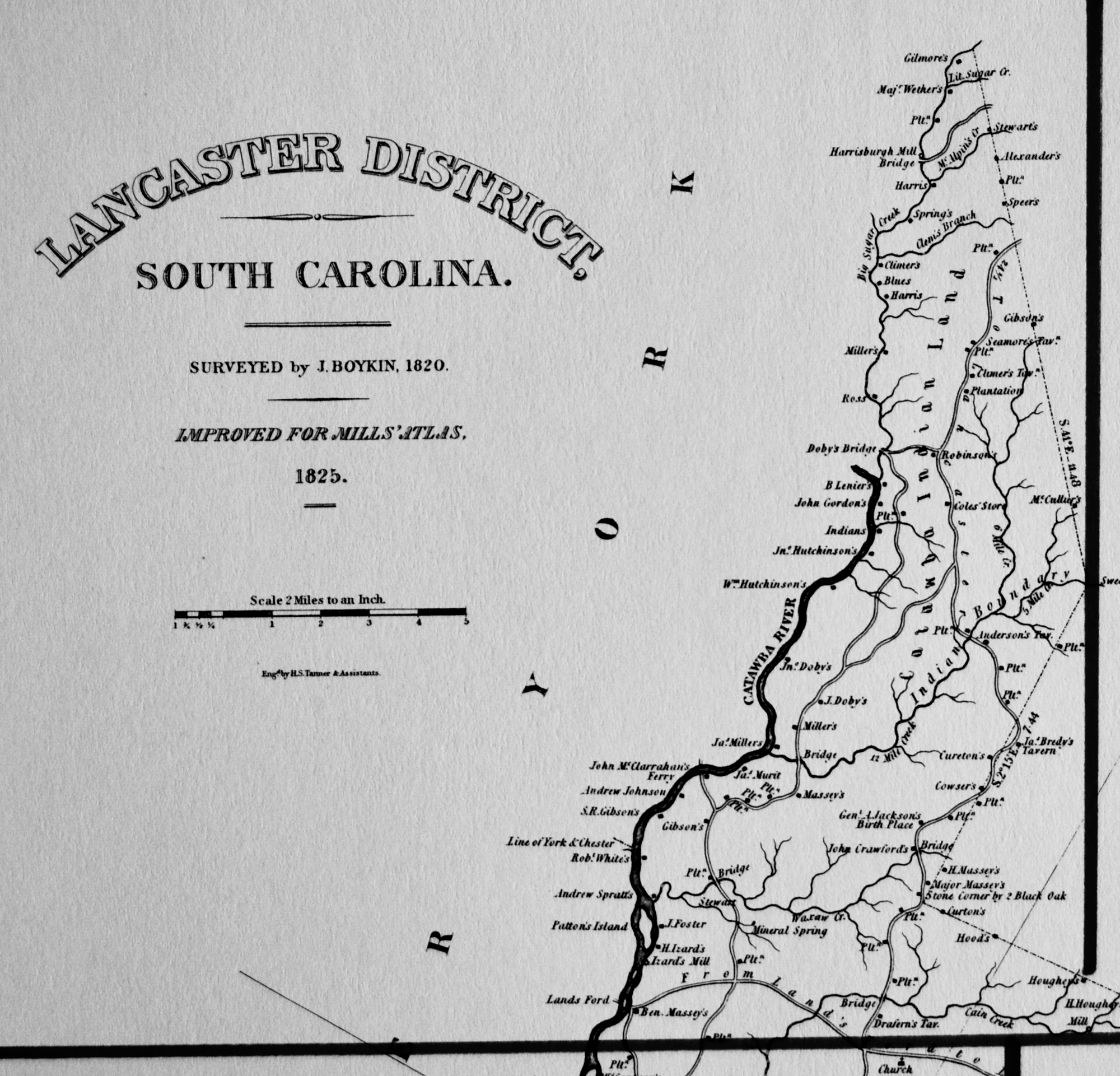
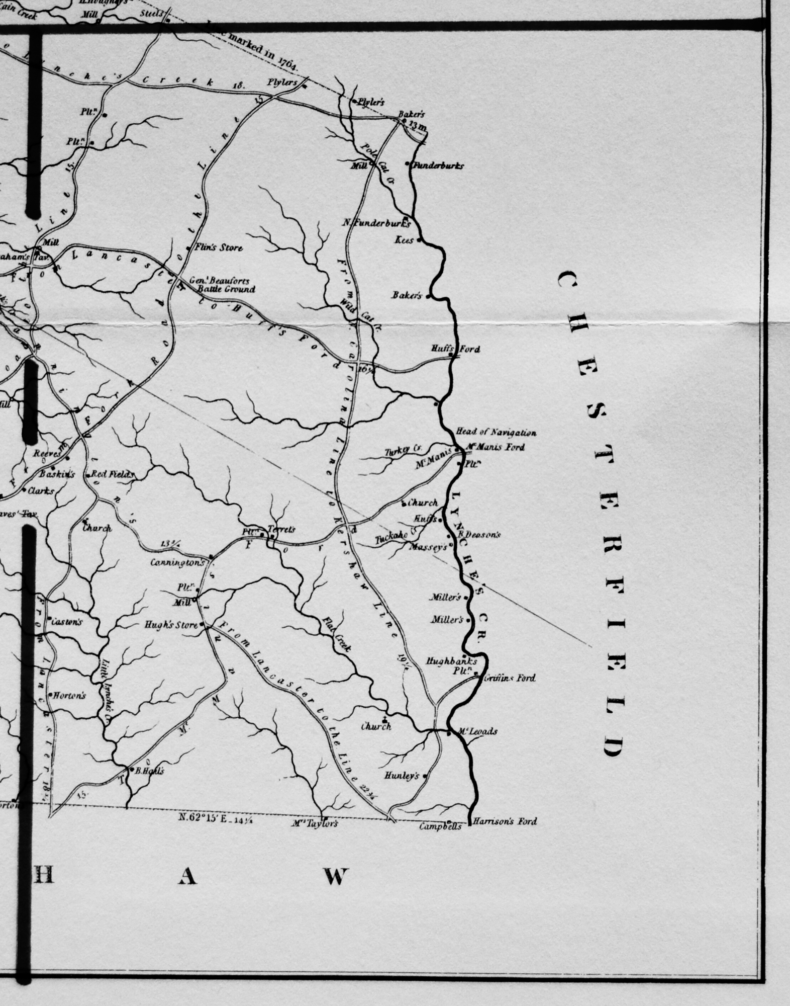
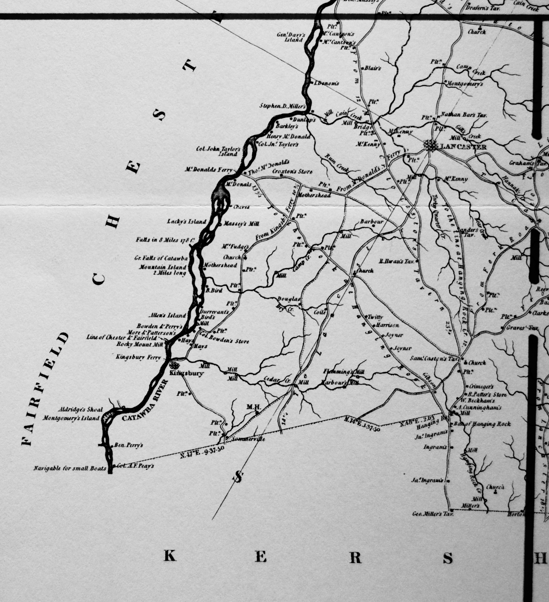
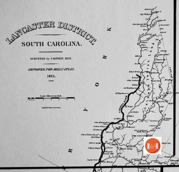
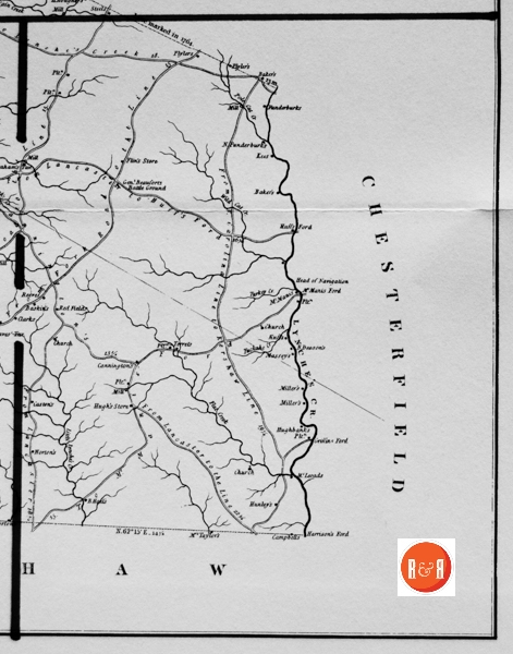
the local areas, from which he created his finished maps of S.C., districts or counties. This resulted in accurate maps of roads, streams, and cities located in each. Click on the More Information / Enlargeable links, (found under the picture column), for an enlargeable county map, a history of Robert Mill’s survey of S.C. counties, written by Gene Waddell in 1980, an index to the names listed on the maps, and enlargeable quadrants for conducting in depth research.
“Stephen H. Boykin prepared maps of Kershaw, Lancaster, and Sumter Districts. He worked on the adjacent districts of Kershaw and Lancaster at the same time, receiving a $200 advance for both in August, 1817, and an $1,800 payment for both on 21 December, 1820. He prepared the map of Sumter District between 20 November, 1820 (when John Lowery petitioned for an additional payment for his map of Sumter), and 28 August, 1821 (when he, Boykin, received a payment of $1,100). In December, 1821, the Senate wanted to know “whether more than one Surveyor was employed to make a Survey of the District of Sumter & if so whether both of them have been paid & the reason why that course was pursued.” The Committee on the Map reported that Governor Pickens had employed Daniel Dubose of Sumter District to prepare the map originally, but Dubose had delayed so long that the next Governor, Geddes, had hired Lowery to make one. Lowery’s survey was approved by James M. Elford (the professor who replaced Blackburn), and Lowery was paid in full. Subsequently, the Legislature gave the Board of Public Works authority over the map project, and the Board rejected the map, stating that it was “defective and incorrect and can not be made to answer the purpose. Boykin was then called upon so that a dependable survey could be produced in as short a time as possible.
Of Boykin’s three maps, only the one of Sumter is known to survive. He must have made good use of plats to be able to compile so detailed a map of so large an area (1,672 square miles) in so short a time. Although his map of Sumter does not resemble a printed map as closely as the maps by Vignoles, Hemingway, and Thompson, its unusual clarity and minute depiction of watercourses make it one of the best submissions and one that required the least revision for use in the Atlas.” (Information from: Mill’s Atlas of South Carolina – 1825, Southern Historical Press, 1980)
R&R has also taken individual county maps and created a list of their recorded sites, allowing R&R’s users, faster access to historic data. Each of the More Information links opens items connected to the Mill’s map of this county. The last four are those related to Quadrants 1-4. Names within each quadrant are listed below and at the bottom of the page, is an alphabetical list, of all names shown in Lancaster District, along with other counties in which the name also appears. Another excellent website to view the Mill’s maps is at Rumsey’s Maps.
| SECTION #1 | SECTION #2 | SECTION #3 | |||
| 1 | Anderson’s Tavern – Lan | 2 | Baker’s – A, Co, Lan (2), Lex, P, Su | 3 | Aldridge, F. – Lan |
| 1 | Blue’s – Lan | 2 | Baskin’s – Lan | 3 | Aldridge, Mrs. – Lan |
| 1 | Cain – H, Lan, P, Su | 2 | Beaufort, Gen. – Lan | 3 | Aldridge’s Shoal – F, Lan |
| 1 | Cain Creek – Lan, P | 2 | Beaufort’s, Gen., Battleground – Lan | 3 | Allen – A (2), Ba, Ch, Ge, Lan, Lar (2) |
| 1 | Catawba Indian Land – Lan | 2 | Casten’s – Lan | 3 | Allen’s Island – Ch, Lan |
| 1 | Clem – Lan | 2 | Deason’s, B. – Lan | 3 | Bar, Nathan Tavern – Lan |
| 1 | Clem’s Branch – Lan | 2 | Flat Creek – D, Lan | 3 | Barbour – Lan |
| 1 | Climer’s – Lan | 2 | Flin – Co, Lan | 3 | Barkley’s – F, Lan |
| 1 | Climer’s Tavern – Lan | 2 | Flin’s Store – Lan | 3 | Battle of Hanging Rock – Lan |
| 1 | Cole – Lan | 2 | Funderburk’s – Ch’f (2), Lan | 3 | Bear Creek – Ch’f, K, Lan, Lex, P, Su |
| 1 | Cole’s Store – Lan | 2 | Funderburk, N. – Lan | 3 | Beckham, W. – Lan |
| 1 | Coles – Lan | 2 | Graham – Lan (2), Lau, W | 3 | Bird – Ba, Lan, Lau, Mar |
| 1 | Cowser’s – Lan | 2 | Griffin – A, Ch’f, F, Gr, Lan, P, Sp | 3 | Bird, B. – Lan |
| 1 | Crawford, John – Lan | 2 | Griffin’s Ford – Ch’f, Lan | 3 | Blair’s – E, Lan |
| 1 | Cureton – K, Lan | 2 | Harrison – Be, Ch’f, Co, Gr, K, Lan, P | 3 | Bowden – Lan |
| 1 | Cureton’s – Lan | 2 | Harrison’s Ford – Ch’f, K, Lan | 3 | Bowden, Col. – Lan |
| 1 | Doby’s – Lan | 2 | Head of Navigation – K, Lan | 3 | Bowden’s, Col.: Store – Lan |
| 1 | Doby, J. – Lan | 2 | Horton’s – Ch’f, K, Lan (2) | 3 | Cantson, Mrs. – Lan (2) |
| 1 | Doby, Jno. – Lan | 2 | Huff’s Ford – Lan | 3 | Casten, Sam – Lan |
| 1 | Doby’s Bridge – Lan | 2 | Hugh’s Store – Lan | 3 | Caston’s, Sami., Tav. – Lan |
| 1 | Drafern’s Tav – Lan | 2 | Kees – Lan | 3 | Cedar Creek – Ba (2), Ch’f, D, E (2), K, Lan, |
| 1 | Foster, J. – Lan | 2 | M.H. – Ba (11), E (4), F, Gr, H (6), Lan, Lex, | 3 | Cheves – E, Lan, O |
| 1 | Gibson’s – A, Cha, K, Lan (3), Mar, W | 2 | McLeoads – Lan, Su | 3 | Crimeger’s – Lan |
| 1 | Gibson, S.R. – Lan (Also in #3) | 2 | McManis’s Ford – Lan | 3 | Croxton – Lan |
| 1 | Gilmore’s – Lan | 2 | McManis – Lan | 3 | Croxton’s Store – Lan |
| 1 | Gordon, John – Lan | 2 | Plyler’s – Lan (2) | 3 | Cunningham, A. – Lan |
| 1 | Harris – A (2), Ch’f, E, F, K, Lan (2), P, | 2 | Pole Cat Creek – Lan | 3 | Davy, Genl. – Ch, Lan |
| 1 | Harrisburgh Mill – Lan | 2 | Red Field’s – Lan | 3 | Davy’s, Gen.: Island – Lan |
| 1 | Houghey’s – Lan | 2 | Reeves – Ba, Lan, Lex, Su | 3 | Donsom’sd, I. – Lan |
| 1 | Indian Boundry – Lan | 2 | Taylor, Mrs. – K, Lan | 3 | Falls in 8 miles – Lan |
| 1 | Indian’s – Lan | 2 | Terrel’s – Lan | 3 | Flemming’s Mill – Lan |
| 1 | Izard’s Mill – Lan | 2 | Tuckahoe Creek – Lan | 3 | Fleming, A. – D, Lan |
| 1 | Jackson’s, Gen. A., Birthplace – Lan | 2 | Graham’s Tavern – L | 3 | Fudge, Mrs. – Lan |
| 1 | Johnson, Andrew – Lan | 2 | Mill – L | 3 | Gill’s Creek – A, Lan, R |
| 1 | Land – Lan | 2 | Carrington’s – L (To) | 3 | Graves – D (2), K, Lan, Mar |
| 1 | Land’s Ford – Ch, Lan | 2 | Huff’s – L | 3 | Grave’s Tavern – Lan |
| 1 | Lenier, B. – Lan | 2 | Miller’s – L | 3 | Hanging Rock Creek – K, Lan |
| 1 | Little Sugar Creek – Lan | 2 | Lynche’s Creek – L | 3 | Hannah – Lan (2) |
| 1 | Massey’s – Lan (2), P | 2 | Banks, Hugh – L | 3 | Hannah’s Creek – Lan |
| 1 | Massey, Ben – Lan | 2 | Hunley’s – L | 3 | Harrison – Be, Ch’f, Co, Gr, K, Lan, P |
| 1 | Massey, H. – Lan | 2 | Harl’s – L | 3 | Hays – Ba, Lan (2) |
| 1 | Massey, Major – Lan | 3 | Ilwan’s, R., Tavern – Lan | ||
| 1 | McAlpin’s Creek – Lan | 3 | Joyner – Be, Lan | ||
| 1 | McCullur’s – Lan | 3 | Kingsbury – Lan | ||
| 1 | Miller’s – Ch, Ch’f, Co, E, F, K, Lan | 3 | Kingsbury Ferry – F, Lan | ||
| 1 | Miller, Jas. – Lan | 3 | Kingsby – Lan | ||
| 1 | Mineral Spring – D, Ge, K (2), Lan, | 3 | Lacky – Ch, Lan | ||
| 1 | Murit, Jas. – Lan | 3 | Lacky’s Island – Ch, Lan | ||
| 1 | Patton’s Island – Ch, Lan | 3 | Lancaster – Ch’f, F, K, Lan, Y | ||
| 1 | Robinson’s – Ch, Co, Lan, O, Su | 3 | McDonald’s – Ch, Ch’f (2), K, Lan, R | ||
| 1 | Ross – Lan, Lau (2) | 3 | McDonald, Henry – Lan | ||
| 1 | Seamore – Lan | 3 | McDonald, Thos. – Lan | ||
| 1 | Seamore’s Tavern – Lan | 3 | McDonald’s Ferry – Lan | ||
| 1 | Six Mile Creek – Lan, Lex, Y | 3 | McKenny – Gr, Lan (3) | ||
| 1 | Speer’s – Lan | 3 | Miller, Geo.- K, Lan | ||
| 1 | Spring’s – Lan | 3 | Miller, Stephen, D., – Lan | ||
| 1 | Steel’s – Lan, Y | 3 | Miller’s, Geo., Tavern – K, Lan | ||
| 1 | Stewart’s – Ch’f, Co, K, Lan (2), Lex | 3 | Montgomery’s – Ch, F, Lan (2), Su, W | ||
| 1 | Waxhaw Creek – Lan | 3 | Montgomery’s Island – F, Lan | ||
| 1 | White, Robt. – Lan | 3 | More – Lan | ||
| 1 | Wither’s, Maj. – L | 3 | More and Patterson’s – Lan | ||
| 1 | Hutchinson’s Jn. – L | 3 | Mothershead – Lan (2) | ||
| 1 | Hutchionson’s, Wm. – L | 3 | Mountain Island – Lan | ||
| 1 | Catawba River – L | 3 | Nathan Bar’s Tavern – Lan (2) | ||
| 1 | Twelve Mile Creek – L | 3 | Patter – Lan | ||
| 1 | Bredy’s, Ja.,Tavern – L | 3 | Patter’s, R., Store – Lan | ||
| 1 | Izard, H. – L | 3 | Peay, A. F. Col. – A, F, K, Lan | ||
| 3 | Perry – Be, Co (4), F, K (2), Lan, R | ||||
| 3 | Perry’s, Ben – Lan | ||||
| 3 | Rocky Mount Mill – Ch, F, Lan | ||||
| 3 | Rum Creek – Lan | ||||
| 3 | Sander’s Tav. – K, Lan | ||||
| 3 | Sanders – Co (2), D, K, Lan, Mar’b, Su | ||||
| 3 | Sommerville – Lan | ||||
| 3 | Taylor, Col. John – Lan | ||||
| 3 | Taylor’s, Col. John, Island – Ch, Lan | ||||
| 3 | To the Fork at Hanging Rock – Lan | ||||
| 3 | Turkey Quarter Creek – Lan | ||||
| 3 | Twitty – Lan | ||||
| 3 | Dunlap’s – L | ||||
| 3 | Massey’s Mill #2 – L | ||||
| 3 | Great Falls of Catawba River – L | ||||
| 3 | Bird’s – L | ||||
| 3 | Bowden and Perry’s – L | ||||
| 3 | Fleming’s Mill – L | ||||
| 3 | Cedar Creek Mills – L | ||||
| 3 | Barbour’s Mill – L | ||||
| 3 | M.H. – L | ||||
| 3 | Ingram’s – L | ||||
| 3 | Ingram, John – L | ||||
| 3 | Clark’s – L |
Please enjoy this structure and all those listed in Roots and Recall. But remember each is private property. So view them from a distance or from a public area such as the sidewalk or public road.
Doby’s Spring and Branch to the south of the church take the name of the John Doby family who purchased the land on both sides of Cane Creek in the Waxhaw Settlement in 1778, land that had originally been granted to William Moore by North Carolina in 1753. Sling Alley was the lane that led by Doby’s Spring but the origin of the name is not now known. Foster’s Spring Branch, rising on Foster land east of S.C. Highway 29, joins Doby’s Branch before running into Cane Creek.
(Information from: Names in South Carolina by C.H. Neuffer, Published by the S.C. Dept. of English, USC)
The Herald reported on Sept. 2, 1886 – “The county commissioners of York and Lancaster met at the site of the old Doby’s Bridge on Sugar Creek on Saturday for the purpose of receiving bids for the erection of a new bridge at that point. The contract was let to Mr. John Perry of Lancaster County. His bid being $387.”
Stay Connected
Explore history, houses, and stories across S.C. Your membership provides you with updates on regional topics, information on historic research, preservation, and monthly feature articles. But remember R&R wants to hear from you and assist in preserving your own family genealogy and memorabilia.
Visit the Southern Queries – Forum to receive assistance in answering questions, discuss genealogy, and enjoy exploring preservation topics with other members. Also listed are several history and genealogical researchers for hire.
User comments welcome — post at the bottom of this page.
Do you have information to share and preserve? Family, school, church, or other older photos and stories are welcome. Send them digitally through the “Share Your Story” link, so they too might be posted on Roots and Recall.
Thanks!
User comments always welcome - please post at the bottom of this page.


Share Your Comments & Feedback: