The Yorkville Enquirer reported on Aug. 3, 1871 – “A new post office has been established on the route between the Union Courthouse and Goudeysville. It will be known as Skull Shoals and A.A. Saratte is post master.”
The Yorkville Enquirer reported on Sept. 5, 1888 – “Mr. Leroy McArthur and Mr. Thompson Robbs are contractors for the bridge across the Pacolett River at Skull Shoals. They expect to finish the work soon. The center spans are 70 feet each and the cost is $2,200.”
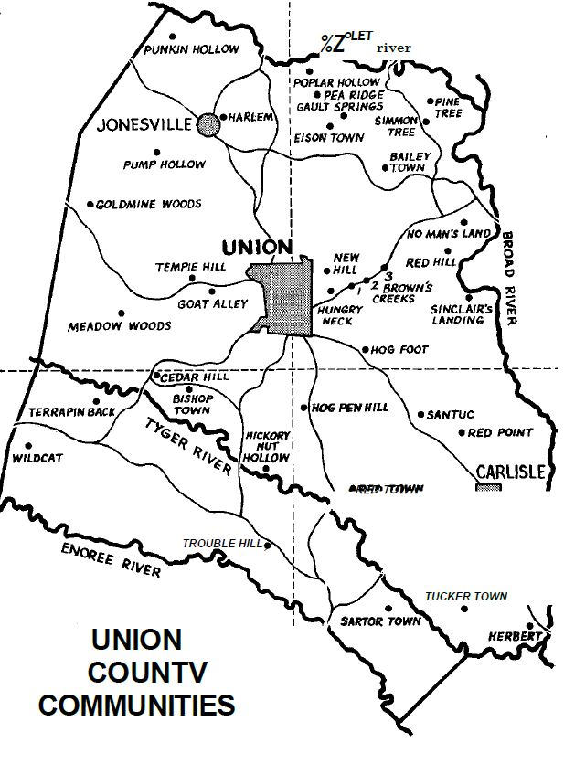
City Directories and History: You may have lived in Union County all your life, but could you get to Hog Pen Hill, Wildcat, Pump Hollow or Skull Shoals? In order to better acquaint Union Countians with where they are, we have compiled a comprehensive list of lesser known communities in the County and their locations. The origins of names of some of the communities seem obvious. However, it would be pure speculation as to how some of them came about. Union County Communities Our thanks to Union County Sheriff J. Harold Lamb, Chief Deputy Sheriff Dan Sanders, and other county deputies for pointing out the locations of these communities around the county.
The accompanying map of the county is divided into four sections. We shall take a trip around the county, by section, to point out the many lesser known communities and places around the county.
(Map and Information from: Names in South Carolina by C.H. Neuffer, Published by the S.C. Dept. of English, USC)
SECTION I
In the northern part of Section I we find Poplar Hollow. Although we don’t know how the name originated, we feel it was named for a large growth of poplar trees in the area. Moving several miles south of Poplar Hollow we find Eison Town and Gault Springs. We have been informed that these communities were named in honor of the Eison and Gault families that lived in the area many years ago.
The Yorkville Enquirer reported on April 12, 1877 – “Mr. N.B. Eison of Union Co., lost a large new dwelling house to fire two weeks ago. It was not occupied and Mr. Eison planned to move in soon. The loss was about $3,000.”
Just below Eison Town and Gault Springs is probably one of the best known sections of Union County, Pea Ridge. However, did you know a large majority of county residents don’t know the true location of Pea Ridge ? Many think Pea Ridge is in Kelly Community. Actually it is several miles off Highway 9 in the Kelton Community. (In years past Pea Ridge was the site of many illegal whiskey stills.)
Traveling east through Pea Ridge on county road No. 13 toward Pinckneyville, there are sections
known as “Simmon” Tree and the Pine Tree. The names of these two sections are obvious. Although the persimmon tree that once stood in the section was blown down, it is still called the “Simmon” Tree today. Swinging south we find Bailey Town. Bailey Town, like the other people-connected “towns” around Union County, was named for the Bailey family or families that resided in that section.
On a trip into Lockhart just off Highway 9 we find a section known as Red Hill and No Man’s Land, the origin of which would be speculation. South of Lockhart on what is known as the River Road is a section known as Sinclair’s Landing. We were told that many years ago the Sinclair family operated a corn-grinding mill at this point.
Going back to Lockhart and traveling to Union on Highway 49, we cross the Third (3), Second (2), and First (1) Brown’s Creek. These names are obvious, although deceiving as First Brown’s Creek section is actually on what is known as the Meng Creek. Near Monarch, on the Peach Orchard Road, are sections known as Hungry Neck and New Hill. We are told that these names originated during the depression era of the twenties and thirties.
The final spot in Section I of the map is located in the Carem Community and is known as Hog Foot. According to reports, this section got its name many years ago . when a train loaded with “porkers” derailed during a heavy rain. The rain washed the hogs into drainage pipes causing them to stop up and requiring many working hours to clear the drains.
SECTION II
Courtesy of the Sutherland Collection – Union Co Historical Commission, Union, SC
Moving into Section 2 of the map, five or six miles south of Union on Highway 176, is a section known as Hog Pen Hill. This area allegedly became known as Hog Pen Hill many years back when a pig farmer of the area located his pens at this site. Down Highway 215 south we come to the community of Santuc. According to a humorous story we have heard, an earlier settler once remarked, “sand has done tuck this place.” We have also been told that until recent years Santuc was spelled Santuck, but the “k” has been dropped by some.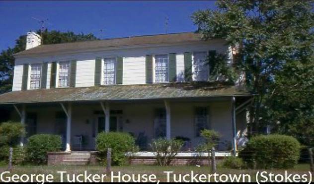
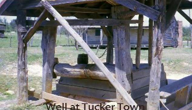
Near the Santuc Community are the communities of Red Point and Red Town. The origins of the names are not known. It is assumed that Tucker Town, northeast of the Tyger River, was named for the Tucker family that resided there. Again it is assumed the nearby communities of Herbert and Sartor Town were named for the respective families that lived there.
SECTION III
West northwest of Black Rock we come to the communities of Trouble Hill and Hickory Nut Hollow. No data is given on Trouble Hill, but we are quite sure there are many hickory trees in Hickory Nut Hollow.
Bishop Town, like some of the previous communities, was named for the family of Bishops who resided there. West of Bishop Town is Wildcat. Maybe a wildcat was spotted in this community in earlier times. The origin of the section known as Terrapin Back is not known. This writer has heard many times of Cedar Hill. Our mother, as a little girl, attended the Cedar Hill Grammar School. We assume the name came from a large growth of cedar trees in the area.
SECTION IV
Probably the second most well-known place in Union County is the section known as the Meadow Woods. Although the section is well known, the origin of the name is unknown. Near Buffalo are Tempie Hill and Goat Alley. Goat Alley got its name from the many goats that grazed in this section prior to the street being cut and houses built. Goldmine Woods got its name from the several gold mines located in this section of the county near West Springs. North of the Goldmine Woods are Pump Hollow and Harlem, and again it would be speculation to say how they were named.
The Rock Hill Herald reported on Aug. 30, 1883 – “The West Spring Gold Mine in Union Co., caved in one day last week and two workman were killed.”
Our final stop in the county is at “Punkin” Hollow. Although we do not know the origin of the name, maybe in history past, this section was known for the pumpkins they grew. We are sure that there are sections of the county that are not covered. But, if you ever get stranded in the county, you can inform someone exactly where you are. UNION DAILY TIMES (May 16,1975)
(Information from: Names in South Carolina by C.H. Neuffer, Published by the S.C. Dept. of English, USC)
Stay Connected
Explore history, houses, and stories across S.C. Your membership provides you with updates on regional topics, information on historic research, preservation, and monthly feature articles. But remember R&R wants to hear from you and assist in preserving your own family genealogy and memorabilia.
Visit the Southern Queries – Forum to receive assistance in answering questions, discuss genealogy, and enjoy exploring preservation topics with other members. Also listed are several history and genealogical researchers for hire.
User comments welcome — post at the bottom of this page.
Please enjoy this structure and all those listed in Roots and Recall. But remember each is private property. So view them from a distance or from a public area such as the sidewalk or public road.
Do you have information to share and preserve? Family, school, church, or other older photos and stories are welcome. Send them digitally through the “Share Your Story” link, so they too might be posted on Roots and Recall.
Thanks!

User comments always welcome - please post at the bottom of this page.


Share Your Comments & Feedback: