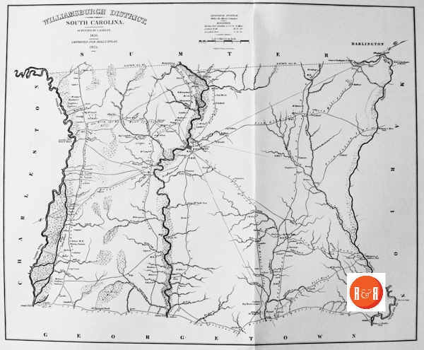
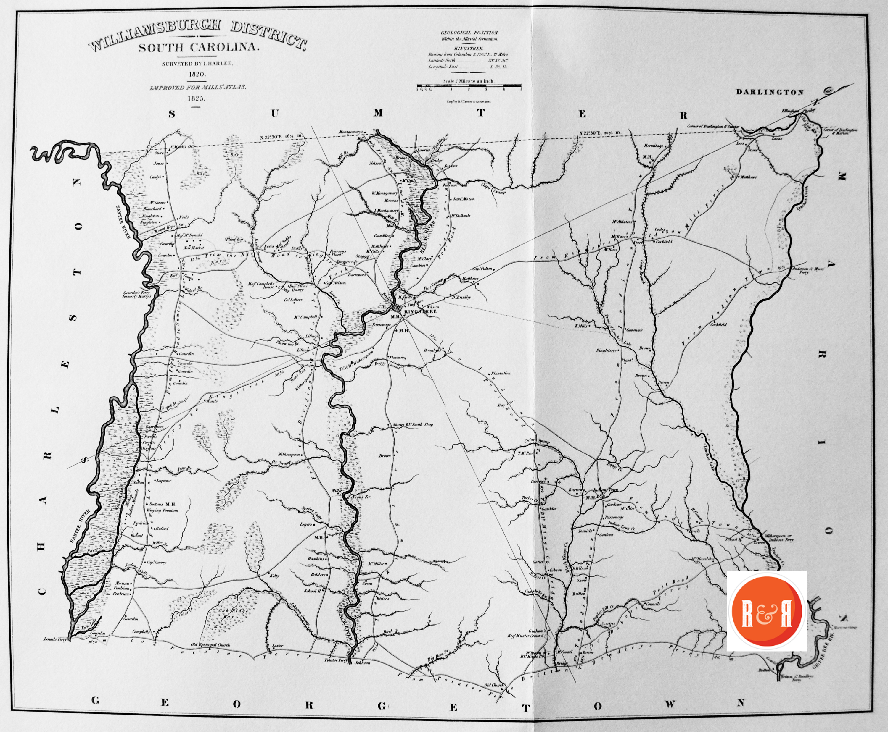
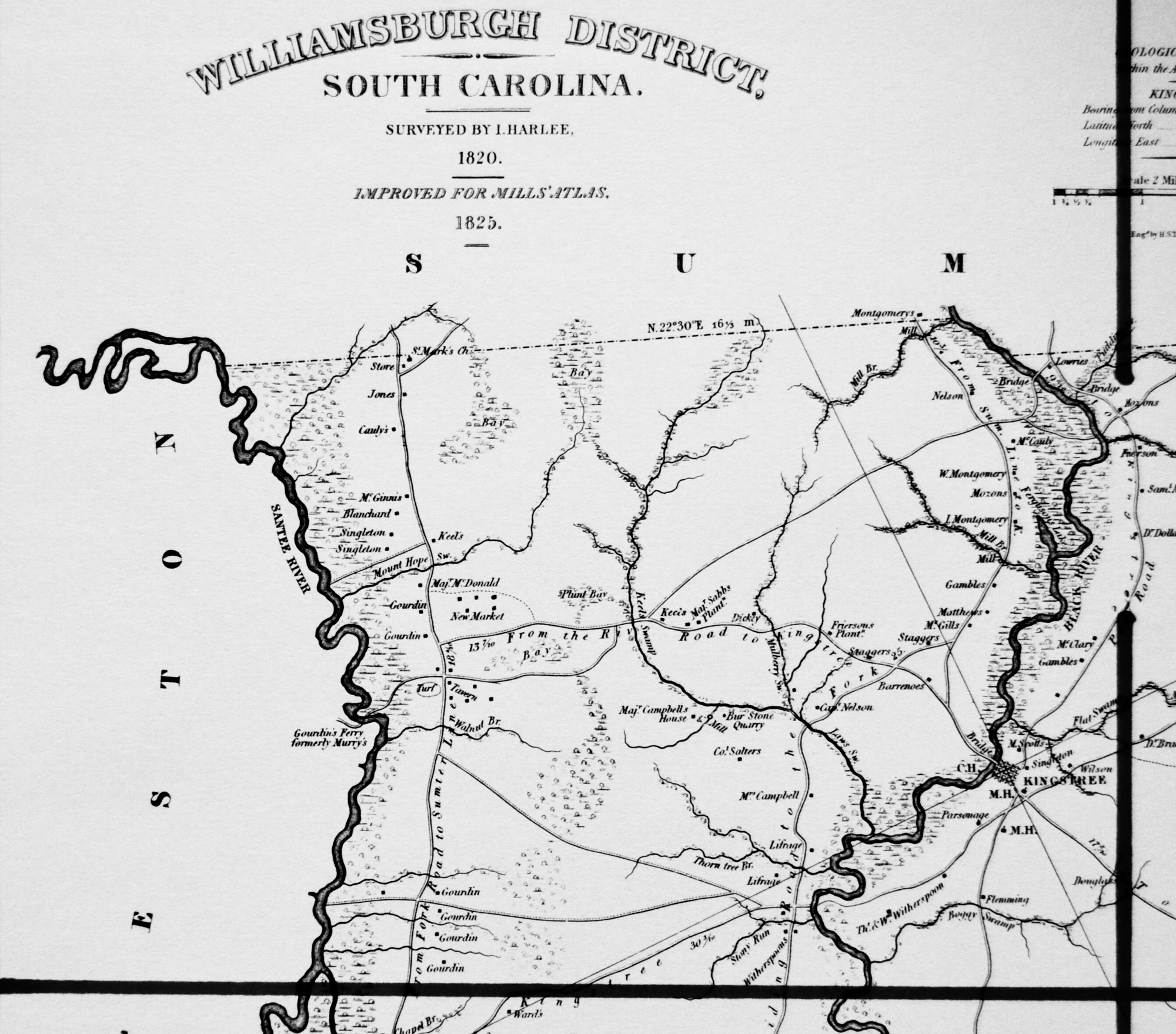
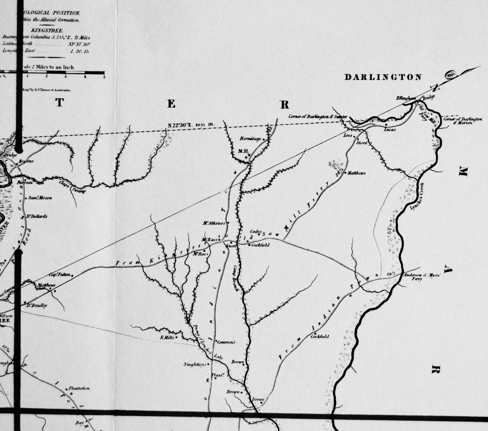
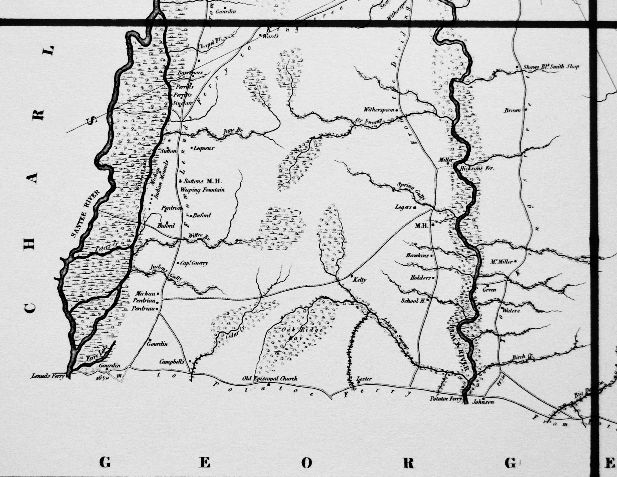
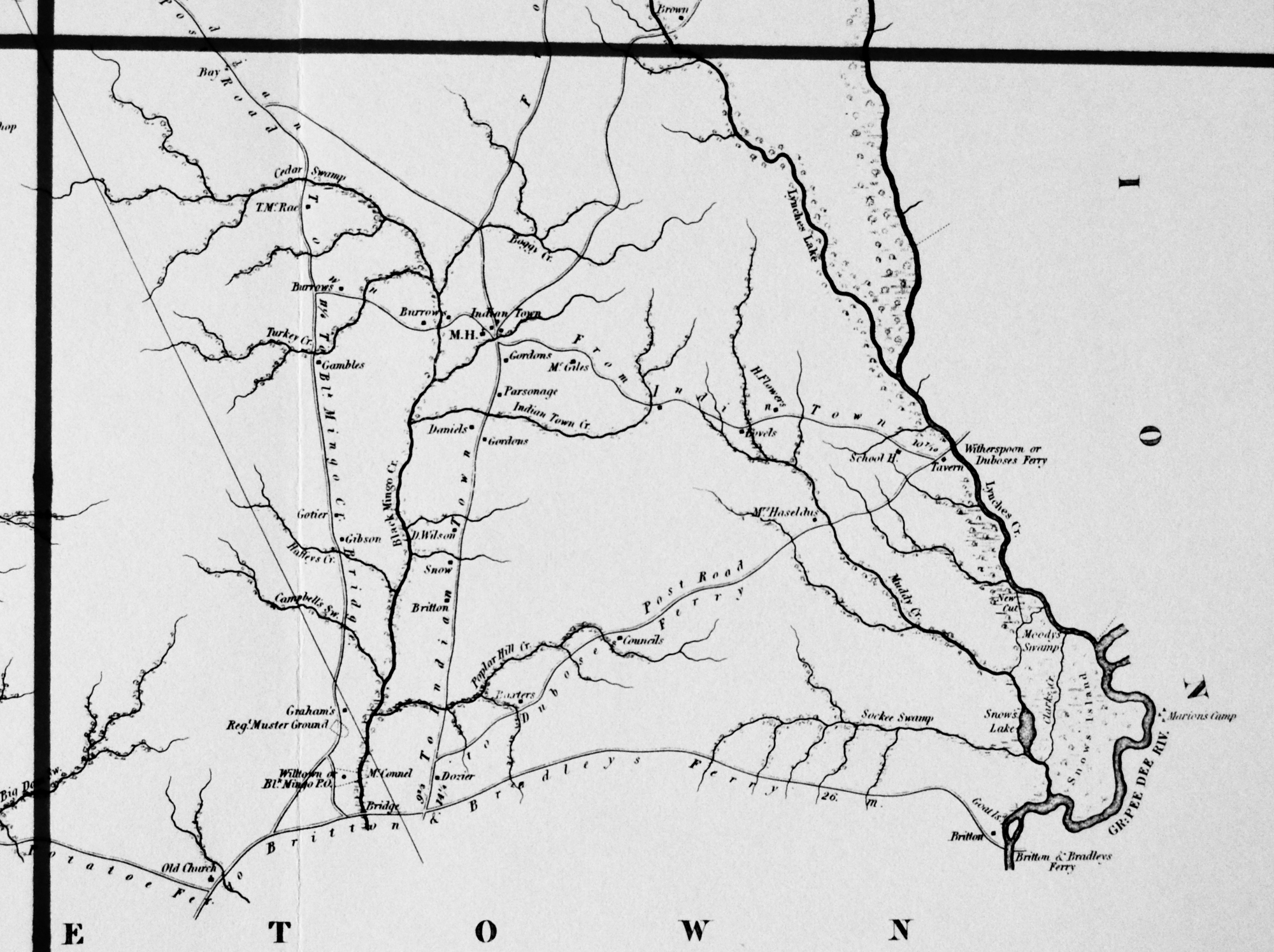
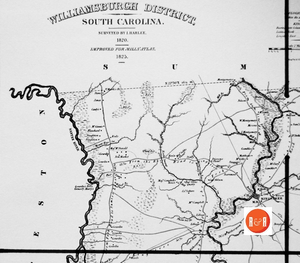
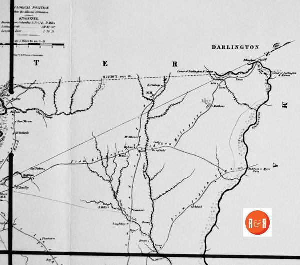
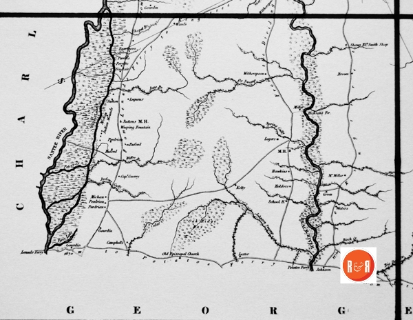
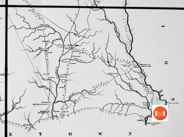
City Directories and History: Architect, Mr. Robert Mills was hired by the State of S.C. to create accurate maps of the state’s districts. In turn, he employed knowledgeable surveyors to survey the local areas, from which he created his finished maps of S.C., districts or counties. This resulted in accurate maps of roads, streams, and cities located in each. Click on the More Information / Enlargeable links, (found under the picture column), for an enlargeable county map, a history of Robert Mill’s survey of S.C. counties, written by Gene Waddell in 1980, an index to the names listed on the maps, and enlargeable quadrants for conducting in depth research.
“John Harllee (c. 1790-1870) signed a receipt for $700 on 16 December, 1819, and it is marked “for the map of the State for Williamsburg District.” The manuscript of this district also has “Jno. Harllee.” The Atlas map incorrectly has “L Harlee.” John was the son of Thomas Harllee, the surveyor who will be considered next, and he was also the grandson of a surveyor; as in other professions during the 18th and early 19th centuries, sons still frequently followed the example of their father. John was about thirty at the time, and he had probably not studied with any surveyor except his father because his manuscript, although probably accurate, has the same crude embellishments such as scribbled lines and muddy watercolors to indicate marshes.” Information from: Mill’s Atlas of South Carolina – 1825, Southern Historical Press, 1980
R&R has also taken individual county maps and created a list of their recorded sites, allowing R&R’s users, faster access to historic data. Each of the More Information links opens items connected to the Mill’s map of this county. The last four are those related to Quadrants 1-4. Names within each quadrant are listed below and at the bottom of the page, is an alphabetical list, of all names shown in Williamsburg District, along with other counties in which the name also appears. Click the highlighted name below to see another excellent example of Williamsburg’s 1820s map.
Scroll down to see the alphabetical listing of names in each section:
| Campbell’s Swamp – W | Marion – D, Ge, H, Mar, Mar’b, W |
| Cauly – W | Marion’s Camp – W |
| Cedar Swamp – Ge, H, W | Matthews – Co, W (3) |
| Chapel Br. – W | McAlister – W |
| Charleston – Cha, Ge, Su, W | McCauly – W |
| Clap – W | McClary – W |
| Claps Swamp – W | McConnell – N, W |
| Clark’s Creek – W | McDonald, Maj. – W |
| Cockfield – W | McGiles – W (2) |
| Codes – W | McGill – W, Y |
| Comer of Darlington and Marion – W | McGinnis – W |
| Comer of Darlington and Sumter – W | McRae – W (2) |
| Councils – W | McRae, T. – W |
| Daniels – E, W | Michau – Ge, W |
| Darlington – Ch’f, D, K, Mar, Mar’b, Su, W | Mill Br. – Co, II, W (2) |
| Dickey – Su, W | Mills, E. – W |
| Dickson, Rev. – W, Y | Montgomery – Ch, F, Lan (2), Su, W |
| Dollard, Dr. – W | Montgomery, I. – Su, W |
| Douglass – R, W | Montgomery, W. – F, Su, W |
| Dozier – W | Moody – Mar (3), W |
| Dubose – Cha, Mar, W | Moody’s Swamp – W |
| Effingham Bridge – W | Mount Hope Swamp – W |
| Ferguson – Cha, Co (2), Sp, W | Mozon- W (2) |
| Ferguson’s Lake – W | Mozon, Sami. – W |
| Ferry – W | Muddy Creek – Mar’b (2), W |
| Ferry Lake – W | Murry, Su, W |
| Flat Swamp – W | Myers – Ge, Mar, O, Su, W |
| Flemming – W | Nelson – Cha, Ch, N, O, R, Su, W |
| Flowers, H. – W | Nelson, Capt. – W |
| Frierson – Cha, W | New Cut – Cha, Co, W |
| Friersons Plant’n – W | New Market – W |
| From Fork Road to Sumter Line – W | O, P, Sp, Su, W |
| From Indian Town – W (3) | Oak Ridge Bay – W |
| From Kingstree to Old Saw Ferry – W | Old Church – Be, W |
| From Lenud’s Ferry to Kingstree – W | Old Episcopal Church – Ge (2), W |
| From Sumter Line to K. – W | Old Saw Mill Ferry – W |
| From the Dividing Road to the Fork – W | Ox Swamp – Su, W |
| From the River Road to Kingstree – W | Parsonage – Cha (2), Su, W (2) |
| Fulton, Capt. – W | Perdriau – W (3) |
| Gamble – W (3) | Perritt – W (2) |
| Georgetown – Ge, H, Mar, W | Peters – Ba, Cha, Ge, W |
| Gibson – A, Cha, K, Lan (3), Mar, W | Peters Creek – N, Sp, W |
| Gordon – Ch’f, Ge, Lau, Mar’b, W (2) | Plunt Bay – W |
| Gotier – W | Poplar Hill Creek – W |
| Gourdin – Cha, W (8) | Post Road – U, W (2) |
| Gourdin’s Ferry formerly Murray’s – Cha, W | Potatoe Ferry – W |
| Gourdon – W | Prong of Lynche’s Lake – W |
| Gpat I. – Cha (2), H, Mar, W | Pudding – W |
| Graham – Lan (2), Lau, W | Pudding Swamp – Su, W |
| Green – Ba, Co, E, Ge (11), Gr, H, Sp, W | Reg’t Muster Gound – W |
| Guerry, Capt. – W | Sabbs, Maj. – W |
| H, Lau, Mar, N, O, Su, W | Sabbs, Maj.: Plant. – W |
| Haffey – W | Salters, Col. – W |
| Haffey’s Creek – W | School House – Be (2), Cha, H (8), Mar, W (2) |
| Haseldus, Mrs. – W | Scott, M. – W |
| Hawkins – W | Shaw – Ba, E, Su, W |
| Hermitage – W | Shaws Bl’k. Smith Shop – W |
| Hickson – W | Sinclair – W |
| Hicksons Ferry – W | Singletary – Ge, Su, W |
| Holder – W | Singleton – Co (2), Ge, K, Su, W (3) |
| Indian Mound – Ch, W | Snow – Ge (2), W |
| Indian Town Creek – W | St. Mark’s Church – W |
| Judon – W | Staggers – W (2) |
| Judons Gully – W | Stony – W |
| June Br. – W | Stony Run – Su (2), W |
| K, Lau, Mar (2), Su (2), U, W | Sumter – D, K, O, R, W |
| K, Mar, O, P, Su, W | Sutton’s M.H. – W |
| Keel – W (2) | Thom tree Br. – W |
| Kelty – W | To Dubose Ferry – W (2) |
| Kingstree – W | To Indian Town – W (2) |
| Lan, Mar, R, Su, W | To Kingstree – W |
| Lau, Mar, N, Sp, Su, W | To Potatoe Ferry – W |
| Law – Su (2), W | Turf – W |
| Laws Swamp – W | Walnut Br. – Co, W |
| Legers-W | Ward – Ge (2), P, W |
| Lenud – Ge, W | Waters – Ba, E, N, W |
| Lenud’s Ferry – Ge, W | Weeping Fountain – W |
| Lequex-W | Willtown or Bl’k Mingo P.O. – W |
| Lester – Ge, Gr, W | Wilson, D. – W |
| Lex, Mar, N, R, U, W (4) | Witherspoon – Su, W (2) |
| Lex, O, P, R (2), Su, W | Witherspoon or Duboses Ferry – W |
| Lifrage – W (3) | Witherspoon, Thos. – W |
| Lovets – W | Witherspoon, Wm. – W |
| Lowrie – W | Wittee – W |
| Lucas – Cha, Ch’f, Ge, W | Wittee Br. – W |
| Lynch – Lau, W | Wittee Lake – W |
| Lynche – Ch’f, Su, W | |
| Lynches Lake – W |
Gourdin’s Depot was named for Captain Theodore L. Gourdin, wealthy Huguenot land owner, who gave the right of way for the Northeastern Railroad to pass through the Santee area, midway from Charleston toward the north, under conditions that a depot be maintained at the crossing of the Santee River Road. This train was called the “Swamp Rabbit” because of its many starts and stops. Tales are told of children coming to see “the rabbit” being scared out of their wits at the sight of this monster.
(Information from: Names in South Carolina by C.H. Neuffer, Published by the S.C. Dept. of English, USC)
Stay Connected
Explore history, houses, and stories across S.C. Your membership provides you with updates on regional topics, information on historic research, preservation, and monthly feature articles. But remember R&R wants to hear from you and assist in preserving your own family genealogy and memorabilia.
Visit the Southern Queries – Forum to receive assistance in answering questions, discuss genealogy, and enjoy exploring preservation topics with other members. Also listed are several history and genealogical researchers for hire.
User comments welcome — post at the bottom of this page.

R&R HISTORY LINK: Article from the SCHS Mag., “Records of the Willtown Pres. Church, 1738-1841” by S.L.C. Simmons
Please enjoy this structure and all those listed in Roots and Recall. But remember each is private property. So view them from a distance or from a public area such as the sidewalk or public road.
Do you have information to share and preserve? Family, school, church, or other older photos and stories are welcome. Send them digitally through the “Share Your Story” link, so they too might be posted on Roots and Recall.
Thanks!
User comments always welcome - please post at the bottom of this page.



Share Your Comments & Feedback: