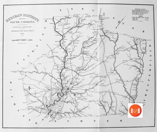
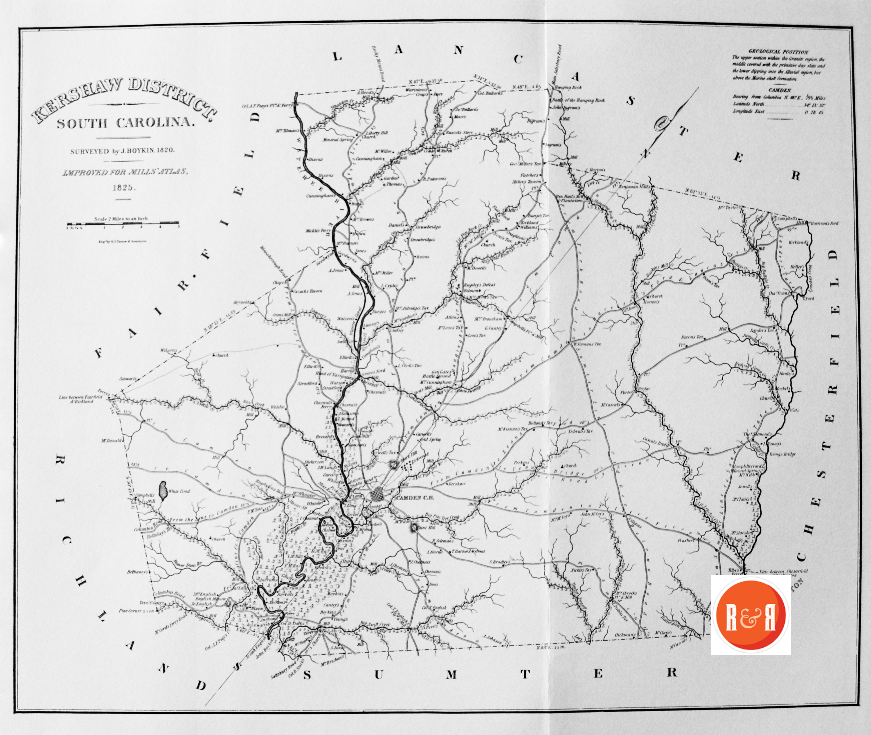
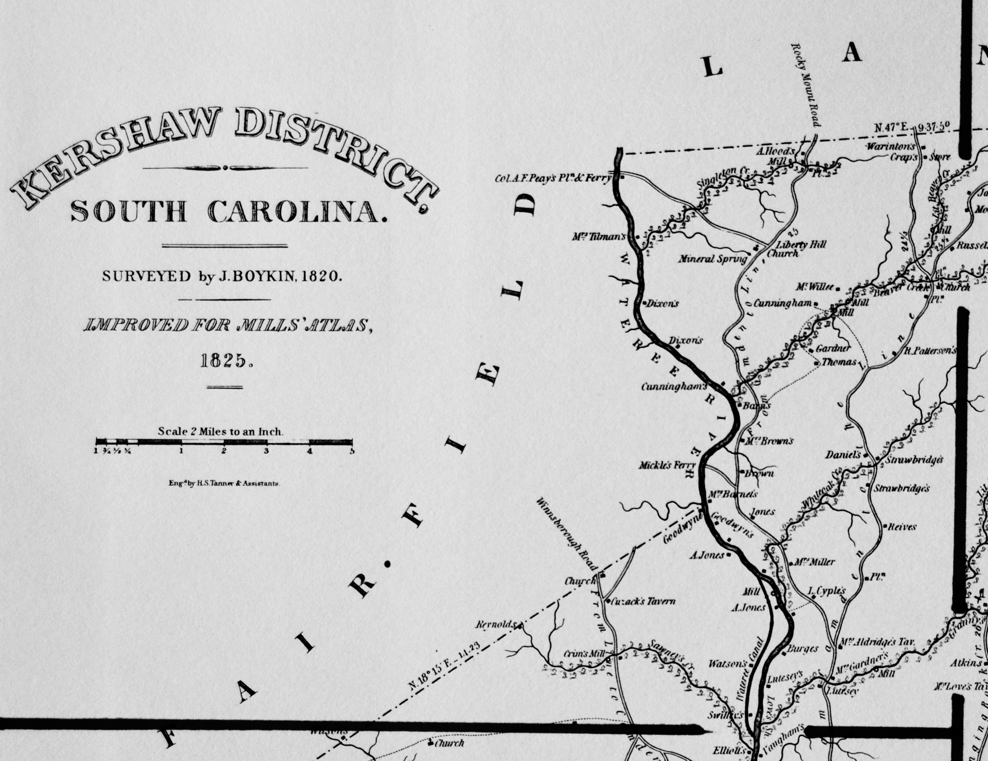
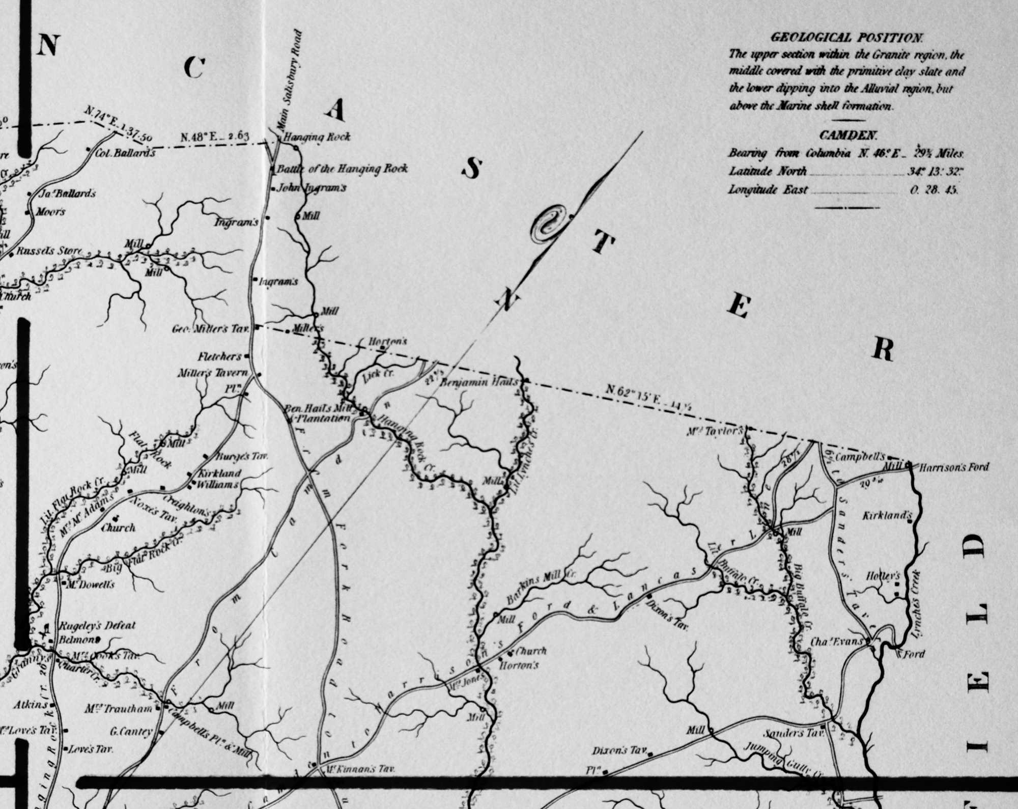
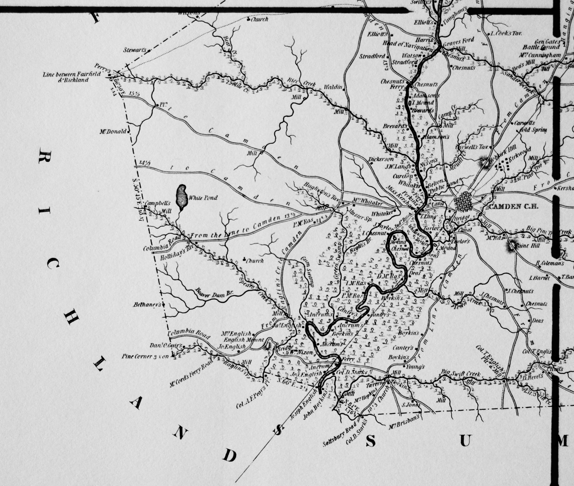
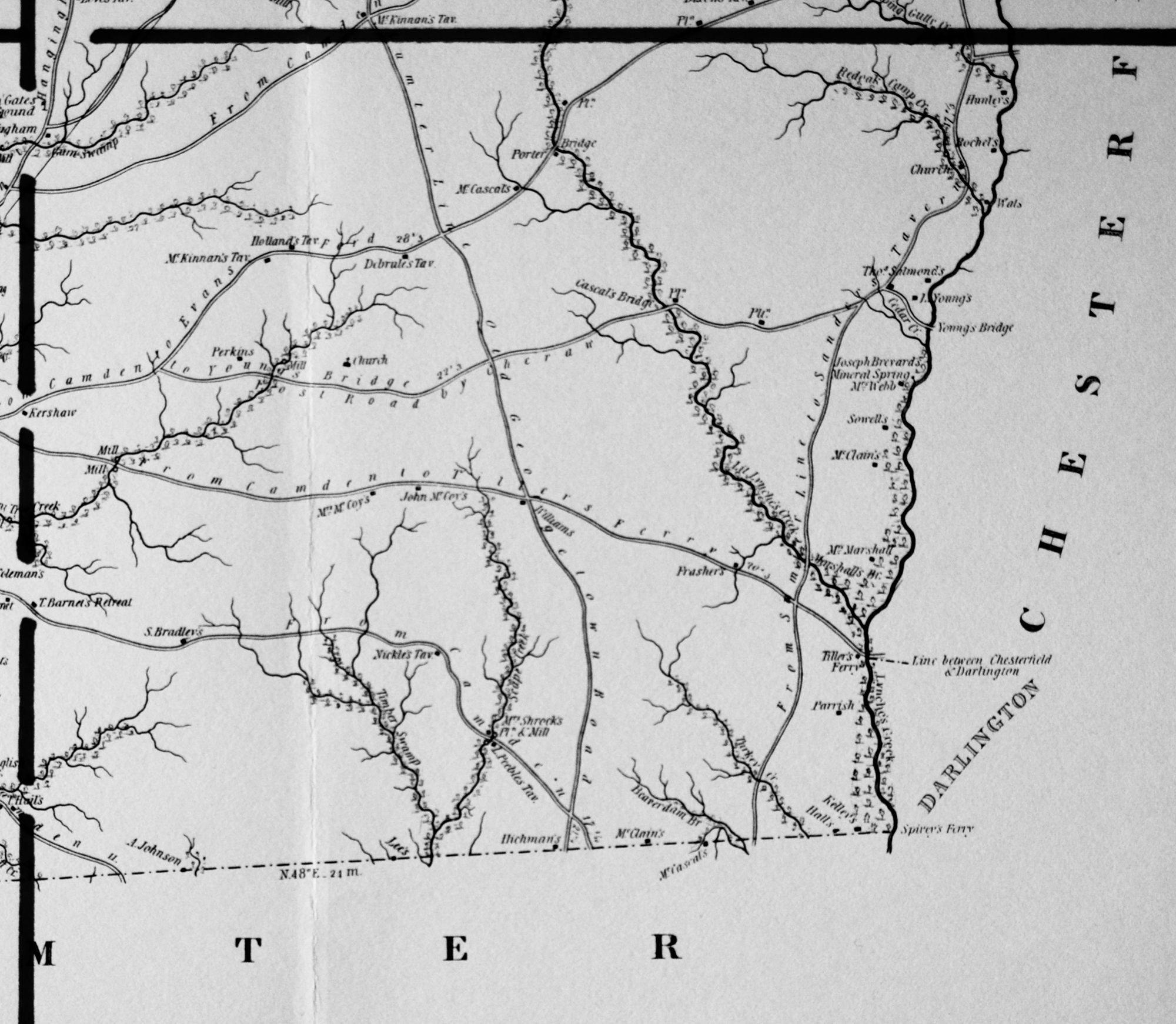
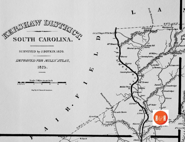
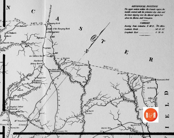
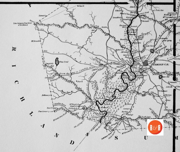
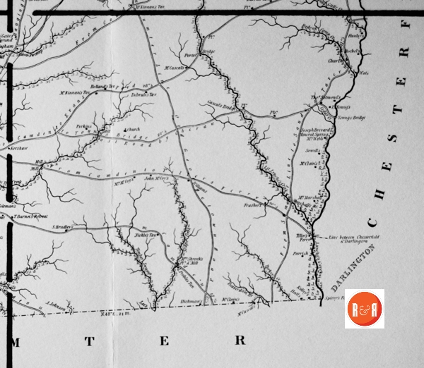
City Directories and History: Architect, Mr. Robert Mills was hired by the State of S.C. to create accurate maps of the state’s districts. In turn, he employed knowledgeable surveyors to survey the local areas, from which he created his finished maps of S.C., districts or counties. This resulted in accurate maps of roads, streams, and cities located in each. Click on the More Information / Enlargeable links, (found under the picture column), for an enlargeable county map, a history of Robert Mill’s survey of S.C. counties, written by Gene Waddell in 1980, an index to the names listed on the maps, and enlargeable quadrants for conducting in depth research.
“Stephen H. Boykin prepared maps of Kershaw, Lancaster, and Sumter Districts. He worked on the adjacent districts of Kershaw and Lancaster at the same time, receiving a $200 advance for both in August, 1817, and an $1,800 payment for both on 21 December, 1820. He prepared the map of Sumter District between 20 November, 1820 (when John Lowery petitioned for an additional payment for his map of Sumter), and 28 August, 1821 (when he, Boykin, received a payment of
$1,100). In December, 1821, the Senate wanted to know “whether more than one Surveyor was employed to make a Survey of the District of Sumter & if so whether both of them have been paid & the reason why that course was pursued.” The Committee on the Map reported that Governor Pickens had employed Daniel Dubose of Sumter District to prepare the map originally, but Dubose had delayed so long that the next Governor, Geddes, had hired Lowery to make one. Lowery’s survey was approved by James M. Elford (the professor who replaced Blackburn), and Lowery was paid in full. Subsequently, the Legislature gave the Board of Public Works authority over the map project, and the Board rejected the map, stating that it was “defective and incorrect and can not be made to answer the purpose. Boykin was then called upon so that a dependable survey could be produced in as short a time as possible.
Of Boykin’s three maps, only the one of Sumter is known to survive. He must have made good use of plats to be able to compile so detailed a map of so large an area (1,672 square miles) in so short a time. Although his map of Sumter does not resemble a printed map as closely as the maps by Vignoles, Hemingway, and Thompson, its unusual clarity and minute depiction of watercourses make it one of the best submissions and one that required the least revision for use in the Atlas.” Information from: Mill’s Atlas of South Carolina – 1825, Southern Historical Press, 1980
R&R has also taken individual county maps and created a list of their recorded sites, allowing R&R’s users, faster access to historic data. Each of the More Information links opens items connected to the Mill’s map of this county. The last four are those related to Quadrants 1-4. Names within each quadrant are listed below and at the bottom of the page, is an alphabetical list, of all names shown in Kershaw District, along with other counties in which the name also appears. Another excellent website to view the Mill’s maps is at Rumsey’s Maps.
Scroll down to view the alphabetical listing of names:
| Adamsons – K (2) | From Line to Camden – K (2) | Miller’s, Gen., Tavern – K, Lan |
| Aldridge’s, Mrs: Tav. – K | From Sumter Line to Sanders Tavern – K | Mineal Spring – D, Ge, K (2), Lan, Lex, N (2), |
| Ancrum – Co, K (3) | Gardner – Co, D, K | Moor – E, K, P, Su, Y |
| Atkins – K | Gardner, Mrs. – K | Mound – K |
| Ballard, Col. – K | Gates, Gen. – K | Mound, I. – K (2) |
| Ballard, Jas. – K | Gibson – A, Cha, K, Lan (3), Mar, W | Mount Creek – K |
| Bams – K | Goodwyn – K (2), O, R | Muster Sp. – K |
| Barkin – K | Goodwyne – K | Nickle – K |
| Barnet, I. – K | Granny’s Quarter Creek – K | Nickle’s Tav. – K |
| Barnet, J. – K | Graves – D (2), K, Lan, Mar | Nixon, Wm. – K |
| Barnet, Mrs. – K | Graves Ford – K | Nixson – K |
| Battle Ground – K, Y | Green Swamp – K, Mar | Noxe – K |
| Battle of the Hanging Rock – K | Guir, Dan’l. O. – K | Noxe’s Tav. – K |
| Bear Creek – Ch’f, K, Lan, Lex, P, Su | Gum Swamp – K, Mar’b | Old Georgetown Road – K |
| Beaver Creek – Ch’f (2), F, K, N, P | Hail, Ben – K | Paint Hill – K |
| Belmont – K | Hail, Benjamin – K | Parrish – K, Y |
| Belton – K, N | Hail, T. – K | Patterson, R. – K, Sp |
| Bethany – K | Hall – Ch, K, Lau (2), N, O, Su | Peay, Col. – A, F, K, Lan |
| Big Buffalo Cr. – K | Hanging Rock – K | Peebles, L. – K |
| Big Flat Rock Creek – K | Hanging Rock Creek – K, Lan | Peebles, L., Tavern – K |
| Big Pine Tree Creek – K | Harris – A (2), Ch’f, E, F, K, Lan (2), P, | Perkin – Ba, Ch’f, K (2) |
| Big Swift Creek – K | Harrison – Be, Ch’f, Co, Gr, K, Lan, P | Perry – Be, Co (4), F, K (2), Lan, R |
| Boykin – K (5), Su (2) | Harrison’s Ford – Ch’f, K, Lan | Pine Corner – K, R |
| Boykin, John – K | Head of Navigation – K, Lan | Plantation – K (9), Lan (49), Mar, Su (57), |
| Bradley, S. – K | Hebkirk Hill – K | Porter – A, Ge (2), K |
| Brisban, Mrs. – K | Hickman – K | Public Land – Cha, K |
| Burge’s Tav. – K | Holland – Gr, K, Lau, P | Raglin – K, R |
| Burges – Ba, K | Holland’s Tavern- K | Red Oak Camp Creek – K |
| Camden C.H. – K | Holley – K | Reives – K |
| Camp Creek – A, H, K, Lan, Lau, P | Holliday – K | Revel, D. – K |
| Campbell – A, Be, Ch’f (3), Co, D, F, K, | Holliday’s Tavern – K | Reynolds – Be, Cha (2), F, K |
| Campbell’s Pin. and Mill – K | Hood, A. – K | Rice – Ch, Co (3), K, P |
| Canal – Ch (3), Ge, K, Lex (2), R | Hood’s, A., Mill – K | Rice Creek – F, K |
| Cantey – Cha, K (3) | Hopkins, Mrs. – K | Richland – F, K, Lex, O, Su |
| Cantey, G. – K | Horton – Ch’f, K, Lan (2) | Right’s Br. – K |
| Carwell – K | Hughston’s Tav. – K | Rochel – K |
| Carwell’s Tav. – K | Johnson, A. – K | Rublev’s Defeat – K |
| Cascal – K | Jones, A. – K (2) | Rugeley – K |
| Cascal’s Bridge – K | Jones, Mrs. – Ba, K | Russel – A, Ch, Ge, H, K |
| Cedar Creek – Ba (2), Ch’f, D, E (2), K, Lan, | Jones, S. – K | Russel’s Store – K |
| Chestnut – K (7) | Jumping Gully Creek – K | Salmond, Thos. – K |
| Chestnut, I. – K | Kelly – Ba, K, Su | Saltsbury Road – K |
| Chestnut, J. – K (2) | Kershaw – K | Sander’s Creek – K, P |
| Cold Spring – K | Kershaw, Miss – K | Sander’s Tav. – K, Lan |
| Coleman, R. – E, K | Kirkland – K (2) | Sanders – Co (2), D, K, Lan, Mar’b, Su |
| Columbia Road from Ragtin’s Creek to Camden – K | Kirkwood – K | Sawney’s Creek – A, F, K |
| Columbia Road from the Line to Camden – K | Lancaster – Ch’f, F, K, Lan, Y | Shroch, Mrs. – K |
| Cook, L. – K | Lang, J.W. – K | Shrock’s, Mrs., Pin. & Mill – K |
| Cook, Mrs. – K | Lang, T. – K | Singleton – Co (2), Ge, K, Su, W (3) |
| Cook’s, L.: Tav. – K | Lang, W. – K | Singleton Creek – K |
| Cooks, Mrs.: Tav. – K | Lee – A, Ch, Co (2), E, F, H, K, Su (2), | Sowell – K |
| Crap – K | Liberty Hill Church – K | Spears Creek – K, R (2) |
| Creighton – K | Lick Creek – K | Spivey – D, K, Su |
| Crim’s Mill – K | Line between Chesterfield and Darlington – K | Spivey Ferry – D (2), K, Su |
| Cunningham – Co, K | Line between Fairfield and Richland – K | Stark, Col. D. – K (2), Su |
| Cunningham, Mrs. – K | Little Beaver Creek – K, O (2) | Stewart – Ch’f, Co, K, Lan (2), Lex |
| Cureton – K, Lan | Little Buffalo Creek * K | Stradford – K (2) |
| Cuzack’s Tavern – K | Little Flat Rock Creek – K | Strawbridge – K (2) |
| Cuzack-K | Little Lynches Creek – Ch’f, K, Lan | Sumter – D, K, O, R, W |
| Cyple, I. – K | Little Pine Tree Creek – K | Swilley – K |
| Daniel – Ba, Ge, K | Little Swift Creek – K, Su | Tavern – Be, Cha, Co (2), Ge, K, Lex, Mar’b |
| Darlington – Ch’f, D, K, Mar, Mar’b, Su, W | Love, Mrs. – K | Taylor – Ba, F, Ge (2), K, Su (3), U, Y |
| Dea’s Mill – K | Love’s Sh. – K | Taylor, J. – K, R |
| Dea-K | Love’s Tavern – K | Taylor, Mrs. – K, Lan |
| Deas-Ge (2), K (2) | Love’s, Mrs., Tav. – K | ter Line – K |
| Debrule – K | Lutesey – K (2) | Thomas – Cha, Ch’f, Co, Ge (3), H, K |
| Debrule’s Tavern – K | Lynche’s Creek – Ch’f, D, K, Mar (2), Su (2), | Tiller – Ch’f, D, K |
| Dickerson – K, Su | Main Salisbury Road – K | Tiller’s Ferry – Ch’f, D (2), K |
| Dixon – K | Marshall, Mrs. – K | Tillman, Mrs. – K |
| Dixon – K, Su | Marshall’s Br. – K | Timber Swamp – K |
| Dixon’s Tavern – K | McAdam, Mrs. – K | To Camden – K |
| E (6), F (7), Gr (2), H (3), K (35), | McCascal – K (2), Su | To Sander’s Tavern – K |
| English Mount – K | McClain – K (2), Su | Town Creek – Ba, E, K |
| English’s, Col. T.: Pltn. and Mill – K | McCord – K, O, R | Trautham, Mrs. – K |
| Evans, Chas. – K | McCord’s Ferry Road – K | Vaugham – K |
| Fairfield – K, Lan, Lex, N, R, U | McCoy, John – K | Waldin – K |
| Ferry – Be, Cha (2), Co, K (4), Lan, N (2), U,Y(S) | McCoy, Mrs. – K | Warinton – K |
| Flat Rock – K. | McDonald – Ch, Ch’f (2), K, Lan, R | Wateree Canal – K |
| Fletcher – K | McDowell – Ge (2), K | Wateree River – F, K, O, R, Su (2) |
| Ford – K, Lex, N, R (2), U (2) | McKinnan – K | Wats – K |
| Fost Road by Cheraw – K | McKinnan’s Tav. – K | Watson – H, K, Mar (3), Su |
| Frasher- K | McRas, D. – K | Webb, Mrs. – K |
| From Camden – K (3) | McRas, I. – K | Whitaker – F, K (3) |
| From Camden to Evans Ford * K | McRas, P. – K | Whitaker, Mrs. – K |
| From Camden to Hanging Rock Creek – K | McWillie – K | White Pond – Ba, Cha (2), K |
| From Camden to Line – K | Mickle – F, K | Whiteoak Creek – K |
| From Camden to the Line – K | Miller – Ch, Ch’f, Co, E, F, K, Lan (5), | Winnsborough Road – K |
| From Camden to Tiller’s Ferry – K | Miller, Geo. – K, Lan | Young – A, Ba, Ch, Co, Gr, K, Lau, O, U |
| From Camden to Young’s Bridge – K | Miller, Mrs. – K | Young, L. – K |
| From Line to Camden – K (2) | Miller’s Tavern – K | Young’s Bridge – K |
Membership in R&R
Stay connected with R&R, “Explore S.C. history, houses, & family stories…” Sign up for a R&R membership. Members receive the “From the Porch” blog, updates on regional topics, and targeted notifications of their choice. Membership also includes travel opportunities: Carolina DeJaunts. Login and prioritize your specific points of family history and enthusiasm: R&R Login.
User comments welcome – post at the bottom of this page.
Please enjoy this structure and all those listed in Roots and Recall. But remember each is private property. So view them from a distance or from a public area such as the sidewalk or public road.
Do you have information to share and preserve? Family, school, church, or other older photos and stories are welcome. Send them digitally through the “Share Your Story” link, so they too might be posted on Roots and Recall.
Thanks!
User comments always welcome - please post at the bottom of this page.


Share Your Comments & Feedback: