The Yorkville Enquirer reported on Sept. 22, 1870 – “The storehouse of Mr. E.M. Boykin, Jr., on Town Creek about four miles from Camden was burned. It is believed that it was arson. There were no goods in the store. Also reported is the store of Mr. W.A. Ancrum, on Swift Creek about nines miles from Camden being burned on the same night. The Ancrum Store had no goods it it.”
City Directories and History: (Mill Tract Plantation) Boykin Mill Complex is a central locale that has historically been
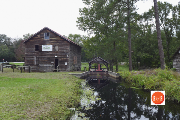
Photo contributed to R&R by Gazie Nagle @ www.fineartbygazie.com
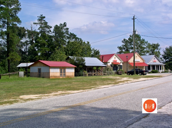
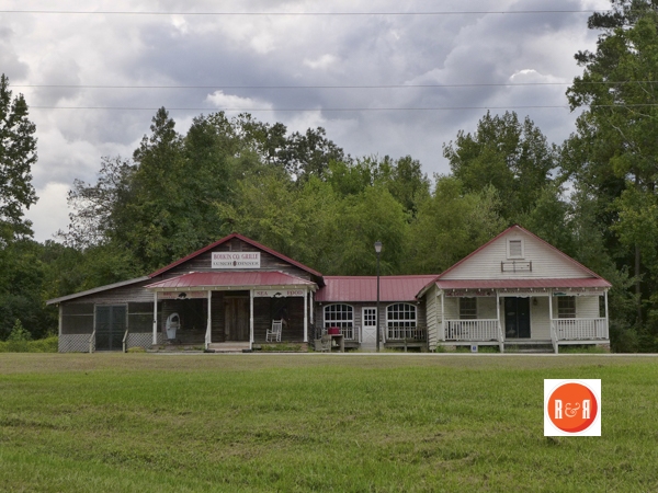
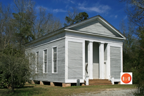
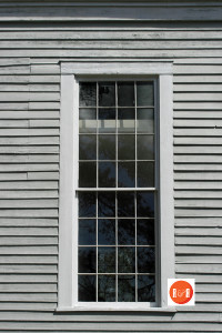
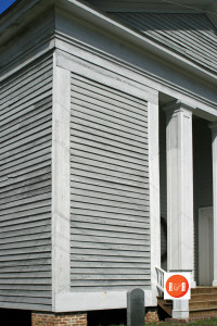
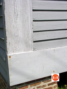
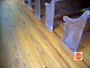
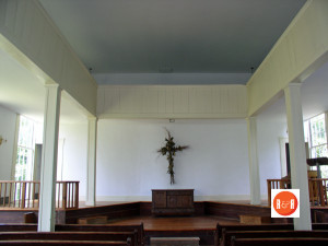
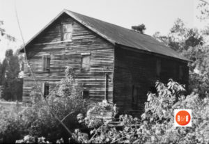
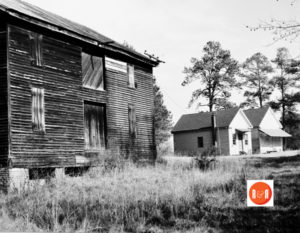
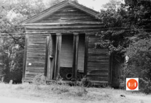
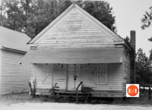
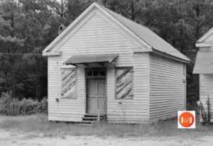
 important in the life of rural Kershaw County. At present, “Boykin Mill” denotes a community which consists of an old post office (ca. 1875), an old general store (ca. 1905), a ca. 1905 grist mill, mill pond, mill dam, gates, and canals. The community also includes an early nineteenth century Greek Revival style Baptist church (ca. 1827), one mid-nineteenth century residence, three twentieth century residences (ca. 1935) built for mill workers, and a
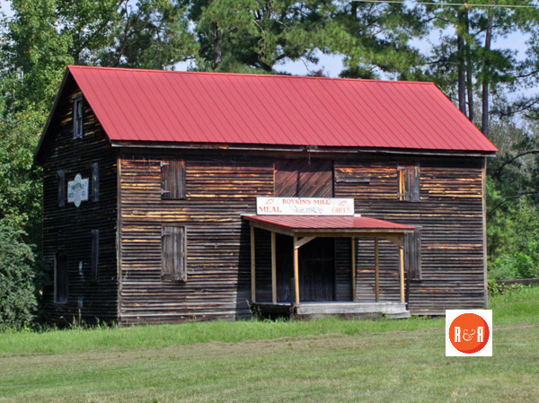
Boykin Mill
smoke house. A Civil War battle site is also a part of the Boykin Mill community. The battle at Boykin Mill took place on April 17, 1865. The importance of these sites revolves around the large mill pond on Swift Creek. The pond dates to at least 1786, when it was platted for Robert English, who was apparently the first grantee of the mill pond tract. A succession of saw and grist mills has been located on or near the dam to the pond since that time. Listed in the National Register September 10, 1992.
[Courtesy of the S.C. Dept. of Archives and History]
See the website for Boykin, SC at http://www.boykinmillfarms.com/default.asp
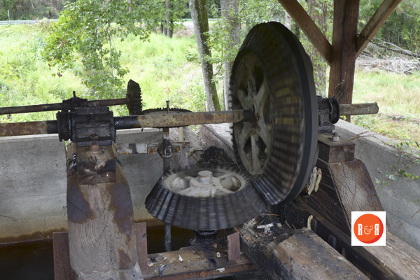
During the time when there was no electricity in the rural areas, corn and saw mills were the principal types of mills in Kershaw County. Because this county is located in the sandhill region of the state, there is an abundant source of water power and since electricity was not available mills were located on creeks which provided water power for their operation. The creeks, often having high hills as banks, were at a greater elevation than the rivers into which they flowed. This fact made possible the easy erection of dams on the creeks. When they were dammed up, mill houses were erected over the dams. Millwrights were tradesmen who specialized in the construction and operation of mills. This writer’s great – grandfather, Luke McLaughlin (1886 -1956), specialized in the process of sharpening mill stones used in the grinding of com and wheat. The tool used for sharpening these huge stone was a metal mill pick. Although millwrighting is now an obsolete art, the millwright was an important person in the community in his day. Mills were the social centers of the community. They were the gathering places for swimming parties, picnics, baptizings, shoot-outs, political rallies, and voting polls. Very few of the churches had baptismal pools; therefore they used millponds. Both my mother and father were baptized in Barfield’s Mill Pond on Beaver Dam Creek. During the War Between the States Boykin’s Mill on Swifts’ Creek flew the Masonic flag to avoid being burned.
——————
Names in S.C. – The Boykin Mill Pond is one of the most interesting sites in the county. It was established as a mill seat late in the 1700s by either the Paynes or the Boykins. On May 5, 1860, a great tragedy occurred here when a gay party boarded a flat boat for a ride around the pond. When the boat hit a snag, its occupants panicked and many jumped out, resulting in the loss of twenty-four lives. Five years later this site was again highlighted as the Battle of Boykin Mill, between Northern and Confederate troops, was fought on its banks April 18, 1865.
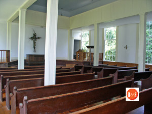
The Swift Creek Baptist Church stands very near the pond. This church was built by the Boykin family, and was a member church of the Baptist Convention of the High Hills of the Santee.
Old Highway #521 and Highway #261 intersect near the pond. The latter of these nearly follows the old Kings Highway to Charleston, which was one of our earliest routes. Were you to turn south on this, you would come to Wannah Plantation, (c. 1870), which derives its name from the Catawba Indian word meaning home or tepee.
The next river plantation is Stockton. Believed to have been the homeplace of “Regulator” Samuel Boykin, this land passed to his son-in-law Zachariah g home or tepee. The site of the Boykin Depot, a railroad siding established in 1849, is about one half a mile to the north. The next large plantation on the left hand side of Highway #261 is Red Bank, appropriately named for its rich red soil. During early 1800s it was known as the Ancrum place. Ancrums Ferry, a well-known river crossing, once belonged to this tract of land. (Hope Boykin – Author)
(Information from: Names in South Carolina by C.H. Neuffer, Published by the S.C. Dept. of English, USC)
Stay Connected
Explore history, houses, and stories across S.C. Your membership provides you with updates on regional topics, information on historic research, preservation, and monthly feature articles. But remember R&R wants to hear from you and assist in preserving your own family genealogy and memorabilia.
Visit the Southern Queries – Forum to receive assistance in answering questions, discuss genealogy, and enjoy exploring preservation topics with other members. Also listed are several history and genealogical researchers for hire.
User comments welcome — post at the bottom of this page.

R&R HISTORY LINK: MULBERRY PLANTATION
R&R HISTORY LINK: NATIONAL REGISTER – IMAGE(S)
Please enjoy this structure and all those listed in Roots and Recall. But remember each is private property. So view them from a distance or from a public area such as the sidewalk or public road.
Do you have information to share and preserve? Family, school, church, or other older photos and stories are welcome. Send them digitally through the “Share Your Story” link, so they too might be posted on Roots and Recall.


GALLERY OF OLD IMAGES – Courtesy of the SC Dept. of Archives and History


User comments always welcome - please post at the bottom of this page.


Share Your Comments & Feedback: